How to get to Zf Insurance Management by bus?
Click on the bus route to see step by step directions with maps, line arrival times and updated time schedules.
From Camping Iriswiese, Verwaltungsverband Eriskirch-Kressbronn am Bodensee-Langenargen
64 minFrom Compleo, Verwaltungsverband Mittleres Schussental
77 minFrom D 78333 Stockach, Verwaltungsgemeinschaft Stockach
141 minFrom Antiquariat Trenkle, Aach
156 minFrom Aachbad Singen, Verwaltungsgemeinschaft Singen (Hohentwiel)
197 minFrom Oh VV, Leutkirch
228 minFrom Klinik Tettnang, Tettnang
37 min
How to get to Zf Insurance Management by train?
Click on the train route to see step by step directions with maps, line arrival times and updated time schedules.
Bus stops near Zf Insurance Management in Verwaltungsgemeinschaft Friedrichshafen
Train stations near Zf Insurance Management in Verwaltungsgemeinschaft Friedrichshafen
Bus lines to Zf Insurance Management in Verwaltungsgemeinschaft Friedrichshafen
- 7394, Konstanz Bürgerbüro,VIEW
- E15, FN Ailingen, Schule,VIEW
- 5, Friedrichshafen Klinikum,VIEW
- 7395, Bahnhof Überlingen,VIEW
- 6, Friedrichshafen Weidenring,VIEW
- 7547, Wangen Busbahnhof,VIEW
- E16, Friedrichshafen Berg, Siedlung,VIEW
- N3, Tettnang Bärenplatz,VIEW
- R45, Ravensburg Bahnhof,VIEW
- 221, Friedrichshafen Stadtbahnhof,VIEW
What are the closest stations to Zf Insurance Management?
The closest stations to Zf Insurance Management are:
- FN Barbarossa Kreisel is 216 meters away, 4 min walk.
- Friedrichshafen Goethestraße is 442 meters away, 6 min walk.
- Friedrichsh. Columbanbrücke is 529 meters away, 7 min walk.
- Friedrichsh. Zf Werk 1 / Ehlerstraße is 761 meters away, 10 min walk.
- Löwental is 1149 meters away, 15 min walk.
- Löwental Bahnhof is 1151 meters away, 15 min walk.
- FN Löwental Bahnhof is 1153 meters away, 15 min walk.
- Friedrichsh. Hafenbahnhof is 2179 meters away, 29 min walk.
Which bus lines stop near Zf Insurance Management?
These bus lines stop near Zf Insurance Management: 221, 5, 6, 7395, 7547, R45.
Which train lines stop near Zf Insurance Management?
These train lines stop near Zf Insurance Management: RB 91, RB93, RE 5.
What’s the nearest train station to Zf Insurance Management in Verwaltungsgemeinschaft Friedrichshafen?
The nearest train stations to Zf Insurance Management in Verwaltungsgemeinschaft Friedrichshafen are Löwental, Löwental Bahnhof and FN Löwental Bahnhof. The closest one is a 15 min walk away.
What’s the nearest bus station to Zf Insurance Management in Verwaltungsgemeinschaft Friedrichshafen?
The nearest bus station to Zf Insurance Management in Verwaltungsgemeinschaft Friedrichshafen is FN Barbarossa Kreisel. It’s a 4 min walk away.
What time is the first train to Zf Insurance Management in Verwaltungsgemeinschaft Friedrichshafen?
The RB 91 is the first train that goes to Zf Insurance Management in Verwaltungsgemeinschaft Friedrichshafen. It stops nearby at 5:03 AM.
What time is the last train to Zf Insurance Management in Verwaltungsgemeinschaft Friedrichshafen?
The RB 91 is the last train that goes to Zf Insurance Management in Verwaltungsgemeinschaft Friedrichshafen. It stops nearby at 12:22 AM.
What time is the first bus to Zf Insurance Management in Verwaltungsgemeinschaft Friedrichshafen?
The 221 is the first bus that goes to Zf Insurance Management in Verwaltungsgemeinschaft Friedrichshafen. It stops nearby at 4:50 AM.
What time is the last bus to Zf Insurance Management in Verwaltungsgemeinschaft Friedrichshafen?
The 6 is the last bus that goes to Zf Insurance Management in Verwaltungsgemeinschaft Friedrichshafen. It stops nearby at 12:29 AM.
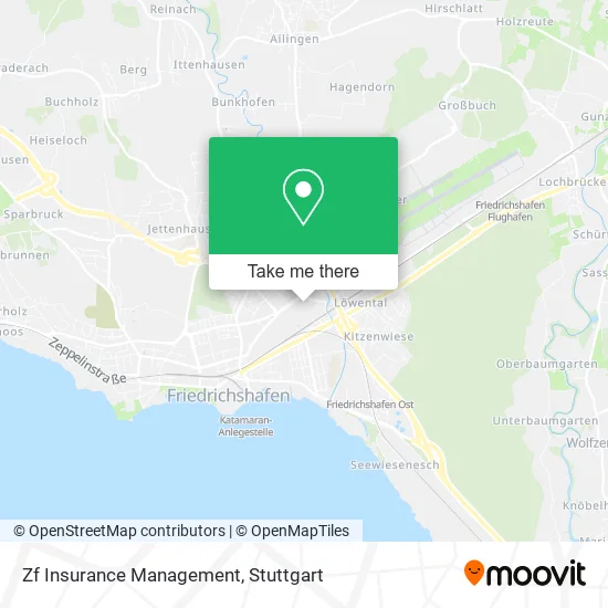
See Zf Insurance Management, Verwaltungsgemeinschaft Friedrichshafen, on the map
Public Transit to Zf Insurance Management in Verwaltungsgemeinschaft Friedrichshafen
Wondering how to get to Zf Insurance Management in Verwaltungsgemeinschaft Friedrichshafen? Moovit helps you find the best way to get to Zf Insurance Management with step-by-step directions from the nearest public transit station.
Moovit provides free maps and live directions to help you navigate through your city. View schedules, routes, timetables, and find out how long does it take to get to Zf Insurance Management in real time.
Looking for the nearest stop or station to Zf Insurance Management? Check out this list of stops closest to your destination: FN Barbarossa Kreisel; Friedrichshafen Goethestraße; Friedrichsh. Columbanbrücke; Friedrichsh. Zf Werk 1 / Ehlerstraße; Löwental; Löwental Bahnhof; FN Löwental Bahnhof; Friedrichsh. Hafenbahnhof.
Bus: 221, 5, 6, 7395, 7547, R45, 7394, E15.Train: RB 91, RB93, RE 5, RE5, RE 3, RE3, RE5, RB91, RB91, RB31.
Want to see if there’s another route that gets you there at an earlier time? Moovit helps you find alternative routes or times. Get directions from and directions to Zf Insurance Management easily from the Moovit App or Website.
We make riding to Zf Insurance Management easy, which is why over 1.5 million users, including users in Verwaltungsgemeinschaft Friedrichshafen, trust Moovit as the best app for public transit. You don’t need to download an individual bus app or train app, Moovit is your all-in-one transit app that helps you find the best bus time or train time available.
For information on prices of bus and train, costs and ride fares to Zf Insurance Management, please check the Moovit app.
Use the app to navigate to popular places including to the airport, hospital, stadium, grocery store, mall, coffee shop, school, college, and university.
Zf Insurance Management Address: Ehlersstraße 50 88046 Friedrichshafen street in Verwaltungsgemeinschaft Friedrichshafen
- Dr. med. Jonas Hartleb,
- Zf Gastronomie Service,
- Betriebskindergarten Ratzfatz Zf,
- Ratzfatz,
- Zugang Werksgelände,
- Compleo,
- Zf Werk 1 / Ehlerstraße,
- Zugang G,
- Zf Fahrradständer,
- Bankhaus August Lenz,
- Fa. Zf Werk 1/Ehlerstr.,
- Zugang Werksgelände,
- Zugang Werksgelände,
- Zugang Werksgelände,
- Nevada,
- Bodensee Bordell,
- Malis,
- Zugang Werksgelände,
- Klein Paris,
- Venus-Fn Saunaclub
Places Near Zf Insurance Management (Verwaltungsgemeinschaft Friedrichshafen)
- Gleis 101/102 (tief), Stuttgart-Mitte,
- Im Wizemann (Halle), Bad Cannstatt,
- Marmorsaal Im Weissenburgpark, Stuttgart-Süd,
- Porsche-Arena, Bad Cannstatt,
- Gasometer Pforzheim, Pforzheim,
- FlixBus Haltestelle, Stuttgart,
- Schleyerhalle, Bad Cannstatt,
- Geilhaus Haus 33a, Reutlingen-Betzingen,
- Hauptbahnhof Stuttgart, Stuttgart-Mitte,
- Hanns-Martin-Schleyer-Halle, Bad Cannstatt,
- Klinikum Stuttgart - Katharinenhospital, Stuttgart-Mitte,
- Mercedes-Benz Museum, Bad Cannstatt,
- Hanns-Martin-Schleyer-Halle (Stuttgart Hans-Martin-Schleyerhalle), Bad Cannstatt,
- Waldfriedhof, Degerloch,
- Porsche Museum, Zuffenhausen,
- Wilhelma (U-Bahn Wilhelma), Bad Cannstatt,
- Pariser Platz Stuttgart, Stuttgart-Mitte,
- Mettingen Eros-Center Puff Laufhaus, Esslingen Am Neckar,
- SI-Centrum, Möhringen,
- Mercedes-Benz Museum (Mercedes Museum Stuttgart), Bad Cannstatt
How to get to popular places in Stuttgart with public transit
Get around Verwaltungsgemeinschaft Friedrichshafen by public transit!
Traveling around Verwaltungsgemeinschaft Friedrichshafen has never been so easy. See step by step directions as you travel to any attraction, street or major public transit station. View bus and train schedules, arrival times, service alerts and detailed routes on a map, so you know exactly how to get to anywhere in Verwaltungsgemeinschaft Friedrichshafen.
When traveling to any destination around Verwaltungsgemeinschaft Friedrichshafen use Moovit's Live Directions with Get Off Notifications to know exactly where and how far to walk, how long to wait for your line, and how many stops are left. Moovit will alert you when it's time to get off — no need to constantly re-check whether yours is the next stop.
Wondering how to use public transit in Verwaltungsgemeinschaft Friedrichshafen or how to pay for public transit in Verwaltungsgemeinschaft Friedrichshafen? Moovit public transit app can help you navigate your way with public transit easily, and at minimum cost. It includes public transit fees, ticket prices, and costs. Looking for a map of Verwaltungsgemeinschaft Friedrichshafen public transit lines? Moovit public transit app shows all public transit maps in Verwaltungsgemeinschaft Friedrichshafen with all Bus, Train, Subway, Light Rail, Ferry, S-Bahn and Funicular routes and stops on an interactive map.
Stuttgart has 7 transit type(s), including: Bus, Train, Subway, Light Rail, Ferry, S-Bahn and Funicular, operated by several transit agencies, including SSB - Stadtbahn, SSB, SSB - Seilbahn / Zacke, S-Bahn Stuttgart, Rhein-Neckar-Verkehr GmbH (rnv), Karlsruher Verkehrsverbund, DB AG, DB Regiobus BW, Arverio Baden-Württemberg GmbH, DB RegioNetz Verkehrs GmbH Westfrankenbahn, DB Regio AG Baden-Württemberg, Südwestdeutsche Verkehrs-AG, DB Regio AG Mitte Region Hessen, DB and Bodensee-Oberschwaben-Bahn