Zitadelle Spandau stop - Sunday schedule
| Line | Direction | Time |
|---|---|---|
| X33 | Galenstr. | 09:34 |
| X33 | Galenstr. | 09:54 |
| X33 | Galenstr. | 10:14 |
| X33 | Galenstr. | 10:34 |
| X33 | Galenstr. | 10:54 |
| X33 | Galenstr. | 11:14 |
| X33 | Galenstr. | 11:34 |
| X33 | Galenstr. | 11:54 |
| X33 | Galenstr. | 12:14 |
| X33 | Galenstr. | 12:34 |
| X33 | Galenstr. | 12:54 |
| X33 | Galenstr. | 13:14 |
| X33 | Galenstr. | 13:34 |
| X33 | Galenstr. | 13:54 |
| X33 | Galenstr. | 14:14 |
| X33 | Galenstr. | 14:34 |
| X33 | Galenstr. | 14:54 |
| X33 | Galenstr. | 15:14 |
| X33 | Galenstr. | 15:34 |
| X33 | Galenstr. | 15:54 |
| X33 | Galenstr. | 16:14 |
| X33 | Galenstr. | 16:34 |
| X33 | Galenstr. | 16:54 |
| X33 | Galenstr. | 17:14 |
| X33 | Galenstr. | 17:34 |
Directions to Zitadelle Spandau (Haselhorst) with public transportation
The following transit lines have routes that pass near Zitadelle Spandau
How to get to Zitadelle Spandau by bus?
Click on the bus route to see step by step directions with maps, line arrival times and updated time schedules.
How to get to Zitadelle Spandau by train?
Click on the train route to see step by step directions with maps, line arrival times and updated time schedules.
How to get to Zitadelle Spandau by subway?
Click on the subway route to see step by step directions with maps, line arrival times and updated time schedules.
Bus stops near Zitadelle Spandau in Haselhorst
- Zitadelle Spandau, 2 min walk,
- Wröhmännerpark, 4 min walk,
- U Zitadelle, 4 min walk,
- Breite Str./Markt, 11 min walk,
Subway stations near Zitadelle Spandau in Haselhorst
- U Altstadt Spandau, 9 min walk,
Train stations near Zitadelle Spandau in Haselhorst
- S Spandau Bhf, 18 min walk,
Bus lines to Zitadelle Spandau in Haselhorst
- X33, S+U Wittenau,
- M36, U Haselhorst,
- M45, Johannesstift,
- 134, Wasserwerk Spandau,
- 136, S+U Rathaus Spandau,
- 671, Schönwalde (Hvl) Erlenbruch,
- N7, Galenstr.,
- 130, Falkenseer Chaussee/Zeppelinstr.,
What are the closest stations to Zitadelle Spandau?
The closest stations to Zitadelle Spandau are:
- Zitadelle Spandau is 103 meters away, 2 min walk.
- Wröhmännerpark is 252 meters away, 4 min walk.
- U Zitadelle is 285 meters away, 4 min walk.
- U Altstadt Spandau is 622 meters away, 9 min walk.
- Breite Str./Markt is 846 meters away, 11 min walk.
- S Spandau Bhf is 1323 meters away, 18 min walk.
Which train lines stop near Zitadelle Spandau?
These train lines stop near Zitadelle Spandau: RB10, RE4, RE8, S9.
Which subway line stops near Zitadelle Spandau?
U7
Which bus line stops near Zitadelle Spandau?
X33
What’s the nearest subway station to Zitadelle Spandau in Haselhorst?
The nearest subway station to Zitadelle Spandau in Haselhorst is U Altstadt Spandau. It’s a 9 min walk away.
What’s the nearest train station to Zitadelle Spandau in Haselhorst?
The nearest train station to Zitadelle Spandau in Haselhorst is S Spandau Bhf. It’s a 18 min walk away.
What’s the nearest bus stop to Zitadelle Spandau in Haselhorst?
The nearest bus stop to Zitadelle Spandau in Haselhorst is Zitadelle Spandau. It’s a 2 min walk away.
What time is the first subway to Zitadelle Spandau in Haselhorst?
The U7 is the first subway that goes to Zitadelle Spandau in Haselhorst. It stops nearby at 3:00 AM.
What time is the last subway to Zitadelle Spandau in Haselhorst?
The U7 is the last subway that goes to Zitadelle Spandau in Haselhorst. It stops nearby at 1:13 AM.
What time is the first train to Zitadelle Spandau in Haselhorst?
The S9 is the first train that goes to Zitadelle Spandau in Haselhorst. It stops nearby at 3:06 AM.
What time is the last train to Zitadelle Spandau in Haselhorst?
The S9 is the last train that goes to Zitadelle Spandau in Haselhorst. It stops nearby at 1:27 AM.
What time is the first bus to Zitadelle Spandau in Haselhorst?
The M36 is the first bus that goes to Zitadelle Spandau in Haselhorst. It stops nearby at 3:06 AM.
What time is the last bus to Zitadelle Spandau in Haselhorst?
The N7 is the last bus that goes to Zitadelle Spandau in Haselhorst. It stops nearby at 4:17 AM.
How much is the subway fare to Zitadelle Spandau?
The subway fare to Zitadelle Spandau costs about €2.40 - €3.50.
How much is the bus fare to Zitadelle Spandau?
The bus fare to Zitadelle Spandau costs about €2.40 - €3.50.
See Zitadelle Spandau, Haselhorst, on the map
Public transit to Zitadelle Spandau stop (ID: 900033103) in Haselhorst
Looking for directions to Zitadelle Spandau in Haselhorst, Germany?
Download the Moovit App to find the current schedule and step-by-step directions for Subway, Bus or Train routes that pass through Zitadelle Spandau.
Looking for the nearest stops closest to Zitadelle Spandau ? Check out this list of closest stops to your destination: Zitadelle Spandau; Wröhmännerpark; U Zitadelle; U Altstadt Spandau; Breite Str./Markt; S Spandau Bhf.
Train: RB10, RE4, RE8, S9, S3.Subway: U7.Bus: X33, M36, M45, 134, 136, 671, N7.
We make riding on public transit to Zitadelle Spandau easy, which is why over 1.5 million users, including users in Haselhorst trust Moovit as the best app for public transit.
Use the app to navigate to popular places including to the airport, hospital, stadium, grocery store, mall, coffee shop, school, college, and university.
Zitadelle Spandau stop’s code is 900033103
The first line to this stop is X33, at 09:34, and the last line is X33 at 22:34.
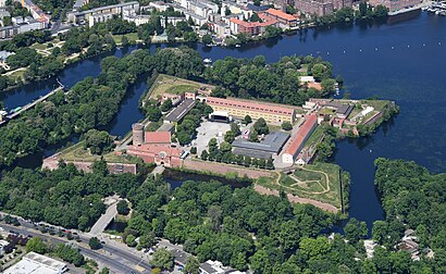
Zitadelle Spandau, Berlin, Germany
This stop serves BVG’s lines
Subway station near Zitadelle Spandau
Train station near Zitadelle Spandau
Popular public transit stations in Haselhorst
Get around Haselhorst by public transit!
Traveling around Haselhorst has never been so easy. See step by step directions as you travel to any attraction, street or major public transit station. View bus and train schedules, arrival times, service alerts and detailed routes on a map, so you know exactly how to get to anywhere in Haselhorst.
When traveling to any destination around Haselhorst use Moovit's Live Directions with Get Off Notifications to know exactly where and how far to walk, how long to wait for your line, and how many stops are left. Moovit will alert you when it's time to get off — no need to constantly re-check whether yours is the next stop.
Wondering how to use public transit in Haselhorst or how to pay for public transit in Haselhorst? Moovit public transit app can help you navigate your way with public transit easily, and at minimum cost. It includes public transit fees, ticket prices, and costs. Looking for a map of Haselhorst public transit lines? Moovit public transit app shows all public transit maps in Haselhorst with all subway, bus or train routes and stops on an interactive map.
Haselhorst has 3 transit type(s), including: subway, bus or train, operated by several transit agencies, including BVG, BVG, BVG, VBB, S-Bahn, Cottbusverkehr, Schöneicher Rüdersdorfer Straßenbahn, Strausberger Eisenbahn GmbH, Stadtverkehrsgesellschaft Tram, Verkehrsbetriebe Brandenburg, Verkehrsverbund Potsdam, BVG, DB Regio Bus, Barnimer Busgesellschaft and Busverkehr Oder-Spree GmbH