How to get to Zoos by bus?
Click on the bus route to see step by step directions with maps, line arrival times and updated time schedules.
How to get to Zoos by train?
Click on the train route to see step by step directions with maps, line arrival times and updated time schedules.
Bus stops near Zoos in Anif
Train stations near Zoos in Anif
Bus lines to Zoos in Anif
- 25, Hellbrunn,VIEW
- 28, Salzburg Europark-Salzburg Ferdinand-Hanusch-Platz,VIEW
- 170, Salzburg - Anif - Hallein - Golling,VIEW
- 170, Golling - Hallein - Anif - Salzburg,VIEW
- 175, Salzburg - Anif - Niederalm - Rif,VIEW
- 270, Salzburg - Eben - Zederhaus - St.Michael - Mauterndorf - Tamsweg Entwurf,VIEW
- 470, Golling - Abtenau - Gosau,VIEW
What are the closest stations to Zoos?
The closest stations to Zoos are:
- Salzburg Schloss Hellbrunn is 470 meters away, 7 min walk.
- Salzburg Alpenstraße/Fa.Porsche is 1507 meters away, 20 min walk.
- Salzburg Aigen S-Bahn is 1678 meters away, 23 min walk.
- Salzburg Aigen S-Bahn 2 is 1678 meters away, 22 min walk.
- Salzburg-Süd S-Bahn is 3182 meters away, 41 min walk.
Which train lines stop near Zoos?
These train lines stop near Zoos: R3, S3.
Which bus lines stop near Zoos?
These bus lines stop near Zoos: 170, 25, 270.
What’s the nearest train station to Zoos in Anif?
The nearest train station to Zoos in Anif is Salzburg Aigen S-Bahn. It’s a 23 min walk away.
What’s the nearest bus station to Zoos in Anif?
The nearest bus station to Zoos in Anif is Salzburg Schloss Hellbrunn. It’s a 7 min walk away.
What time is the first train to Zoos in Anif?
The S8 is the first train that goes to Zoos in Anif. It stops nearby at 4:12 AM.
What time is the last train to Zoos in Anif?
The S3 is the last train that goes to Zoos in Anif. It stops nearby at 12:35 AM.
What time is the first bus to Zoos in Anif?
The 170 is the first bus that goes to Zoos in Anif. It stops nearby at 5:16 AM.
What time is the last bus to Zoos in Anif?
The 170 is the last bus that goes to Zoos in Anif. It stops nearby at 12:44 AM.
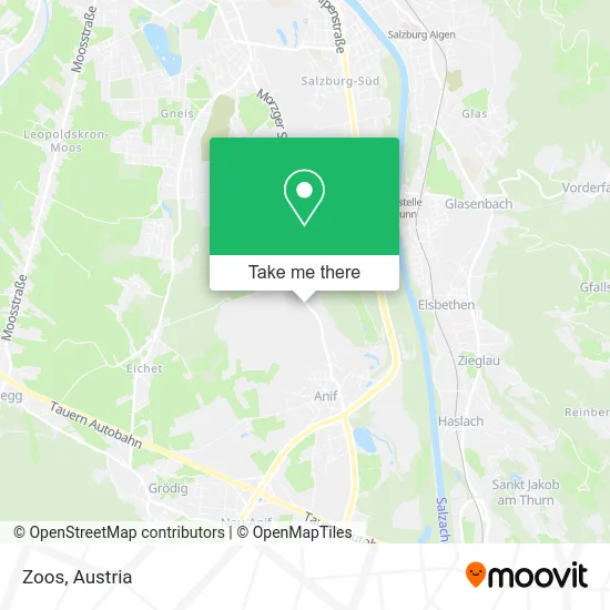
See Zoos, Anif, on the map
Public Transit to Zoos in Anif
Wondering how to get to Zoos in Anif? Moovit helps you find the best way to get to Zoos with step-by-step directions from the nearest public transit station.
Moovit provides free maps and live directions to help you navigate through your city. View schedules, routes, timetables, and find out how long does it take to get to Zoos in real time.
Looking for the nearest stop or station to Zoos? Check out this list of stops closest to your destination: Salzburg Schloss Hellbrunn; Salzburg Alpenstraße/Fa.Porsche; Salzburg Aigen S-Bahn; Salzburg Aigen S-Bahn 2; Salzburg-Süd S-Bahn.
Train: R3, S3, 221-S, S8, 221-S, S8, A5, A7, A14, A14.Bus: 170, 25, 270, 28, 175.
Want to see if there’s another route that gets you there at an earlier time? Moovit helps you find alternative routes or times. Get directions from and directions to Zoos easily from the Moovit App or Website.
We make riding to Zoos easy, which is why over 1.5 million users, including users in Anif, trust Moovit as the best app for public transit. You don’t need to download an individual bus app or train app, Moovit is your all-in-one transit app that helps you find the best bus time or train time available.
For information on prices of bus and train, costs and ride fares to Zoos, please check the Moovit app.
Use the app to navigate to popular places including to the airport, hospital, stadium, grocery store, mall, coffee shop, school, college, and university.
Zoos Address: Hellbrunnerstraße 73 5081 Anif street in Anif
- Numa I Ivy Rooms,
- Das Zoo,
- Lederleitner Rosenhaus Hellbrunn,
- Anif B.Salzburg Friesacher,
- Anif B.Salzburg Zoo Salzburg,
- Zoo Hellbrunn,
- Mag.Oec Eva Prem,
- Linzner Caroline,
- Sperling Kay Dipl-ING,
- Walter Haslauer,
- Fachfoto Royal Gmbh,
- Tierklinik Anif,
- Friesacher,
- MOON POWER GmbH,
- Compact Tours Gmbh,
- Friesacher Heuriger,
- Dagmar Pereira,
- Dr. Dr. Philip Bogner,
- Engel & Völkers Salzburg,
- Anif-Residenz GmbH
Places Near Zoos (Anif)
- Ronacher, 1., Innere Stadt,
- Setagayapark, Döbling,
- Mariahilfer Strasse, Mariahilf,
- Leopoldauer Alm, Floridsdorf,
- Lugner City, Rudolfsheim-Fünfhaus,
- Thomas-Klestil-Platz, Landstraße,
- Raimund-Theater, Mariahilf,
- Schweizerhaus (Karl Kolariks Schweizerhaus), Leopoldstadt,
- Türkenschanzpark, Währing,
- 10er Marie, Ottakring,
- Ghegastraße 3, Landstraße,
- Feuerhalle Simmering, Simmering,
- Kabarett Simpl, 1., Innere Stadt,
- Wien Rennbahn Freudenau, Leopoldstadt,
- Auhof-Center, Penzing,
- Donauzentrum, Donaustadt,
- Strandbad Gänsehäufel, Donaustadt,
- Schiffsanleger Wien-Nussdorf, Döbling,
- Klinik Floridsdorf (Krankenhaus Nord), Floridsdorf,
- Zentralfriedhof Halle 3, Simmering
How to get to popular places in Austria with public transit
Get around Anif by public transit!
Traveling around Anif has never been so easy. See step by step directions as you travel to any attraction, street or major public transit station. View bus and train schedules, arrival times, service alerts and detailed routes on a map, so you know exactly how to get to anywhere in Anif.
When traveling to any destination around Anif use Moovit's Live Directions with Get Off Notifications to know exactly where and how far to walk, how long to wait for your line, and how many stops are left. Moovit will alert you when it's time to get off — no need to constantly re-check whether yours is the next stop.
Wondering how to use public transit in Anif or how to pay for public transit in Anif? Moovit public transit app can help you navigate your way with public transit easily, and at minimum cost. It includes public transit fees, ticket prices, and costs. Looking for a map of Anif public transit lines? Moovit public transit app shows all public transit maps in Anif with all Bus, Train, Subway, Light Rail, Ferry and Funicular routes and stops on an interactive map.
Austria has 6 transit type(s), including: Bus, Train, Subway, Light Rail, Ferry and Funicular, operated by several transit agencies, including Wiener Linien GmbH & Co KG, Vienna Airport Lines, OEBB Personenverkehr AG Kundenservice, Wiener Lokalbahnen GmbH, City Air Terminal Betriebsgesellschaft m.b.H., CAT, Österreichische Postbus AG, VOR GmbH, Graz Linien, Graz-Köflacher Bahn und Busbetrieb GmbH, Steiermarkbahn und Bus GmbH, Linz Linien GmbH, Salzburg AG (Salzburger Lokalbahn), Salzburg AG (OBus) and KMG Klagenfurt Mobil GmbH