Directions to Zopa (Maltepe) with public transportation
The following transit lines have routes that pass near Zopa
 Bus: 133T, 16A, 16D, 17S, 4.
- Metro: M4.
- Train: B1.
- Dolmus & Minibus: KÜÇÜKYALI-AYDINEVLER-FINDIKLI, MALTEPE - BÜYÜKBAKKALKÖY, MALTEPE - ESENKENT, C58, C58.
How to get to Zopa by bus?
Click on the bus route to see step by step directions with maps, line arrival times and updated time schedules.
From Pendik Yüksek Hızlı Tren Garı, Pendik
52 minFrom Ümraniye Sgk., Ümraniye
79 minFrom Kadıköy Tarihi Salı Pazarı, Kadıköy
59 minFrom Göztepe Ağız ve Diş Sağlığı Merkezi, Kadıköy
76 minFrom Sancaktepe Ağız ve Diş Sağlığı Merkezi, Sancaktepe
64 minFrom Kadıköy Cuma Pazarı, Kadıköy
60 minFrom Fatih Sultan Mehmet Eğitim Ve Araştırma Hastanesi, Ataşehir
51 minFrom Tas Ocagi Poliklinik, Kartal
56 minFrom Yeditepe Üniversitesi, Ataşehir
74 minFrom Kadıköy/Bostancı, Bostancı,Kadıköy
34 min
How to get to Zopa by train?
Click on the train route to see step by step directions with maps, line arrival times and updated time schedules.
How to get to Zopa by metro?
Click on the metro route to see step by step directions with maps, line arrival times and updated time schedules.
From Pendik Yüksek Hızlı Tren Garı, Pendik
60 minFrom Ümraniye Sgk., Ümraniye
81 minFrom Kadıköy Tarihi Salı Pazarı, Kadıköy
47 minFrom Sancaktepe Ağız ve Diş Sağlığı Merkezi, Sancaktepe
96 minFrom Kadıköy Cuma Pazarı, Kadıköy
48 minFrom Fatih Sultan Mehmet Eğitim Ve Araştırma Hastanesi, Ataşehir
49 minFrom Tas Ocagi Poliklinik, Kartal
56 minFrom Yeditepe Üniversitesi, Ataşehir
78 minFrom Kadıköy/Bostancı, Bostancı,Kadıköy
58 min
Train station near Zopa in Maltepe
- Maltepe, 7 min walk,VIEW
Bus stops near Zopa in Maltepe
Dolmus & Minibus station near Zopa in Maltepe
- Maltepe İstasyon, 8 min walk,VIEW
Bus lines to Zopa in Maltepe
- 16D, Kadıköy-Kaynarca Sondurak,VIEW
- 133T, Deniz Harp Okulu-Maltepe Peronlar,VIEW
- 4, Maltepe Peronlar-İskele,VIEW
- C50, Kadıköy(Kartaldan Başlar),VIEW
- 16, Pendik-Kadıköy,VIEW
- 16A, Pendik-Harem Peronlar 3,VIEW
- 17, Kadıköy-Pendik,VIEW
- 17S, Bostancı Peronlar-Uğur Mumcu,VIEW
- 133F, Acarlar Sitesi-Cevizli Peronlar,VIEW
- 133G, Kartal-Gülensu Mahallesi,VIEW
What are the closest stations to Zopa?
The closest stations to Zopa are:
- Maltepe is 505 meters away, 7 min walk.
- Dr.Sadik Ahmet - Pendik Yönü is 512 meters away, 7 min walk.
- Maltepe İstasyon is 526 meters away, 8 min walk.
- İstasyon Yolu - Kadiköy Yönü is 654 meters away, 9 min walk.
- Maltepe Bağdat Caddesi - Pendik Yönü is 1207 meters away, 16 min walk.
Which bus lines stop near Zopa?
These bus lines stop near Zopa: 133T, 16A, 16D, 17S, 4.
Which metro line stops near Zopa?
M4 (Sabiha Gökçen Havalimanı→Kadıköy)
Which train line stops near Zopa?
B1 (Halkalı)
Which Dolmus & Minibus lines stop near Zopa?
These Dolmus & Minibus lines stop near Zopa: KÜÇÜKYALI-AYDINEVLER-FINDIKLI, MALTEPE - BÜYÜKBAKKALKÖY, MALTEPE - ESENKENT.
What’s the nearest train station to Zopa in Maltepe?
The nearest train station to Zopa in Maltepe is Maltepe. It’s a 7 min walk away.
What’s the nearest bus station to Zopa in Maltepe?
The nearest bus station to Zopa in Maltepe is Dr.Sadik Ahmet - Pendik Yönü. It’s a 7 min walk away.
What’s the nearest Dolmus & Minibus station to Zopa in Maltepe?
The nearest Dolmus & Minibus station to Zopa in Maltepe is Maltepe İstasyon. It’s a 8 min walk away.
What time is the first train to Zopa in Maltepe?
The B1 is the first train that goes to Zopa in Maltepe. It stops nearby at 6:02 AM.
What time is the last train to Zopa in Maltepe?
The B1 is the last train that goes to Zopa in Maltepe. It stops nearby at 12:11 AM.
What time is the first bus to Zopa in Maltepe?
The 4 is the first bus that goes to Zopa in Maltepe. It stops nearby at 5:55 AM.
What time is the last bus to Zopa in Maltepe?
The 16D is the last bus that goes to Zopa in Maltepe. It stops nearby at 12:57 AM.
What time is the first Dolmus & Minibus to Zopa in Maltepe?
The KADIKÖY - PENDIK is the first Dolmus & Minibus that goes to Zopa in Maltepe. It stops nearby at 3:03 AM.
What time is the last Dolmus & Minibus to Zopa in Maltepe?
The KADIKÖY - PENDIK is the last Dolmus & Minibus that goes to Zopa in Maltepe. It stops nearby at 3:16 AM.
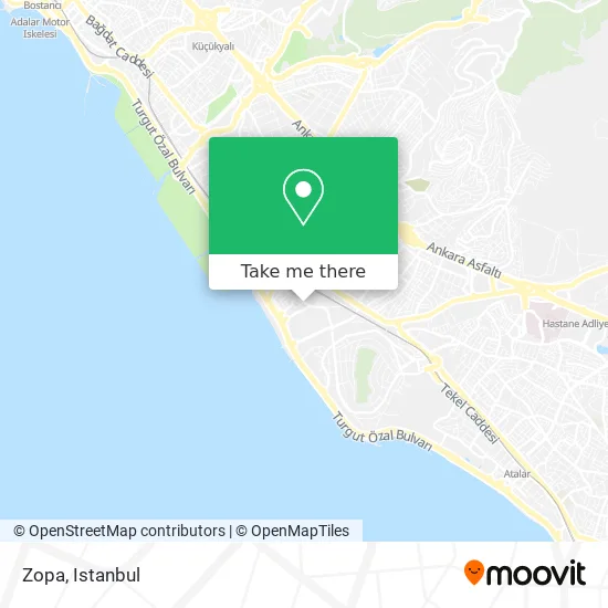
See Zopa, Maltepe, on the map
Public Transit to Zopa in Maltepe
Wondering how to get to Zopa in Maltepe? Moovit helps you find the best way to get to Zopa with step-by-step directions from the nearest public transit station.
Moovit provides free maps and live directions to help you navigate through your city. View schedules, routes, timetables, and find out how long does it take to get to Zopa in real time.
Looking for the nearest stop or station to Zopa? Check out this list of stops closest to your destination: Maltepe; Dr.Sadik Ahmet - Pendik Yönü; Maltepe İstasyon; İstasyon Yolu - Kadiköy Yönü; Maltepe Bağdat Caddesi - Pendik Yönü.
Bus: 133T, 16A, 16D, 17S, 4, C50, 16, 17.Metro: M4.Train: B1.Dolmus & Minibus: KÜÇÜKYALI-AYDINEVLER-FINDIKLI, MALTEPE - BÜYÜKBAKKALKÖY, MALTEPE - ESENKENT, C58, C58, C64, C64, C64.
Want to see if there’s another route that gets you there at an earlier time? Moovit helps you find alternative routes or times. Get directions from and directions to Zopa easily from the Moovit App or Website.
We make riding to Zopa easy, which is why over 1.5 million users, including users in Maltepe, trust Moovit as the best app for public transit. You don’t need to download an individual bus app or train app, Moovit is your all-in-one transit app that helps you find the best bus time or train time available.
For information on prices of Dolmus & Minibus, metro, bus and train, costs and ride fares to Zopa, please check the Moovit app.
Use the app to navigate to popular places including to the airport, hospital, stadium, grocery store, mall, coffee shop, school, college, and university.
Zopa Address: Mareşal Fevzi Çakmak Caddesi, 34844 Yalı, İstanbul street in Maltepe
- South Park,
- Pozıtıf Eczanesı,
- Alpinestar Drift Team,
- Moni Pasta,
- Nlss Mühendislik ve Ar-Ge,
- Yali Erkek Kuaforu,
- Saloon Murat Alçınkaya,
- Salon Black,
- Emas Makina,
- Maltepe Deniz Sitesi,
- Dragos Drive Sitesi,
- Garanti Koza Sitesi,
- İkram Nakliyat,
- Marmara Deniz Sitesi,
- KeyifHane,
- Yalı Mahallesi,
- Duvar,
- Selim Alparslan Mali Müşavirlik Bürosu,
- Vişneli Kurabiye,
- Eca Armatur Sanayi
Places Near Zopa (Maltepe)
- Tersane İstanbul, Beyoğlu,
- VİALAND AVM, Eyüp,
- Hz. Yuşa Tepesi, Beykoz,
- Başakşehir Çam Ve Sakura Şehir Hastanesi, Basaksehir,
- İstanbul,
- 41 Burda AVM, Kocaeli Merkezi,
- Karaköy Genelevi, Karaköy, Beyoğlu,
- METROPOL IsTaNBuL, Ataşehir,
- Mall Of İstanbul, Basaksehir,
- 2 Nolu Minibüss, Beylikduzu,
- 212 AVM, Bagcilar,
- Gebze-Harem Minibüs Hattı, Gebze,
- Mehmet Emin Tokadî Hz. Türbesi, Fatih,
- Hilltown AVM, Maltepe,
- Beylikdüzü - 4 Nolu Minibüs Hattı, Beylikduzu,
- Bakırköy Sosyete Pazarı, Bakirköy,
- Gebze Koop Durağı, Gebze,
- Şehit Prof. Dr. İlhan Varank Eğitim Ve Araştırma Hastanesi, Sancaktepe,
- İstinye Park, Sariyer,
- Topkule Kışlası 47.Komando Tugay Komutanlığı, Esenler
How to get to popular places in Istanbul with public transit
Get around Maltepe by public transit!
Traveling around Maltepe has never been so easy. See step by step directions as you travel to any attraction, street or major public transit station. View bus and train schedules, arrival times, service alerts and detailed routes on a map, so you know exactly how to get to anywhere in Maltepe.
When traveling to any destination around Maltepe use Moovit's Live Directions with Get Off Notifications to know exactly where and how far to walk, how long to wait for your line, and how many stops are left. Moovit will alert you when it's time to get off — no need to constantly re-check whether yours is the next stop.
Wondering how to use public transit in Maltepe or how to pay for public transit in Maltepe? Moovit public transit app can help you navigate your way with public transit easily, and at minimum cost. It includes public transit fees, ticket prices, and costs. Looking for a map of Maltepe public transit lines? Moovit public transit app shows all public transit maps in Maltepe with all Bus, Train, Metro, Tram, Ferry, Metrobus and Dolmus & Minibus routes and stops on an interactive map.
Istanbul has 7 transit type(s), including: Bus, Train, Metro, Tram, Ferry, Metrobus and Dolmus & Minibus, operated by several transit agencies, including Marmaray, Metro İstanbul, Metrobüs, UAB, İETT, İETT ÇIFT KATLI HATLAR, İETT BÖLGESEL HATLAR, TCDD, Şehir Hatları, Dentur Avrasya, Beyden, Turyol, Mavi Marmara, Havaist and Prenstur
