How to get to &Pizza by bus?
Click on the bus route to see step by step directions with maps, line arrival times and updated time schedules.
From Hyattsville, MD, Prince George's County
70 minFrom VA Medical Center-Washington, Washington
45 minFrom Hyattsville District Court, Prince George's County
67 minFrom Tenleytown, Washington
64 minFrom Alfred Street Baptist Church, Alexandria
58 minFrom The Mall at Prince Georges, Prince George's County
87 minFrom National Zoo, Washington
58 minFrom Hilton Alexandria Old Town, Alexandria
76 minFrom Oxon Hill, MD, Prince George's County
67 minFrom US department of state SA 4 E, Washington
39 min
How to get to &Pizza by train?
Click on the train route to see step by step directions with maps, line arrival times and updated time schedules.
How to get to &Pizza by metro?
Click on the metro route to see step by step directions with maps, line arrival times and updated time schedules.
From Hyattsville, MD, Prince George's County
54 minFrom VA Medical Center-Washington, Washington
53 minFrom Tenleytown, Washington
26 minFrom Alfred Street Baptist Church, Alexandria
51 minFrom The Mall at Prince Georges, Prince George's County
46 minFrom National Zoo, Washington
31 minFrom Hilton Alexandria Old Town, Alexandria
29 minFrom US department of state SA 4 E, Washington
29 min
Metro stations near &Pizza in Washington
Bus stops near &Pizza in Washington
Bus lines to &Pizza in Washington
What are the closest stations to &Pizza?
The closest stations to &Pizza are:
- Eastern Market is 40 yards away, 1 min walk.
- 8 St Se+D St SE is 62 yards away, 1 min walk.
- 8 St Se+E St SE is 117 yards away, 2 min walk.
- Pennsylvania Ave Se & 8th St Se is 117 yards away, 2 min walk.
- Navy Yard Metro Station is 1658 yards away, 20 min walk.
Which bus lines stop near &Pizza?
These bus lines stop near &Pizza: C53, D10.
Which train lines stop near &Pizza?
These train lines stop near &Pizza: MARC, NORTHEAST REGIONAL.
Which metro lines stop near &Pizza?
These metro lines stop near &Pizza: BLUE, ORANGE, SILVER.
What’s the nearest metro station to &Pizza in Washington?
The nearest metro station to &Pizza in Washington is Eastern Market. It’s a 1 min walk away.
What’s the nearest bus station to &Pizza in Washington?
The nearest bus station to &Pizza in Washington is 8 St Se+D St SE. It’s a 1 min walk away.
What time is the first metro to &Pizza in Washington?
The BLUE is the first metro that goes to &Pizza in Washington. It stops nearby at 5:08 AM.
What time is the last metro to &Pizza in Washington?
The ORANGE is the last metro that goes to &Pizza in Washington. It stops nearby at 12:22 AM.
What time is the first bus to &Pizza in Washington?
The D10 is the first bus that goes to &Pizza in Washington. It stops nearby at 3:00 AM.
What time is the last bus to &Pizza in Washington?
The C53 is the last bus that goes to &Pizza in Washington. It stops nearby at 3:20 AM.
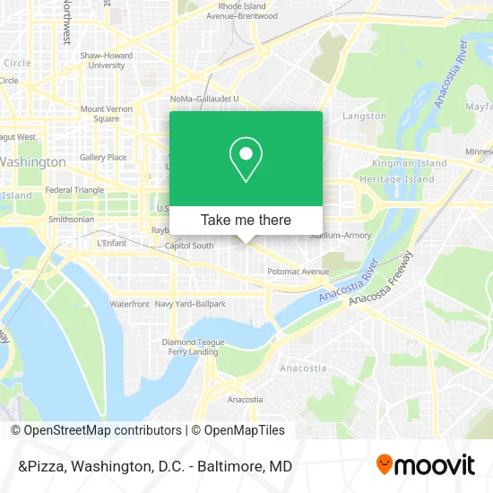
See &Pizza, Washington, on the map
Public Transit to &Pizza in Washington
Wondering how to get to &Pizza in Washington? Moovit helps you find the best way to get to &Pizza with step-by-step directions from the nearest public transit station.
Moovit provides free maps and live directions to help you navigate through your city. View schedules, routes, timetables, and find out how long does it take to get to &Pizza in real time.
Looking for the nearest stop or station to &Pizza? Check out this list of stops closest to your destination: Eastern Market; 8 St Se+D St SE; 8 St Se+E St SE; Pennsylvania Ave Se & 8th St Se; Navy Yard Metro Station.
Bus: C53, D10, C55, D1X.Train: MARC, NORTHEAST REGIONAL.Metro: BLUE, ORANGE, SILVER, GREEN.
Want to see if there’s another route that gets you there at an earlier time? Moovit helps you find alternative routes or times. Get directions from and directions to &Pizza easily from the Moovit App or Website.
We make riding to &Pizza easy, which is why over 1.5 million users, including users in Washington, trust Moovit as the best app for public transit. You don’t need to download an individual bus app or train app, Moovit is your all-in-one transit app that helps you find the best bus time or train time available.
For information on prices of metro, bus and train, costs and ride fares to &Pizza, please check the Moovit app.
Use the app to navigate to popular places including to the airport, hospital, stadium, grocery store, mall, coffee shop, school, college, and university.
&Pizza Address: 8th Street Southeast street in Washington
- Popeyes,
- Mr Nice Guys,
- Kinfolk Dispensary,
- CapitalOne ATM,
- 8th and D St,
- Ledo Pizza and Pasta,
- Crutchfield Insurance Agency,
- Cafe 8 (Cafe8),
- 8th St SE and Pennsylvania Ave SE,
- Eastern Market Metro Station,
- South Carolina Ave SE & 7th St,
- AS You Are Bar,
- Ted's Bulletin,
- DC Circulator - Union Station to Navy Yard Metro,
- 7th St D St SE,
- Old Naval Hospital (Temporary Home for Veterans of Wars),
- 550 8th St SE ,
- Mekki DC,
- Little Pearl,
- Matchbox
Places Near &Pizza (Washington)
- Sibley Memorial Hospital, Washington,
- Westfield Montgomery Mall, Montgomery County,
- Pennsylvania Ave NW (3rd st and pennsylvania), Washington,
- Marriott Marquis Washington, DC, Washington,
- Warner Theatre, Washington,
- Basilica of the National Shrine, Washington,
- Georgetown, Washington,
- Museum Of The Bible, Washington,
- M&T Bank Stadium, Baltimore,
- Camden Yards, Baltimore,
- Rock Creek Tennis Center, Washington,
- PG Mall, Prince George's County,
- National Theatre, Washington,
- The Anthem, Washington,
- National Zoo, Washington,
- Washington DC VA Medical Center, Washington,
- Capital One Arena, Washington,
- Washington National Cathedral, Washington,
- Amazon Hq2, Arlington County,
- National Museum of African American History and Culture, Washington
How to get to popular places in Washington, D.C. - Baltimore, MD with public transit
Get around Washington by public transit!
Traveling around Washington has never been so easy. See step by step directions as you travel to any attraction, street or major public transit station. View bus and train schedules, arrival times, service alerts and detailed routes on a map, so you know exactly how to get to anywhere in Washington.
When traveling to any destination around Washington use Moovit's Live Directions with Get Off Notifications to know exactly where and how far to walk, how long to wait for your line, and how many stops are left. Moovit will alert you when it's time to get off — no need to constantly re-check whether yours is the next stop.
Wondering how to use public transit in Washington or how to pay for public transit in Washington? Moovit public transit app can help you navigate your way with public transit easily, and at minimum cost. It includes public transit fees, ticket prices, and costs. Looking for a map of Washington public transit lines? Moovit public transit app shows all public transit maps in Washington with all Bus, Train, Metro, Light Rail and Ferry routes and stops on an interactive map.
Washington, D.C. - Baltimore, MD has 5 transit type(s), including: Bus, Train, Metro, Light Rail and Ferry, operated by several transit agencies, including WMATA, Montgomery County Ride On, Fairfax Connector, TheBus, PRTC, DASH - Alexandria, Arlington Transit (ART), RTA of Central Maryland, MDOT MTA, MDOT MTA Light RailLink, MDOT MTA Commuter Bus, MDOT MTA Local Bus, FXBGO!, Virginia Railway Express (VRE) and MARC