How to get to cacapoopoopeepeeshire by bus?
Click on the bus route to see step by step directions with maps, line arrival times and updated time schedules.
From Ghostbusters Building, Manhattan
85 minFrom E 66th St (2nd Ave & 66th), Manhattan
64 minFrom E 84th St, Manhattan
82 minFrom Pier 61, Manhattan
97 minFrom Pier 40 - Hudson River Park, Manhattan
99 minFrom Studio 54, Manhattan
80 minFrom The Armory, Manhattan
95 minFrom Pier 61 - Chelsea Piers, Manhattan
107 minFrom 22 Cortlandt Street, Manhattan
89 min
How to get to cacapoopoopeepeeshire by train?
Click on the train route to see step by step directions with maps, line arrival times and updated time schedules.
How to get to cacapoopoopeepeeshire by subway?
Click on the subway route to see step by step directions with maps, line arrival times and updated time schedules.
From Ghostbusters Building, Manhattan
55 minFrom E 66th St (2nd Ave & 66th), Manhattan
57 minFrom E 84th St, Manhattan
48 minFrom Pier 61, Manhattan
47 minFrom Pier 40 - Hudson River Park, Manhattan
43 minFrom Studio 54, Manhattan
49 minFrom The Armory, Manhattan
55 minFrom Pier 61 - Chelsea Piers, Manhattan
47 minFrom 22 Cortlandt Street, Manhattan
39 min
Bus stops near cacapoopoopeepeeshire in Queens
Subway station near cacapoopoopeepeeshire in Queens
- Myrtle-Wyckoff Avs, 2 min walk,VIEW
Bus lines to cacapoopoopeepeeshire in Queens
What are the closest stations to cacapoopoopeepeeshire?
The closest stations to cacapoopoopeepeeshire are:
- Seneca Av/Cornelia St is 93 yards away, 2 min walk.
- Putnam Av/Onderdonk Av is 116 yards away, 2 min walk.
- Myrtle-Wyckoff Avs is 155 yards away, 2 min walk.
- Madison St/Cypress Av is 192 yards away, 3 min walk.
- Myrtle Av/Madison St is 230 yards away, 3 min walk.
- Gates Av/Seneca Av is 363 yards away, 5 min walk.
Which bus lines stop near cacapoopoopeepeeshire?
These bus lines stop near cacapoopoopeepeeshire: B38, B60, Q39.
Which train line stops near cacapoopoopeepeeshire?
CITY TERMINAL ZONE (Atlantic Terminal)
Which subway lines stop near cacapoopoopeepeeshire?
These subway lines stop near cacapoopoopeepeeshire: L, M.
What’s the nearest subway station to cacapoopoopeepeeshire in Queens?
The nearest subway station to cacapoopoopeepeeshire in Queens is Myrtle-Wyckoff Avs. It’s a 2 min walk away.
What’s the nearest bus station to cacapoopoopeepeeshire in Queens?
The nearest bus stations to cacapoopoopeepeeshire in Queens are Seneca Av/Cornelia St and Putnam Av/Onderdonk Av. The closest one is a 2 min walk away.
What time is the first subway to cacapoopoopeepeeshire in Queens?
The L is the first subway that goes to cacapoopoopeepeeshire in Queens. It stops nearby at 3:01 AM.
What time is the last subway to cacapoopoopeepeeshire in Queens?
The L is the last subway that goes to cacapoopoopeepeeshire in Queens. It stops nearby at 3:16 AM.
What time is the first bus to cacapoopoopeepeeshire in Queens?
The Q58 is the first bus that goes to cacapoopoopeepeeshire in Queens. It stops nearby at 3:14 AM.
What time is the last bus to cacapoopoopeepeeshire in Queens?
The B38 is the last bus that goes to cacapoopoopeepeeshire in Queens. It stops nearby at 3:29 AM.
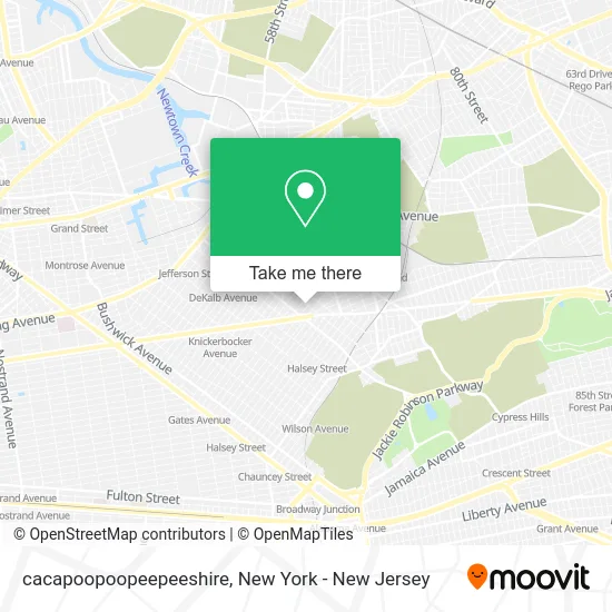
See cacapoopoopeepeeshire, Queens, on the map
Public Transit to cacapoopoopeepeeshire in Queens
Wondering how to get to cacapoopoopeepeeshire in Queens? Moovit helps you find the best way to get to cacapoopoopeepeeshire with step-by-step directions from the nearest public transit station.
Moovit provides free maps and live directions to help you navigate through your city. View schedules, routes, timetables, and find out how long does it take to get to cacapoopoopeepeeshire in real time.
Looking for the nearest stop or station to cacapoopoopeepeeshire? Check out this list of stops closest to your destination: Seneca Av/Cornelia St; Putnam Av/Onderdonk Av; Myrtle-Wyckoff Avs; Madison St/Cypress Av; Myrtle Av/Madison St; Gates Av/Seneca Av.
Bus: B38, B60, Q39, Q58, Q98, Q55, B13.Train: CITY TERMINAL ZONE.Subway: L, M.
Want to see if there’s another route that gets you there at an earlier time? Moovit helps you find alternative routes or times. Get directions from and directions to cacapoopoopeepeeshire easily from the Moovit App or Website.
We make riding to cacapoopoopeepeeshire easy, which is why over 1.5 million users, including users in Queens, trust Moovit as the best app for public transit. You don’t need to download an individual bus app or train app, Moovit is your all-in-one transit app that helps you find the best bus time or train time available.
For information on prices of subway, bus and train, costs and ride fares to cacapoopoopeepeeshire, please check the Moovit app.
Use the app to navigate to popular places including to the airport, hospital, stadium, grocery store, mall, coffee shop, school, college, and university.
Location: Queens, New York - New Jersey
- Seneca Crystal Cleaners,
- Bar Freda,
- Energy Protein Spot,
- Comida Mexicana,
- Cut It Out Barbershop,
- Bar Freda,
- Renta De Mesas Y Sillas,
- Bienestar Y Riqueza,
- Suarez Realty Inc,
- Western Union,
- Milk and Pull,
- Arias Tax Service,
- Inoava Corporation,
- Cositas Pequenas,
- Bella,
- M&S,
- Iglesia Sinaí,
- Radio Alli Willak,
- Toro Taxes Ridgewood,
- Margarets Catering
Places Near cacapoopoopeepeeshire (Queens)
- Queens Center Mall, Queens,
- 3 Stone St, Manhattan,
- San Gennaro Feast, Manhattan,
- Pier 83, Manhattan,
- Times Square, Manhattan,
- SoHo, Manhattan,
- 376 Hudson Street, Manhattan,
- 1 Police Plaza, Manhattan,
- Katz's Deli, Manhattan,
- 911 Memorial, Manhattan,
- Hudson Yards, Manhattan,
- 26 Federal Plaza, Manhattan,
- 111 Centre New York City Supreme Court, Manhattan,
- Wall Street, Manhattan,
- Mountainside Hospital, Glen Ridge,
- Chinatown, Manhattan,
- 66 John Street, Manhattan,
- Rockefeller Center, Manhattan,
- qqqq, Manhattan,
- Bellevue Hospital, Manhattan
How to get to popular places in New York - New Jersey with public transit
Get around Queens by public transit!
Traveling around Queens has never been so easy. See step by step directions as you travel to any attraction, street or major public transit station. View bus and train schedules, arrival times, service alerts and detailed routes on a map, so you know exactly how to get to anywhere in Queens.
When traveling to any destination around Queens use Moovit's Live Directions with Get Off Notifications to know exactly where and how far to walk, how long to wait for your line, and how many stops are left. Moovit will alert you when it's time to get off — no need to constantly re-check whether yours is the next stop.
Wondering how to use public transit in Queens or how to pay for public transit in Queens? Moovit public transit app can help you navigate your way with public transit easily, and at minimum cost. It includes public transit fees, ticket prices, and costs. Looking for a map of Queens public transit lines? Moovit public transit app shows all public transit maps in Queens with all Bus, Train, Subway, Light Rail, Ferry and Cable Car routes and stops on an interactive map.
New York - New Jersey has 6 transit type(s), including: Bus, Train, Subway, Light Rail, Ferry and Cable Car, operated by several transit agencies, including MTA Subway, Metro-North Railroad, LIRR, PATH, MTA New York City Transit - Express routes, MTA Bus, NJ Transit, NYC Ferry, NICE bus, Bee-Line Bus, NJ Transit Rail, Norwalk Transit District, Hartford Line, River Valley Transit and HART