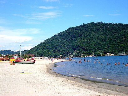
Directions to centro de mangaratiba (Mangaratiba) with public transportation
The following transit lines have routes that pass near centro de mangaratiba
 Bus: 117T, 457U, ANGRA DOS REIS - RIO DE JANEIRO, MANGARATIBA - INGAIBA, MANGARATIBA - ITACURUÇÁ (VIA MURIQUI / AXIXÁ).
- Ferry: MANGARATIBA - ILHA GRANDE.
How to get to centro de mangaratiba by bus?
Click on the bus route to see step by step directions with maps, line arrival times and updated time schedules.
Bus stops near centro de mangaratiba in Mangaratiba
- Estrada São João Marcos, 29, 5 min walk,
- Estrada São João Marcos, 360, 5 min walk,
- Estrada São João Marcos, 13, 6 min walk,
- Estrada São João Marcos, 12, 7 min walk,
Ferry station near centro de mangaratiba in Mangaratiba
- Mangaratiba ⛴, 19 min walk,
Bus lines to centro de mangaratiba in Mangaratiba
- MANGARATIBA - INGAIBA, Mangaratiba - Ingaiba,
- MANGARATIBA - ITACURUÇÁ (VIA MURIQUI / AXIXÁ), Mangaratiba - Itacuruçá (Via Muriqui / Axixá),
- MANGARATIBA - JACAREÍ, Mangaratiba - Jacareí,
- MANGARATIBA - JUNQUEIRA, Mangaratiba - Junqueira,
- MANGARATIBA - SERRA DO PILOTO, Mangaratiba - Serra do Piloto,
- 117T, Itaguaí - Mangaratiba (via Praia do Saco),
- 122T, Itaguaí - Mangaratiba (via Axixá / Itacuruçá / Muriquí),
- 457U, Itaguaí - Jacareí (via Mangaratiba/Sahy-Ibicuí),
- V123, Itaguaí ,
- MANGARATIBA - PRAIA DO SACO, Praia Do Saco,
- MANGARATIBA - SERRA DO PILOTO, Serra Do Piloto,
- MANGARATIBA - INGAÍBA, Ingaíba ,
What are the closest stations to centro de mangaratiba?
The closest stations to centro de mangaratiba are:
- Estrada São João Marcos, 29 stop is 274 meters away, 5 min walk.
- Estrada São João Marcos, 13 stop is 357 meters away, 6 min walk.
- Estrada São João Marcos, 360 stop is 370 meters away, 5 min walk.
- Estrada São João Marcos, 12 stop is 420 meters away, 7 min walk.
- Mangaratiba ⛴ station is 1458 meters away, 19 min walk.
Which bus lines stop near centro de mangaratiba?
These bus lines stop near centro de mangaratiba: 117T, 457U, ANGRA DOS REIS - RIO DE JANEIRO, MANGARATIBA - INGAIBA, MANGARATIBA - ITACURUÇÁ (VIA MURIQUI / AXIXÁ).
What’s the nearest bus station to centro de mangaratiba in Mangaratiba?
The nearest bus stations to centro de mangaratiba in Mangaratiba are Estrada São João Marcos, 29 and Estrada São João Marcos, 360. The closest one is a 5 min walk away.
What’s the nearest ferry station to centro de mangaratiba in Mangaratiba?
The nearest ferry station to centro de mangaratiba in Mangaratiba is Mangaratiba ⛴. It’s a 19 min walk away.
What time is the first bus to centro de mangaratiba in Mangaratiba?
The 117T is the first bus that goes to centro de mangaratiba in Mangaratiba. It stops nearby at 4:46 AM.
What time is the last bus to centro de mangaratiba in Mangaratiba?
The 457U is the last bus that goes to centro de mangaratiba in Mangaratiba. It stops nearby at 10:52 PM.
What time is the first ferry to centro de mangaratiba in Mangaratiba?
The MANGARATIBA - ILHA GRANDE is the first ferry that goes to centro de mangaratiba in Mangaratiba. It stops nearby at 8:00 AM.
What time is the last ferry to centro de mangaratiba in Mangaratiba?
The MANGARATIBA - ILHA GRANDE is the last ferry that goes to centro de mangaratiba in Mangaratiba. It stops nearby at 6:50 PM.
See centro de mangaratiba, Mangaratiba, on the map
Public Transit to centro de mangaratiba in Mangaratiba
Wondering how to get to centro de mangaratiba in Mangaratiba? Moovit helps you find the best way to get to centro de mangaratiba with step-by-step directions from the nearest public transit station.
Moovit provides free maps and live directions to help you navigate through your city. View schedules, routes, timetables, and find out how long does it take to get to centro de mangaratiba in real time.
Looking for the nearest stop or station to centro de mangaratiba? Check out this list of stops closest to your destination: Estrada São João Marcos; Estrada São João Marcos; Estrada São João Marcos; Estrada São João Marcos; Mangaratiba ⛴.
Bus: 117T, 457U, ANGRA DOS REIS - RIO DE JANEIRO, MANGARATIBA - INGAIBA, MANGARATIBA - ITACURUÇÁ (VIA MURIQUI / AXIXÁ), MANGARATIBA - JACAREÍ, MANGARATIBA - JUNQUEIRA, MANGARATIBA - SERRA DO PILOTO, MANGARATIBA - PRAIA DO SACO, MANGARATIBA - SERRA DO PILOTO, V123, MANGARATIBA - INGAÍBA.Ferry: MANGARATIBA - ILHA GRANDE.
Want to see if there’s another route that gets you there at an earlier time? Moovit helps you find alternative routes or times. Get directions from and directions to centro de mangaratiba easily from the Moovit App or Website.
We make riding to centro de mangaratiba easy, which is why over 1.7 billion users, including users in Mangaratiba, trust Moovit as the best app for public transit. You don’t need to download an individual bus app or train app, Moovit is your all-in-one transit app that helps you find the best bus time or train time available.
For information on prices of bus, costs and ride fares to centro de mangaratiba, please check the Moovit app.
Use the app to navigate to popular places including to the airport, hospital, stadium, grocery store, mall, coffee shop, school, college, and university.
Location: Mangaratiba, Rio de Janeiro Region
- Rainha do Açaí,
- Parque Natural Municipal da Pedra do Urubu,
- Papaléguas Lanches & Papaléguas Pizzas,
- Sítio Vista Alegre,
- Rua Rio Branco, 156,
- Instituto Lucia Castilho,
- Praça do skate,
- Rua Geraldo de Araujo Caçapa, 179,
- Bazar,
- bar do baixinho das pedras,
- Igreja Evangelica Assembleia de Deus Ministério Proclame - Admip,
- Projetos de Engenharia Rb,
- Nelfer - Distribuidora de Ferro e Aço,
- Farmacias Farmax,
- Mercado Belot,
- Pousada Imperial,
- Zero 7 Auto Pecas,
- Fibrasil Infraestrutura e Fibra Ótica,
- Millenium Vidracaria e Serralheria,
- Ciep-294 Cândido Jorge Capixaba
Places Near centro de mangaratiba (Mangaratiba)
- Rodoviária Novo Rio (Rodoviária do Rio de Janeiro), Santo Cristo,
- Avenida Venezuela 134, Saúde,
- Hospital Municipal Ronaldo Gazolla, Acari,
- Shopping Nova América, Del Castilho,
- Shopping RioSul, Botafogo,
- Hospital Pedro Ernesto, Vila Isabel,
- Hospital Federal Do Andaraí, Andaraí,
- Hospital Federal Cardoso Fontes, Jacarepaguá,
- Niterói, Niterói,
- Praia do Arpoador, Ipanema,
- Rua Licínio Cardoso, São Francisco Xavier,
- Shopping Rio Sul, Botafogo,
- Avenida Rio Branco, Centro,
- Museu Do Amanhã, Centro,
- Shopping Downtown, Barra Da Tijuca,
- Norte Shopping, Cachambi,
- Rio De Janeiro,
- Feirão De Malhas, Duque De Caxias,
- Feira Livre da Gloria, Glória,
- West Shopping, Campo Grande
How to get to popular places in Rio de Janeiro Region with public transit
Get around Mangaratiba by public transit!
Traveling around Mangaratiba has never been so easy. See step by step directions as you travel to any attraction, street or major public transit station. View bus and train schedules, arrival times, service alerts and detailed routes on a map, so you know exactly how to get to anywhere in Mangaratiba.
When traveling to any destination around Mangaratiba use Moovit's Live Directions with Get Off Notifications to know exactly where and how far to walk, how long to wait for your line, and how many stops are left. Moovit will alert you when it's time to get off — no need to constantly re-check whether yours is the next stop.
Wondering how to use public transit in Mangaratiba or how to pay for public transit in Mangaratiba? Moovit public transit app can help you navigate your way with public transit easily, and at minimum cost. It includes public transit fees, ticket prices, and costs. Looking for a map of Mangaratiba public transit lines? Moovit public transit app shows all public transit maps in Mangaratiba with all Bus, Train, Metro, Light Rail, Ferry, Cable Car, Gondola and Funicular routes and stops on an interactive map.
Rio de Janeiro Region has 8 transit type(s), including: Bus, Train, Metro, Light Rail, Ferry, Cable Car, Gondola and Funicular, operated by several transit agencies, including TrensRJ, Metrô Rio, VLT Carioca, Barcas Rio, BRT MOBI-Rio, Auto Viação Alpha, Auto Viação Tijuca, Gire Transportes, Transurb, Viação Nossa Senhora das Graças, Consórcio INTERSUL, Braso Lisboa, Caprichosa Auto Ônibus, Auto Viação Três Amigos and Rodoviária Âncora Matias