How to get to ecco by bus?
Click on the bus route to see step by step directions with maps, line arrival times and updated time schedules.
From Sensual Asian Massage, Boca Raton
48 minFrom Sample Rd, Deerfield Beach
114 minFrom Ollie's Bargain Outlet, Boynton Beach-Delray Beach
36 minFrom North Area Transportation Terminal, Pompano Beach
158 minFrom Butterfly World, Pompano Beach
103 minFrom Tri-Rail-Pompano Beach Station, Pompano Beach
108 minFrom Amazon Fulfillment Center-DMF3, Pompano Beach
121 minFrom Funky Buddha Brewery And Lounge, Boca Raton
53 minFrom Pretty in Palm Beach, Boynton Beach-Delray Beach
53 min
Bus stop near ecco in Boca Raton
- BUTTS RD at TWN CTR RD, 10 min walk,VIEW
Bus lines to ecco in Boca Raton
What are the closest stations to ecco?
The closest stations to ecco are:
- BUTTS RD at TWN CTR RD is 817 yards away, 10 min walk.
Which bus lines stop near ecco?
These bus lines stop near ecco: 2, 3, 91, 92.
What’s the nearest bus station to ecco in Boca Raton?
The nearest bus station to ecco in Boca Raton is BUTTS RD at TWN CTR RD. It’s a 10 min walk away.
What time is the first bus to ecco in Boca Raton?
The 3 is the first bus that goes to ecco in Boca Raton. It stops nearby at 5:26 AM.
What time is the last bus to ecco in Boca Raton?
The 2 is the last bus that goes to ecco in Boca Raton. It stops nearby at 9:35 PM.
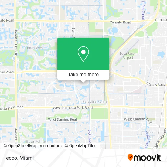
See ecco, Boca Raton, on the map
Public Transit to ecco in Boca Raton
Wondering how to get to ecco in Boca Raton? Moovit helps you find the best way to get to ecco with step-by-step directions from the nearest public transit station.
Moovit provides free maps and live directions to help you navigate through your city. View schedules, routes, timetables, and find out how long does it take to get to ecco in real time.
Looking for the nearest stop or station to ecco? Check out this list of stops closest to your destination: BUTTS RD at TWN CTR RD.
Bus: 2, 3, 91, 92.
Want to see if there’s another route that gets you there at an earlier time? Moovit helps you find alternative routes or times. Get directions from and directions to ecco easily from the Moovit App or Website.
We make riding to ecco easy, which is why over 1.5 million users, including users in Boca Raton, trust Moovit as the best app for public transit. You don’t need to download an individual bus app or train app, Moovit is your all-in-one transit app that helps you find the best bus time or train time available.
For information on prices of bus and train, costs and ride fares to ecco, please check the Moovit app.
Use the app to navigate to popular places including to the airport, hospital, stadium, grocery store, mall, coffee shop, school, college, and university.
ecco Address: 6000 Glades Rd Boca Raton, FL 33431 street in Boca Raton
- Tiffany & Co,
- Lynn's Hallmark,
- Athlete's Foot,
- Calzedonia,
- Currency Exchange International,
- Casper,
- Tesla,
- PANDORA,
- Radioshack,
- Pottery Barn,
- VICTORIA'S SECRET,
- Bcbgeneration at Bloomingdales,
- Petrossian,
- Clonhadas USA,
- The North Face,
- Bistro N,
- Emporio Armani,
- Oakley,
- Anastasia Beverly Hills Brow Studio,
- NORDSTROM rack
Places Near ecco (Boca Raton)
- Dolphin Mall, Miami,
- Keiser University Flagship Campus, West Palm Beach,
- Miami VA Hospital, Miami,
- Sawgrass mall ( FL ), Miami Beach,
- Dolphin Mall Bus, Miami,
- Aventura Mall, Miami Beach,
- Miami Design District, Miami,
- Wynwood, Miami,
- Marlins Park, Miami,
- Richard E. Gerstein Justice Building, Miami,
- Bayside Marketplace, Miami,
- Aventura Mall, Miami,
- Sawgrass Mall, Miami,
- Miami-Dade County Courthouse, Miami,
- Little Havana, Miami,
- Port of Miami Cruise Terminal, Miami,
- Hard Rock Stadium, Miami Gardens,
- Brickell City Centre, Miami,
- Miami Freedom Park, Miami,
- Zoo Miami, Miami
How to get to popular places in Miami with public transit
Get around Boca Raton by public transit!
Traveling around Boca Raton has never been so easy. See step by step directions as you travel to any attraction, street or major public transit station. View bus and train schedules, arrival times, service alerts and detailed routes on a map, so you know exactly how to get to anywhere in Boca Raton.
When traveling to any destination around Boca Raton use Moovit's Live Directions with Get Off Notifications to know exactly where and how far to walk, how long to wait for your line, and how many stops are left. Moovit will alert you when it's time to get off — no need to constantly re-check whether yours is the next stop.
Wondering how to use public transit in Boca Raton or how to pay for public transit in Boca Raton? Moovit public transit app can help you navigate your way with public transit easily, and at minimum cost. It includes public transit fees, ticket prices, and costs. Looking for a map of Boca Raton public transit lines? Moovit public transit app shows all public transit maps in Boca Raton with all Bus, Train, Light Rail and Ferry routes and stops on an interactive map.
Miami has 4 transit type(s), including: Bus, Train, Light Rail and Ferry, operated by several transit agencies, including Broward County Transit, Miami-Dade Transit, Metrorail, Palm Tran, Tri-Rail, Brightline, MARTY, City of Homestead Trolley, Key West Transit, Treasure Coast Connector, GoLine IRT, Amtrak, Greyhound-us, FlixBus-us and Aventura Express Shuttle Bus