Directions to Lango (Changsha County) with public transportation
The following transit lines have routes that pass near Lango
 Bus: Route 501 Inner Loop, 503, Route 701, Xingsha Route 106, Xingsha Route 102 Limited.
- Metro: Line 3, Line 3, Line 5.
How to get to Lango by bus?
Click on the bus route to see step by step directions with maps, line arrival times and updated time schedules.
From Hunan Provincial Museum - Special Exhibition Hall 1, Kaifu District
47 minFrom MSUTREE (Shanghang International Store), Yuhua District
35 minFrom Changsha Core - North Gate, Kaifu District
46 minFrom Zhongnan University Xiangya Hospital Outpatient - West Gate 2, Kaifu District
49 minFrom Apple Authorized Dealer (Sam Changsha Store), Yuhua District
54 minFrom Route 10 (Hunan Agricultural University - Changsha Railway Station), Furong District
27 minFrom Changsha Experimental Middle School, Furong District
36 minFrom Central South University Xiangya Second Hospital - Parking Lot, Furong District
46 minFrom Xiangya Road (Xiangya Stomatological Hospital), Kaifu District
48 minFrom Changsha Public Security Bureau Furong Branch - Parking Lot, Furong District
40 min
How to get to Lango by metro?
Click on the metro route to see step by step directions with maps, line arrival times and updated time schedules.
From MSUTREE (Shanghang International Store), Yuhua District
46 minFrom Changsha Core - North Gate, Kaifu District
67 minFrom Zhongnan University Xiangya Hospital Outpatient - West Gate 2, Kaifu District
71 minFrom Apple Authorized Dealer (Sam Changsha Store), Yuhua District
55 minFrom Changsha Experimental Middle School, Furong District
46 minFrom Central South University Xiangya Second Hospital - Parking Lot, Furong District
52 minFrom Xiangya Road (Xiangya Stomatological Hospital), Kaifu District
70 minFrom Changsha Public Security Bureau Furong Branch - Parking Lot, Furong District
44 min
Bus stops near Lango in Changsha County
Bus lines to Lango in Changsha County
- Xingsha Route 102 Limited, Huaxiang Settlement Area,VIEW
- Xingsha Route 2, Jiangling Tianxia Complex,VIEW
- Xingsha Route 101, Changsha County No.1 Middle School,VIEW
- Xingsha Route 106, Hunan Agricultural University,VIEW
- 503, Changsha South Railway,VIEW
- Route 701, Xingsha,VIEW
- Route 501 Outer Ring, Xingsha Tea Market,VIEW
- Route 501 Inner Loop, Xingsha Tea Market,VIEW
- Xingsha Route 102, Teli East Intersection,VIEW
- Route 703, Changsha Medical School,VIEW
- Route 808, Tongchang Bus Depot,VIEW
- Xingsha Route 202, Huibu District,VIEW
- Route 127, Changsha Health Vocational College,VIEW
- Route X105, Hongshan Bridge,VIEW
- Xingsha Route 704, West Auto Station,VIEW
- Xingsha Route 105, Guangda Metro,VIEW
- Route 704, Quantang Resettlement Complex,VIEW
- Urban-Rural Transit Line 1, Baojia Resettlement Area,VIEW
- Rural Transit Line 3, Xingsha Auto,VIEW
- Urban-Rural Transit Line 2, Huanghua Industrial Park,VIEW
What are the closest stations to Lango?
The closest stations to Lango are:
- Liangtang Intersection is 128 meters away, 2 min walk.
- Chutian Home Garden is 422 meters away, 6 min walk.
- Juxin Market is 424 meters away, 6 min walk.
- Xingsha Shopping Center is 546 meters away, 8 min walk.
- Economic Development Zone is 609 meters away, 8 min walk.
- Yichulianhua is 624 meters away, 8 min walk.
- Hu (South) is 890 meters away, 12 min walk.
- Baimapu is 1520 meters away, 20 min walk.
Which bus lines stop near Lango?
These bus lines stop near Lango: Route 501 Inner Loop, 503, Route 701, Xingsha Route 106.
Which metro line stops near Lango?
Line 3 (Guangsheng)
What’s the nearest metro station to Lango in Changsha County?
The nearest metro station to Lango in Changsha County is Hu (South). It’s a 12 min walk away.
What’s the nearest bus station to Lango in Changsha County?
The nearest bus station to Lango in Changsha County is Liangtang Intersection. It’s a 2 min walk away.
What time is the first metro to Lango in Changsha County?
The Line 3 is the first metro that goes to Lango in Changsha County. It stops nearby at 6:30 AM.
What time is the last metro to Lango in Changsha County?
The Line 3 is the last metro that goes to Lango in Changsha County. It stops nearby at 11:52 PM.
What time is the first bus to Lango in Changsha County?
The Xingsha Route 2 is the first bus that goes to Lango in Changsha County. It stops nearby at 6:05 AM.
What time is the last bus to Lango in Changsha County?
The Route 703 is the last bus that goes to Lango in Changsha County. It stops nearby at 10:07 PM.
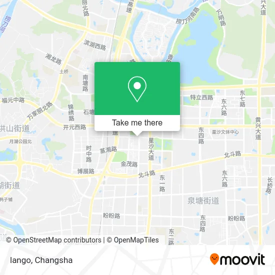
See Lango, Changsha County, on the map
Public Transit to Lango in Changsha County
Wondering how to get to Lango in Changsha County? Moovit helps you find the best way to get to Lango with step-by-step directions from the nearest public transit station.
Moovit provides free maps and live directions to help you navigate through your city. View schedules, routes, timetables, and find out how long does it take to get to Lango in real time.
Looking for the nearest stop or station to Lango? Check out this list of stops closest to your destination: Liangtang Intersection; Chutian Home Garden; Juxin Market; Xingsha Shopping Center; Economic Development Zone; Yichulianhua; Hu (South); Baimapu.
Bus: Route 501 Inner Loop, 503, Route 701, Xingsha Route 106, Xingsha Route 102 Limited, Xingsha Route 2, Xingsha Route 101, Xingsha Route 106, 503, Route 501 Inner Loop, Xingsha Route 102, Route 703, Route 808, Xingsha Route 202, Route 127.Metro: Line 3, Line 3, Line 5.
Want to see if there’s another route that gets you there at an earlier time? Moovit helps you find alternative routes or times. Get directions from and directions to Lango easily from the Moovit App or Website.
We make riding to Lango easy, which is why over 1.5 million users, including users in Changsha County, trust Moovit as the best app for public transit. You don’t need to download an individual bus app or train app, Moovit is your all-in-one transit app that helps you find the best bus time or train time available.
For information on prices of bus and metro, costs and ride fares to Lango, please check the Moovit app.
Use the app to navigate to popular places including to the airport, hospital, stadium, grocery store, mall, coffee shop, school, college, and university.
Lango Address: 凉塘路58号附近 street in Changsha County
- Wang Jiao Congee (Xingsha Tongcheng Store),
- Dr. Zhou Dental,
- Mountain Water Residential Complex Phase 3,
- Mountain Water Home (Kaiyuan Middle Road Store),
- MI G Ge,
- Xingsha Zhou Zhiqiang Internal Medicine Clinic,
- Arden (Liangtan Road Store),
- Yun Wei Dessert (Hotpot Lamb · Dessert),
- Leaf Bathing,
- Siyu Hair Care Salon (Shanshui Residential Area Branch),
- Zhen Wang Wholesale Supermarket,
- Railway Blue Ticket Agency,
- Tongcheng Business Plaza - Service Center,
- Red Star Rice Dish,
- Tuo Gu,
- Hong Kong Celebrity (Xingsha Branch),
- Liangtang Road / Tianhua Middle Road (Intersection),
- Changsha Stomatological Hospital Xingsha Clinic,
- Impression Wind,
- ONYOU (Liangtang Road)
Places Near Lango (Changsha County)
- National University of Defense Technology (North Gate), Kaifu District,
- Apple Authorized Dealer (Sam Changsha Store), Yuhua District,
- Du Fu River Pavilion, Tianxin District,
- Hunan Provincial Maternal and Child Health Hospital - Outpatient Department, Kaifu District,
- Zhongnan University Xiangya Hospital, Kaifu District,
- Xingsha Police Station Songya Community Police Room, Changsha County,
- Hunan Province Tumor Hospital, Yuelu District,
- Yuelu Mountain Juzizhou Tourist Area, Yuelu District,
- Hunan Provincial Museum - Multipurpose Hall, Kaifu District,
- Wanjiali International Mall, Furong District,
- Changsha Bank ATM (Sifang Branch), Kaifu District,
- Changsha Yangming Mountain Funeral Home, Yuhua District,
- Changsha South Station Square, Yuelu District,
- Hunan University of Traditional Chinese Medicine First Affiliated Hospital, Yuhua District,
- Changsha Bank (Sifang Branch), Kaifu District,
- First Club, Kaifu District,
- Changsha South Station, Yuhua District,
- Central South University Xiangya Second Hospital, Furong District,
- Desiqin City Square, Yuhua District,
- First Affiliated Hospital of Hunan University of Traditional Chinese Medicine - Outpatient Department, Yuhua District
How to get to popular places in Changsha with public transit
Get around Changsha County by public transit!
Traveling around Changsha County has never been so easy. See step by step directions as you travel to any attraction, street or major public transit station. View bus and train schedules, arrival times, service alerts and detailed routes on a map, so you know exactly how to get to anywhere in Changsha County.
When traveling to any destination around Changsha County use Moovit's Live Directions with Get Off Notifications to know exactly where and how far to walk, how long to wait for your line, and how many stops are left. Moovit will alert you when it's time to get off — no need to constantly re-check whether yours is the next stop.
Wondering how to use public transit in Changsha County or how to pay for public transit in Changsha County? Moovit public transit app can help you navigate your way with public transit easily, and at minimum cost. It includes public transit fees, ticket prices, and costs. Looking for a map of Changsha County public transit lines? Moovit public transit app shows all public transit maps in Changsha County with all Bus and Metro routes and stops on an interactive map.
Changsha has 2 transit type(s), including: Bus and Metro, operated by several transit agencies, including Changsha Metro and Changsha Bus Group
Public transit lines with stations closest to Lango in Changsha County
Metro lines with stations closest to Lango in Changsha County
Bus lines with stations closest to Lango in Changsha County
Liangtang Intersection
- Xingsha Route 102 LimitedZhumengyuan - Huaxiang Resettlement Area
- Xingsha Route 2East Bus Station - Jianglintianxia Community
- Xingsha Route 101Changsha County Traffic Police - Changsha County First Middle School
- Xingsha Route 106Hunan Agricultural University - Venice City
- 503Huibu Complex - Changsha South Railway Station