The Most Popular Urban Mobility App in Sarasota.
All local mobility options in one app
Sarasota County Area Transit is a public transportation provider in Sarasota which operates Bus routes.
The Sarasota County Area Transit has 14 Bus routes in Sarasota with 1282 Bus stops.
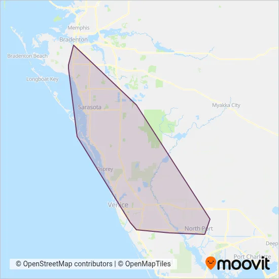
Their Bus routes cover an area from the North (Bradenton) with a stop at 13th St W @ 6th Ave W to the South (North Port) with a stop at S Sumter Blvd @ S Tamiami Trl.Their most western stop is 26th St W @ 60th Ave W (Bayshore Gardens) and the most eastern stop is City Hall Blvd @ Kramer Way (North Port).
Sarasota County Area Transit line schedules (timetables, itineraries, service hours), and departure and arrival times to stations are updated in the app in real time.
For Sarasota County Area Transit service alerts, please check the Moovit website for real-time info on bus status, bus delays, changes of bus routes, changes of stops and any service changes.
Sarasota County Area Transit is a public transportation provider in Sarasota which operates Bus routes.
The Sarasota County Area Transit has 14 Bus routes in Sarasota with 1282 Bus stops.
Their Bus routes cover an area from the North (Bradenton) with a stop at 13th St W @ 6th Ave W to the South (North Port) with a stop at S Sumter Blvd @ S Tamiami Trl.Their most western stop is 26th St W @ 60th Ave W (Bayshore Gardens) and the most eastern stop is City Hall Blvd @ Kramer Way (North Port).
Sarasota County Area Transit line schedules (timetables, itineraries, service hours), and departure and arrival times to stations are updated in the app in real time.
The Sarasota County Area Transit has Bus routes operating across Sarasota including: Osprey, Sarasota, Fruitville, Gulf Gate Estates, Bayshore Gardens, South Gate Ridge, Laurel, South Bradenton, Southgate, North Sarasota.
The longest line from the Sarasota County Area Transit is: 17. This Bus route starts from N Seaboard Ave @ E Venice Ave (Venice) and ends at N Lemon Ave @ 2nd St (Sarasota). It covers over 34 km and has 103 stops.
The shortest line is: 25. This Bus line begins from S Tuttle Ave @ Bee Ridge Rd and finishes at Southgate Mall Street Side (Sarasota). It runs through 2 km with 10 stops.
According to Moovit Insights, the most popular lines for Sarasota County Area Transit are .
Costs and prices of different ticket types may change, based on several factors. Please check the Moovit app to view bus fares of individual lines. For more information on ride fares and for buying bus tickets online please visit Sarasota County Area Transit's official site.
Looking for a specific Sarasota County Area Transit Bus schedule? All Sarasota County Area Transit lines and schedules in Sarasota can be found in the Moovit App. Moovit gives you directions for Sarasota County Area Transit routes and provides helpful step-by-step navigation.