
021 Bus Route Map
View the 021 route map and see all 021 stops along the route. The map of 021 shows where the bus travels and the location of each stop, making it easy to understand the entire route at a glance.
Explore S.t.a.c. - Casale Automotive Transport Company routes on the map and see where S.t.a.c. - Casale Automotive Transport Company bus services operate. Use the 021 map to find bus stops and see how the 021 connects different areas along its trip.
All 021 stops on the map are displayed in route order, helping you follow the 021 bus from the first stop to the last.
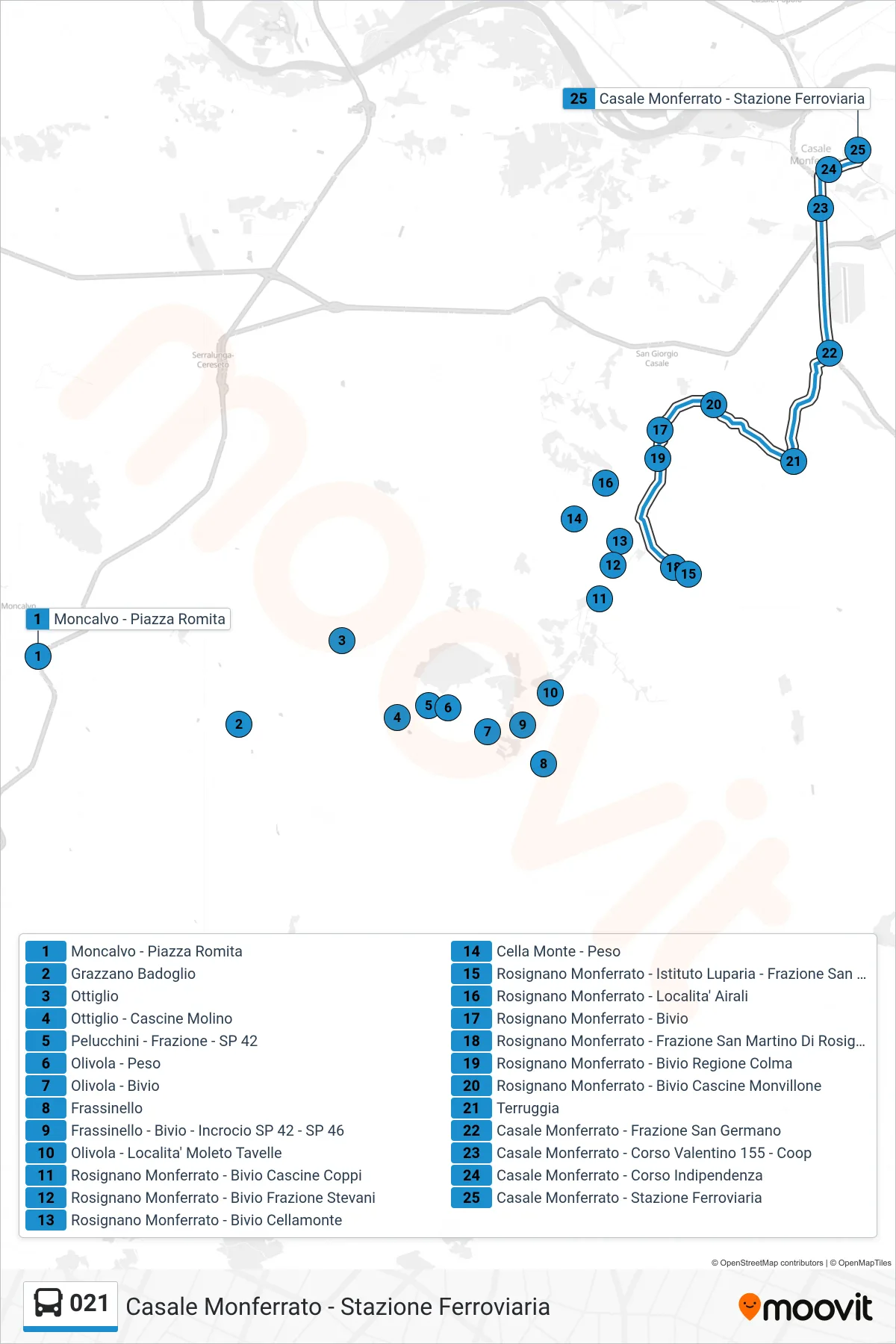
Stops list (021 - Casale Monferrato - Railway Station)
- Moncalvo - Romita Square
- Grazzano Badoglio
- Ottiglio
- Ottiglio - Molino Farms
- Pelucchini - District - SP 42
- Olivola - Peso
- Olivola - Junction
- Frassinello
- Frassinello - Junction - Intersection SP 42 - SP 46
- Olivola - Moleto Tavelle Location
- Rosignano Monferrato - Cascine Coppi Junction
- Rosignano Monferrato - Stevani District Junction
- Rosignano Monferrato - Cellamonte Junction
- Cella Monte - Weight Station
- Rosignano Monferrato - Luparia Institute - San Martino District
- Rosignano Monferrato - Airali Area
- Rosignano Monferrato - Junction
- Rosignano Monferrato - San Martino di Rosignano District
- Rosignano Monferrato - Colma Region Junction
- Rosignano Monferrato - Cascine Monvillone Junction
- Terruggia
- Casale Monferrato - San Germano District
- Casale Monferrato - Corso Valentino 155 - Coop
- Casale Monferrato - Corso Indipendenza
- Casale Monferrato - Railway Station