
041 Light Rail Route Map
View the 041 route map and see all 041 stops along the route. The map of 041 shows where the light rail travels and the location of each stop, making it easy to understand the entire route at a glance.
Explore St. Werke Krefeld routes on the map and see where St. Werke Krefeld light rail services operate. Use the 041 map to find light rail stations and see how the 041 connects different areas along its trip.
All 041 stops on the map are displayed in route order, helping you follow the 041 light rail from the first station to the last.
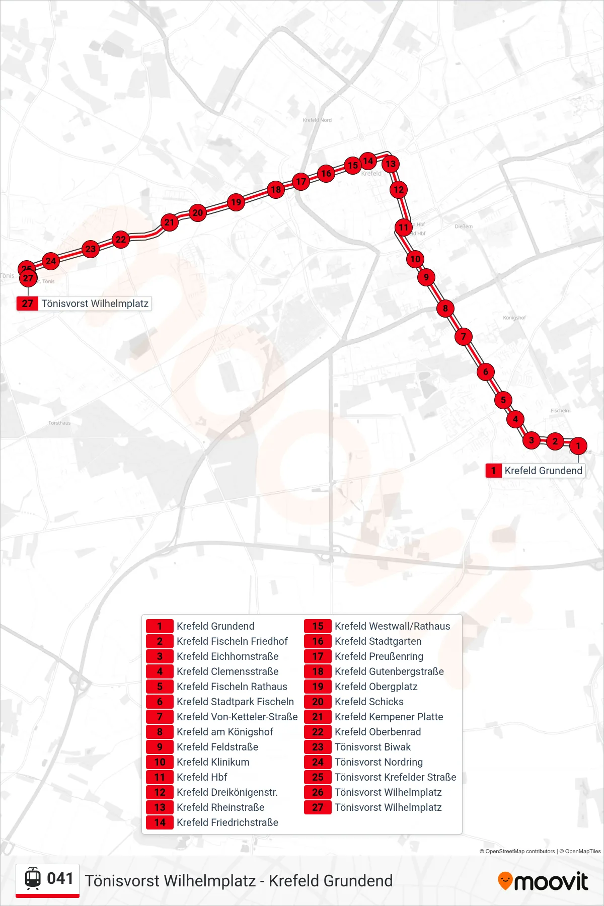
Stops list (041 - Tönisvorst Wilhelmplatz)
- Krefeld Grundend
- Krefeld Fischeln Friedhof
- Krefeld Eichhornstraße
- Krefeld Clemensstraße
- Krefeld Fischeln Rathaus
- Krefeld Stadtpark Fischeln
- Krefeld Von-Ketteler-Straße
- Krefeld am Königshof
- Krefeld Feldstraße
- Krefeld Klinikum
- Krefeld Hbf
- Krefeld Dreikönigenstr.
- Krefeld Rheinstraße
- Krefeld Friedrichstraße
- Krefeld Westwall/Rathaus
- Krefeld Stadtgarten
- Krefeld Preußenring
- Krefeld Gutenbergstraße
- Krefeld Obergplatz
- Krefeld Schicks
- Krefeld Kempener Platte
- Krefeld Oberbenrad
- Tönisvorst Biwak
- Tönisvorst Nordring
- Tönisvorst Krefelder Straße
- Tönisvorst Wilhelmplatz
- Tönisvorst Wilhelmplatz