
060 Bus Route Map
View the 060 route map and see all 060 stops along the route. The map of 060 shows where the bus travels and the location of each stop, making it easy to understand the entire route at a glance.
Explore St. Werke Krefeld routes on the map and see where St. Werke Krefeld bus services operate. Use the 060 map to find bus stops and see how the 060 connects different areas along its trip.
All 060 stops on the map are displayed in route order, helping you follow the 060 bus from the first stop to the last.
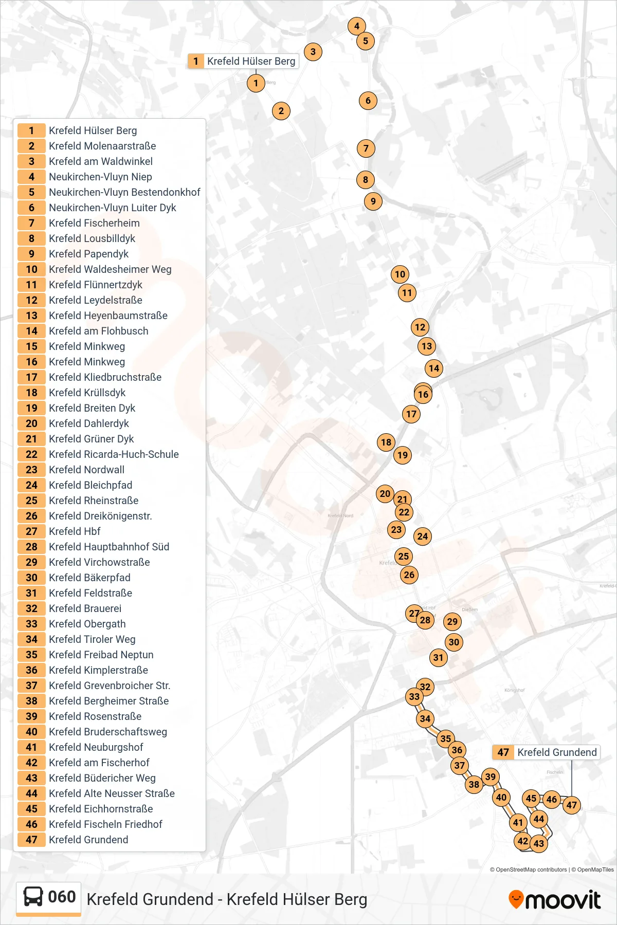
Stops list (060 - Krefeld Grundend)
- Krefeld Hülser Berg
- Krefeld Molenaarstraße
- Krefeld am Waldwinkel
- Neukirchen-Vluyn Niep
- Neukirchen-Vluyn Bestendonkhof
- Neukirchen-Vluyn Luiter Dyk
- Krefeld Fischerheim
- Krefeld Lousbilldyk
- Krefeld Papendyk
- Krefeld Waldesheimer Weg
- Krefeld Flünnertzdyk
- Krefeld Leydelstraße
- Krefeld Heyenbaumstraße
- Krefeld am Flohbusch
- Krefeld Minkweg
- Krefeld Minkweg
- Krefeld Kliedbruchstraße
- Krefeld Krüllsdyk
- Krefeld Breiten Dyk
- Krefeld Dahlerdyk
- Krefeld Grüner Dyk
- Krefeld Ricarda-Huch-Schule
- Krefeld Nordwall
- Krefeld Bleichpfad
- Krefeld Rheinstraße
- Krefeld Dreikönigenstr.
- Krefeld Hbf
- Krefeld Hauptbahnhof Süd
- Krefeld Virchowstraße
- Krefeld Bäkerpfad
- Krefeld Feldstraße
- Krefeld Brauerei
- Krefeld Obergath
- Krefeld Tiroler Weg
- Krefeld Freibad Neptun
- Krefeld Kimplerstraße
- Krefeld Grevenbroicher Str.
- Krefeld Bergheimer Straße
- Krefeld Rosenstraße
- Krefeld Bruderschaftsweg
- Krefeld Neuburgshof
- Krefeld am Fischerhof
- Krefeld Büdericher Weg
- Krefeld Alte Neusser Straße
- Krefeld Eichhornstraße
- Krefeld Fischeln Friedhof
- Krefeld Grundend