
064 Bus Route Map
View the 064 route map and see all 064 stops along the route. The map of 064 shows where the bus travels and the location of each stop, making it easy to understand the entire route at a glance.
Explore St. Werke Krefeld routes on the map and see where St. Werke Krefeld bus services operate. Use the 064 map to find bus stops and see how the 064 connects different areas along its trip.
All 064 stops on the map are displayed in route order, helping you follow the 064 bus from the first stop to the last.
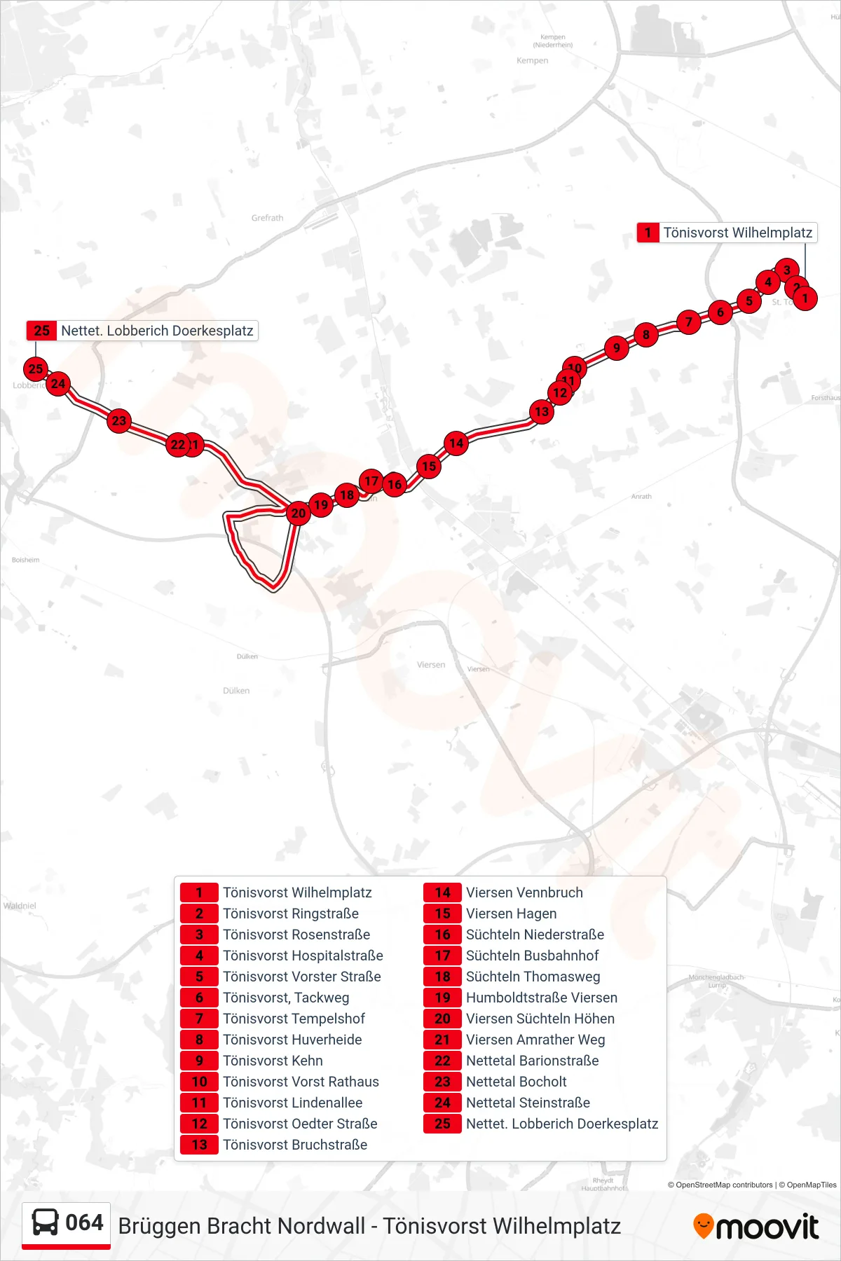
Stops list (064 - Nettet. Lobberich Doerkesplatz)
- Tönisvorst Wilhelmplatz
- Tönisvorst Ringstraße
- Tönisvorst Rosenstraße
- Tönisvorst Hospitalstraße
- Tönisvorst Vorster Straße
- Tönisvorst, Tackweg
- Tönisvorst Tempelshof
- Tönisvorst Huverheide
- Tönisvorst Kehn
- Tönisvorst Vorst Rathaus
- Tönisvorst Lindenallee
- Tönisvorst Oedter Straße
- Tönisvorst Bruchstraße
- Viersen Vennbruch
- Viersen Hagen
- Süchteln Niederstraße
- Süchteln Busbahnhof
- Süchteln Thomasweg
- Humboldtstraße Viersen
- Viersen Süchteln Höhen
- Viersen Amrather Weg
- Nettetal Barionstraße
- Nettetal Bocholt
- Nettetal Steinstraße
- Nettet. Lobberich Doerkesplatz
Change direction
- Route Map - 064 - Nettetal Schaag Hubertusplatz
- Route Map - 064 - Süchteln Busbahnhof
- Route Map - 064 - Brüggen Christenfeld Wendehammer
- Route Map - 064 - Süchteln Busbahnhof
- Route Map - 064 - Nettet. Lobberich Doerkesplatz
- Route Map - 064 - Tönisvorst Wilhelmplatz
- Route Map - 064 - Brüggen Bracht Nordwall