
076 Bus Route Map
View the 076 route map and see all 076 stops along the route. The map of 076 shows where the bus travels and the location of each stop, making it easy to understand the entire route at a glance.
Explore DB Bahn Rheinlandbus routes on the map and see where DB Bahn Rheinlandbus bus services operate. Use the 076 map to find bus stops and see how the 076 connects different areas along its trip.
All 076 stops on the map are displayed in route order, helping you follow the 076 bus from the first stop to the last.
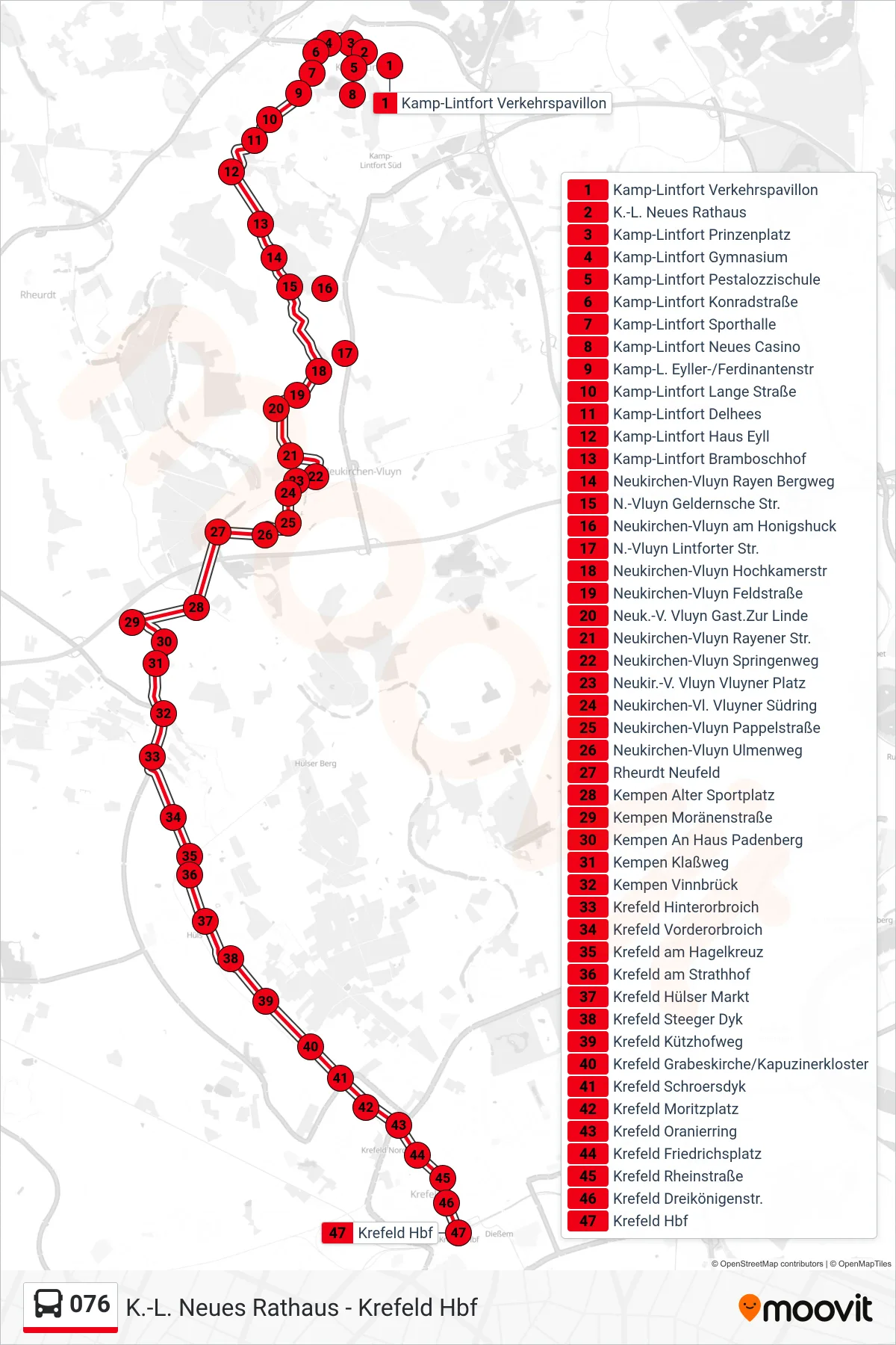
Stops list (076 - Krefeld Hbf)
- Kamp-Lintfort Verkehrspavillon
- K.-L. Neues Rathaus
- Kamp-Lintfort Prinzenplatz
- Kamp-Lintfort Gymnasium
- Kamp-Lintfort Pestalozzischule
- Kamp-Lintfort Konradstraße
- Kamp-Lintfort Sporthalle
- Kamp-Lintfort Neues Casino
- Kamp-L. Eyller-/Ferdinantenstr
- Kamp-Lintfort Lange Straße
- Kamp-Lintfort Delhees
- Kamp-Lintfort Haus Eyll
- Kamp-Lintfort Bramboschhof
- Neukirchen-Vluyn Rayen Bergweg
- N.-Vluyn Geldernsche Str.
- Neukirchen-Vluyn am Honigshuck
- N.-Vluyn Lintforter Str.
- Neukirchen-Vluyn Hochkamerstr
- Neukirchen-Vluyn Feldstraße
- Neuk.-V. Vluyn Gast.Zur Linde
- Neukirchen-Vluyn Rayener Str.
- Neukirchen-Vluyn Springenweg
- Neukir.-V. Vluyn Vluyner Platz
- Neukirchen-Vl. Vluyner Südring
- Neukirchen-Vluyn Pappelstraße
- Neukirchen-Vluyn Ulmenweg
- Rheurdt Neufeld
- Kempen Alter Sportplatz
- Kempen Moränenstraße
- Kempen An Haus Padenberg
- Kempen Klaßweg
- Kempen Vinnbrück
- Krefeld Hinterorbroich
- Krefeld Vorderorbroich
- Krefeld am Hagelkreuz
- Krefeld am Strathhof
- Krefeld Hülser Markt
- Krefeld Steeger Dyk
- Krefeld Kützhofweg
- Krefeld Grabeskirche/Kapuzinerkloster
- Krefeld Schroersdyk
- Krefeld Moritzplatz
- Krefeld Oranierring
- Krefeld Friedrichsplatz
- Krefeld Rheinstraße
- Krefeld Dreikönigenstr.
- Krefeld Hbf