
089 Bus Route Map
View the 089 route map and see all 089 stops along the route. The map of 089 shows where the bus travels and the location of each stop, making it easy to understand the entire route at a glance.
Explore VVG routes on the map and see where VVG bus services operate. Use the 089 map to find bus stops and see how the 089 connects different areas along its trip.
All 089 stops on the map are displayed in route order, helping you follow the 089 bus from the first stop to the last.
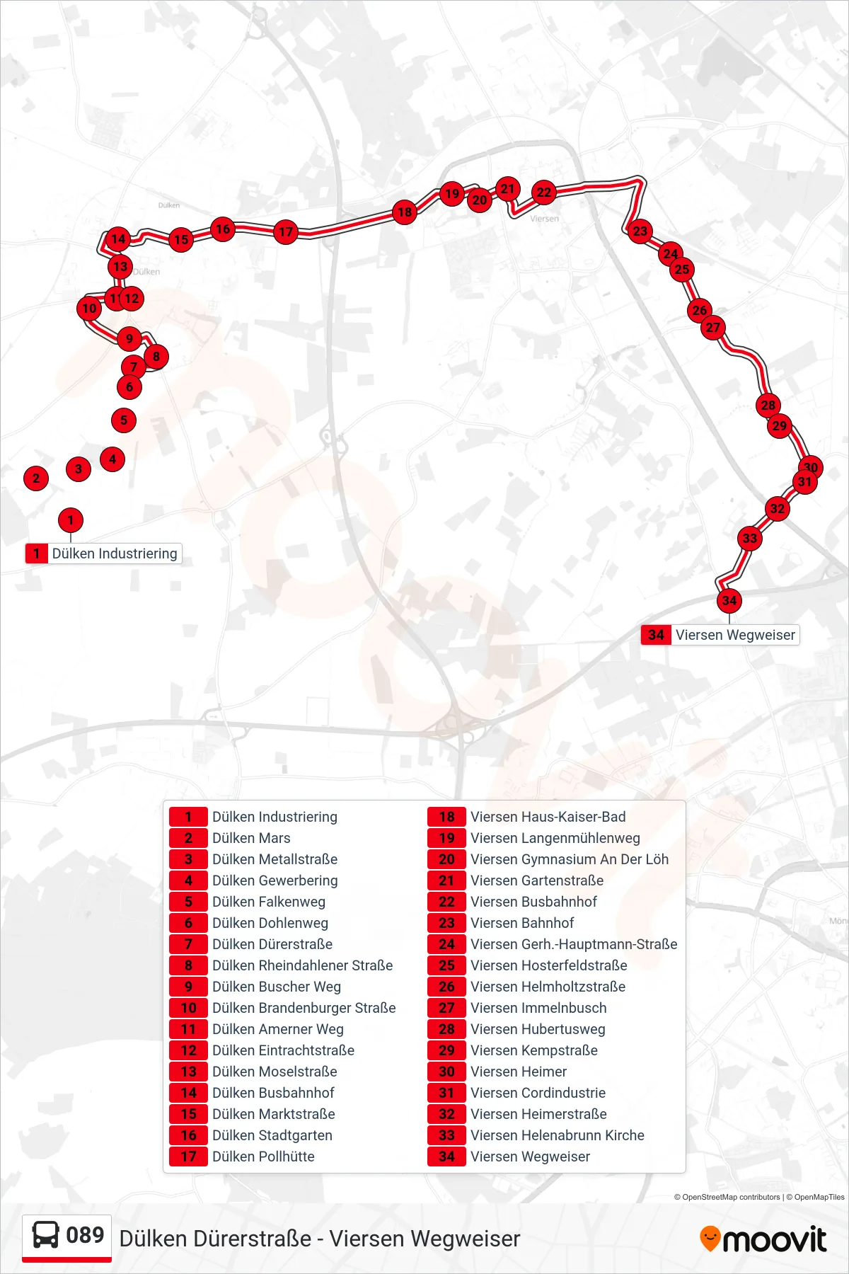
Stops list (089 - Viersen Wegweiser)
- Dülken Industriering
- Dülken Mars
- Dülken Metallstraße
- Dülken Gewerbering
- Dülken Falkenweg
- Dülken Dohlenweg
- Dülken Dürerstraße
- Dülken Rheindahlener Straße
- Dülken Buscher Weg
- Dülken Brandenburger Straße
- Dülken Amerner Weg
- Dülken Eintrachtstraße
- Dülken Moselstraße
- Dülken Busbahnhof
- Dülken Marktstraße
- Dülken Stadtgarten
- Dülken Pollhütte
- Viersen Haus-Kaiser-Bad
- Viersen Langenmühlenweg
- Viersen Gymnasium An Der Löh
- Viersen Gartenstraße
- Viersen Busbahnhof
- Viersen Bahnhof
- Viersen Gerh.-Hauptmann-Straße
- Viersen Hosterfeldstraße
- Viersen Helmholtzstraße
- Viersen Immelnbusch
- Viersen Hubertusweg
- Viersen Kempstraße
- Viersen Heimer
- Viersen Cordindustrie
- Viersen Heimerstraße
- Viersen Helenabrunn Kirche
- Viersen Wegweiser