
1 Bus Route Map
View the 1 route map and see all 1 stops along the route. The map of 1 shows where the bus travels and the location of each stop, making it easy to understand the entire route at a glance.
Explore San Severo Transit routes on the map and see where San Severo Transit bus services operate. Use the 1 map to find bus stops and see how the 1 connects different areas along its trip.
All 1 stops on the map are displayed in route order, helping you follow the 1 bus from the first stop to the last.
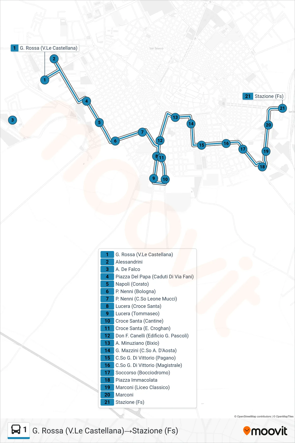
Stops list (1 - G. Rossa (Castellana Avenue)→Railway Station)
- G. Rossa (Castellana Avenue)
- Alessandrini
- A. De Falco
- Pope's Square (Via Fani Martyrs)
- Naples (Corato)
- P. Nenni (Bologna)
- P. Nenni (Leone Mucci Avenue)
- Lucera (Holy Cross)
- Lucera (Tommaseo)
- Holy Cross (Wineries)
- Holy Cross (E. Croghan)
- Don F. Canelli (G. Pascoli Building)
- Minuziano (Bixio)
- G. Mazzini (D'Aosta Avenue)
- G. Di Vittorio Course (Pagano)
- G. Di Vittorio Avenue (Magistrale)
- Soccorso (Bocce Court)
- Immaculate Square
- Marconi (Classical High School)
- Marconi
- Railway Station