
1 Bus Route Map
View the 1 route map and see all 1 stops along the route. The map of 1 shows where the bus travels and the location of each stop, making it easy to understand the entire route at a glance.
Explore CTA routes on the map and see where CTA bus services operate. Use the 1 map to find bus stops and see how the 1 connects different areas along its trip.
All 1 stops on the map are displayed in route order, helping you follow the 1 bus from the first stop to the last.
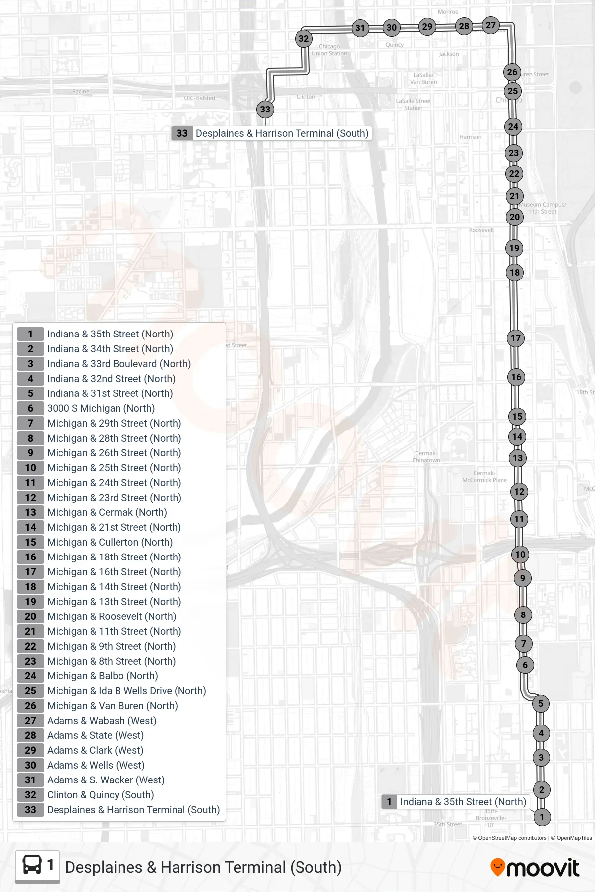
Stops list (1 - Desplaines & Harrison Terminal (South))
- Indiana & 35th Street (North)
- Indiana & 34th Street (North)
- Indiana & 33rd Boulevard (North)
- Indiana & 32nd Street (North)
- Indiana & 31st Street (North)
- 3000 S Michigan (North)
- Michigan & 29th Street (North)
- Michigan & 28th Street (North)
- Michigan & 26th Street (North)
- Michigan & 25th Street (North)
- Michigan & 24th Street (North)
- Michigan & 23rd Street (North)
- Michigan & Cermak (North)
- Michigan & 21st Street (North)
- Michigan & Cullerton (North)
- Michigan & 18th Street (North)
- Michigan & 16th Street (North)
- Michigan & 14th Street (North)
- Michigan & 13th Street (North)
- Michigan & Roosevelt (North)
- Michigan & 11th Street (North)
- Michigan & 9th Street (North)
- Michigan & 8th Street (North)
- Michigan & Balbo (North)
- Michigan & Ida B Wells Drive (North)
- Michigan & Van Buren (North)
- Adams & Wabash (West)
- Adams & State (West)
- Adams & Clark (West)
- Adams & Wells (West)
- Adams & S. Wacker (West)
- Clinton & Quincy (South)
- Desplaines & Harrison Terminal (South)