
1 Bus Route Map
View the 1 route map and see all 1 stops along the route. The map of 1 shows where the bus travels and the location of each stop, making it easy to understand the entire route at a glance.
Explore NT routes on the map and see where NT bus services operate. Use the 1 map to find bus stops and see how the 1 connects different areas along its trip.
All 1 stops on the map are displayed in route order, helping you follow the 1 bus from the first stop to the last.
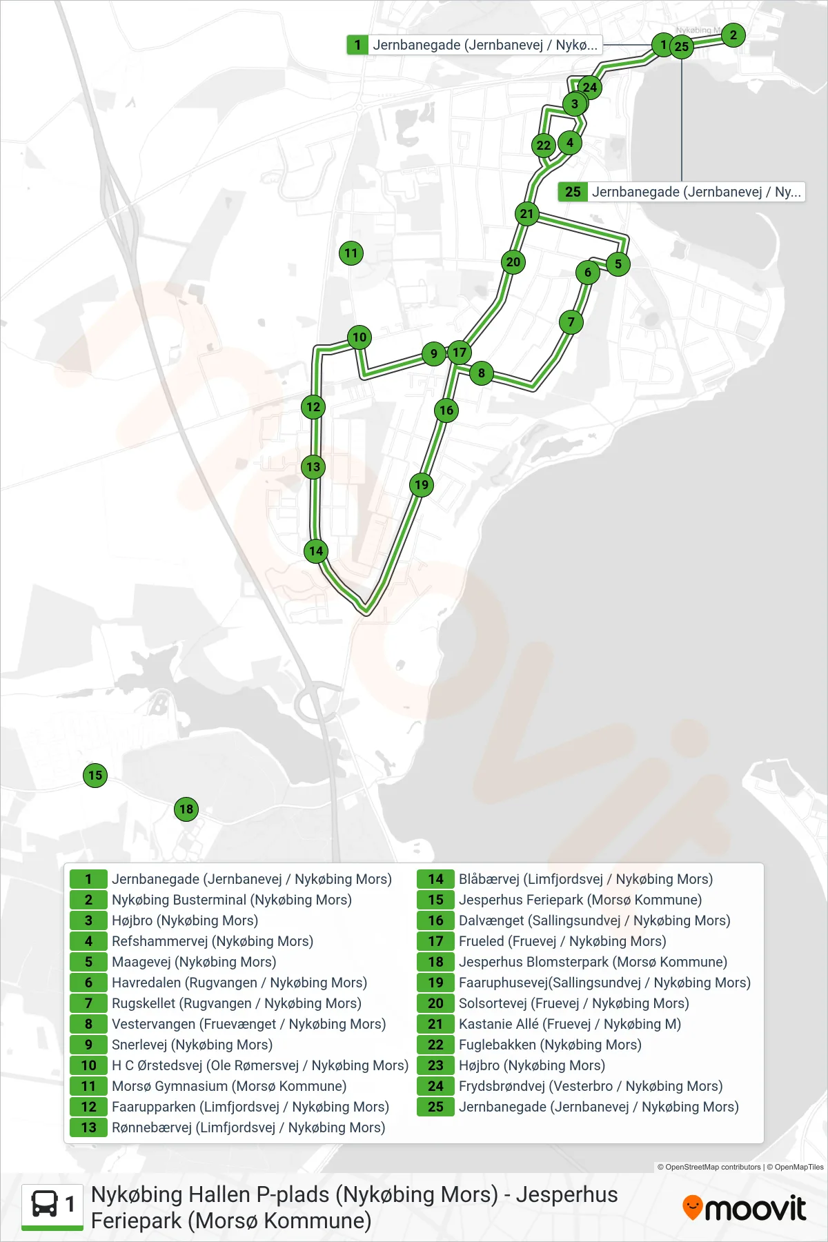
Stops list (1 - Sydbyen - Centrum)
- Jernbanegade (Jernbanevej / Nykøbing Mors)
- Nykøbing Busterminal (Nykøbing Mors)
- Højbro (Nykøbing Mors)
- Refshammervej (Nykøbing Mors)
- Maagevej (Nykøbing Mors)
- Havredalen (Rugvangen / Nykøbing Mors)
- Rugskellet (Rugvangen / Nykøbing Mors)
- Vestervangen (Fruevænget / Nykøbing Mors)
- Snerlevej (Nykøbing Mors)
- H C Ørstedsvej (Ole Rømersvej / Nykøbing Mors)
- Morsø Gymnasium (Morsø Kommune)
- Faarupparken (Limfjordsvej / Nykøbing Mors)
- Rønnebærvej (Limfjordsvej / Nykøbing Mors)
- Blåbærvej (Limfjordsvej / Nykøbing Mors)
- Jesperhus Feriepark (Morsø Kommune)
- Dalvænget (Sallingsundvej / Nykøbing Mors)
- Frueled (Fruevej / Nykøbing Mors)
- Jesperhus Blomsterpark (Morsø Kommune)
- Faaruphusevej(Sallingsundvej / Nykøbing Mors)
- Solsortevej (Fruevej / Nykøbing Mors)
- Kastanie Allé (Fruevej / Nykøbing M)
- Fuglebakken (Nykøbing Mors)
- Højbro (Nykøbing Mors)
- Frydsbrøndvej (Vesterbro / Nykøbing Mors)
- Jernbanegade (Jernbanevej / Nykøbing Mors)