
1 Bus Route Map
View the 1 route map and see all 1 stops along the route. The map of 1 shows where the bus travels and the location of each stop, making it easy to understand the entire route at a glance.
Explore NT routes on the map and see where NT bus services operate. Use the 1 map to find bus stops and see how the 1 connects different areas along its trip.
All 1 stops on the map are displayed in route order, helping you follow the 1 bus from the first stop to the last.
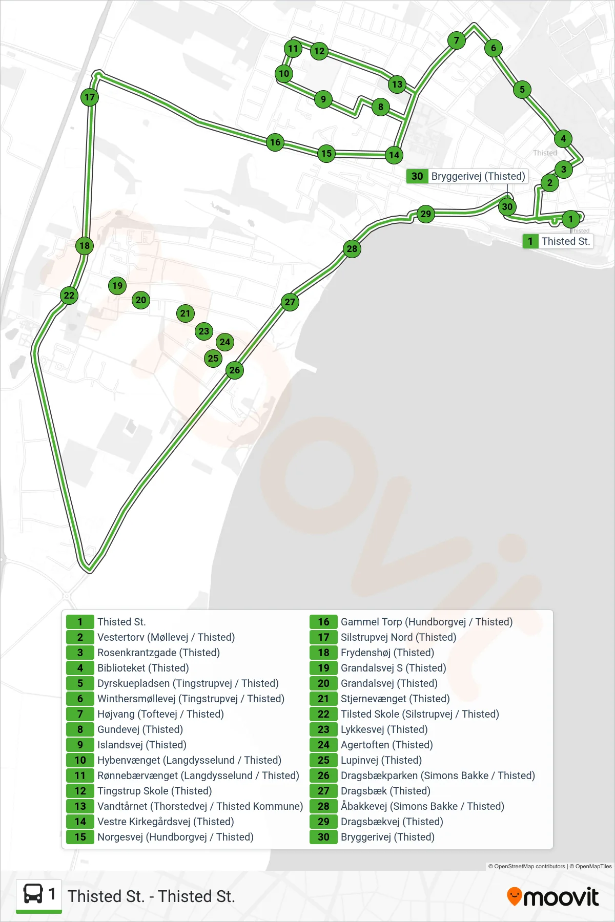
Stops list (1 - Thisted St.)
- Thisted St.
- Vestertorv (Møllevej / Thisted)
- Rosenkrantzgade (Thisted)
- Biblioteket (Thisted)
- Dyrskuepladsen (Tingstrupvej / Thisted)
- Winthersmøllevej (Tingstrupvej / Thisted)
- Højvang (Toftevej / Thisted)
- Gundevej (Thisted)
- Islandsvej (Thisted)
- Hybenvænget (Langdysselund / Thisted)
- Rønnebærvænget (Langdysselund / Thisted)
- Tingstrup Skole (Thisted)
- Vandtårnet (Thorstedvej / Thisted Kommune)
- Vestre Kirkegårdsvej (Thisted)
- Norgesvej (Hundborgvej / Thisted)
- Gammel Torp (Hundborgvej / Thisted)
- Silstrupvej Nord (Thisted)
- Frydenshøj (Thisted)
- Grandalsvej S (Thisted)
- Grandalsvej (Thisted)
- Stjernevænget (Thisted)
- Tilsted Skole (Silstrupvej / Thisted)
- Lykkesvej (Thisted)
- Agertoften (Thisted)
- Lupinvej (Thisted)
- Dragsbækparken (Simons Bakke / Thisted)
- Dragsbæk (Thisted)
- Åbakkevej (Simons Bakke / Thisted)
- Dragsbækvej (Thisted)
- Bryggerivej (Thisted)