
1 Bus Route Map
View the 1 route map and see all 1 stops along the route. The map of 1 shows where the bus travels and the location of each stop, making it easy to understand the entire route at a glance.
Explore Midttrafik routes on the map and see where Midttrafik bus services operate. Use the 1 map to find bus stops and see how the 1 connects different areas along its trip.
All 1 stops on the map are displayed in route order, helping you follow the 1 bus from the first stop to the last.
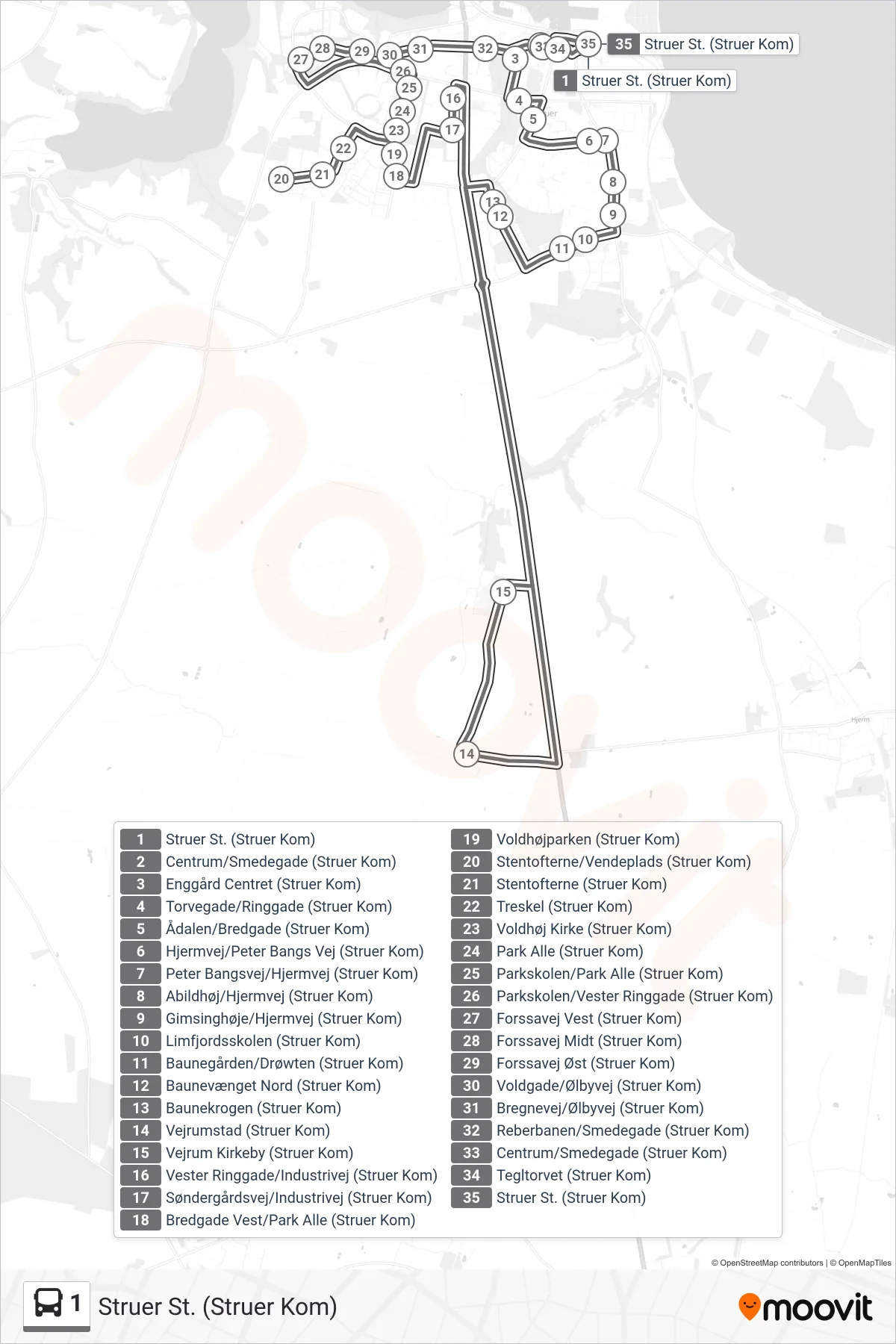
Stops list (1 - Struer St. (Struer Kom))
- Struer St. (Struer Kom)
- Centrum/Smedegade (Struer Kom)
- Enggård Centret (Struer Kom)
- Torvegade/Ringgade (Struer Kom)
- Ådalen/Bredgade (Struer Kom)
- Hjermvej/Peter Bangs Vej (Struer Kom)
- Peter Bangsvej/Hjermvej (Struer Kom)
- Abildhøj/Hjermvej (Struer Kom)
- Gimsinghøje/Hjermvej (Struer Kom)
- Limfjordsskolen (Struer Kom)
- Baunegården/Drøwten (Struer Kom)
- Baunevænget Nord (Struer Kom)
- Baunekrogen (Struer Kom)
- Vejrumstad (Struer Kom)
- Vejrum Kirkeby (Struer Kom)
- Vester Ringgade/Industrivej (Struer Kom)
- Søndergårdsvej/Industrivej (Struer Kom)
- Bredgade Vest/Park Alle (Struer Kom)
- Voldhøjparken (Struer Kom)
- Stentofterne/Vendeplads (Struer Kom)
- Stentofterne (Struer Kom)
- Treskel (Struer Kom)
- Voldhøj Kirke (Struer Kom)
- Park Alle (Struer Kom)
- Parkskolen/Park Alle (Struer Kom)
- Parkskolen/Vester Ringgade (Struer Kom)
- Forssavej Vest (Struer Kom)
- Forssavej Midt (Struer Kom)
- Forssavej Øst (Struer Kom)
- Voldgade/Ølbyvej (Struer Kom)
- Bregnevej/Ølbyvej (Struer Kom)
- Reberbanen/Smedegade (Struer Kom)
- Centrum/Smedegade (Struer Kom)
- Tegltorvet (Struer Kom)
- Struer St. (Struer Kom)