
1 Bus Route Map
View the 1 route map and see all 1 stops along the route. The map of 1 shows where the bus travels and the location of each stop, making it easy to understand the entire route at a glance.
Explore Midttrafik routes on the map and see where Midttrafik bus services operate. Use the 1 map to find bus stops and see how the 1 connects different areas along its trip.
All 1 stops on the map are displayed in route order, helping you follow the 1 bus from the first stop to the last.
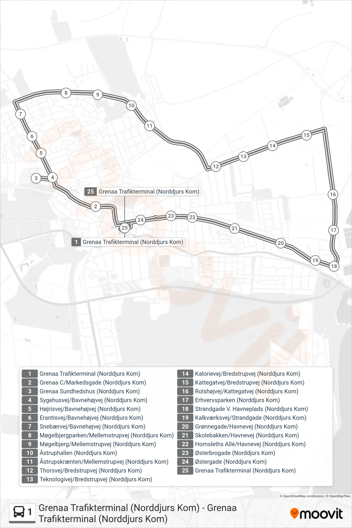
Stops list (1 - Grenaa Trafikterminal (Norddjurs Kom))
- Grenaa Trafikterminal (Norddjurs Kom)
- Grenaa C/Markedsgade (Norddjurs Kom)
- Grenaa Sundhedshus (Norddjurs Kom)
- Sygehusvej/Bavnehøjvej (Norddjurs Kom)
- Højrisvej/Bavnehøjvej (Norddjurs Kom)
- Erantisvej/Bavnehøjvej (Norddjurs Kom)
- Snebærvej/Bavnehøjvej (Norddjurs Kom)
- Møgelbjergparken/Mellemstrupvej (Norddjurs Kom)
- Møgelbjerg/Mellemstrupvej (Norddjurs Kom)
- Åstruphallen (Norddjurs Kom)
- Åstrupskrænten/Mellemstrupvej (Norddjurs Kom)
- Thorsvej/Bredstrupvej (Norddjurs Kom)
- Teknologivej/Bredstrupvej (Norddjurs Kom)
- Kalorievej/Bredstrupvej (Norddjurs Kom)
- Kattegatvej/Bredstrupvej (Norddjurs Kom)
- Rolshøjvej/Kattegatvej (Norddjurs Kom)
- Erhvervsparken (Norddjurs Kom)
- Strandgade V. Havneplads (Norddjurs Kom)
- Kalkværksvej/Strandgade (Norddjurs Kom)
- Grønnegade/Havnevej (Norddjurs Kom)
- Skolebakken/Havnevej (Norddjurs Kom)
- Hornsleths Allé/Havnevej (Norddjurs Kom)
- Østerbrogade (Norddjurs Kom)
- Østergade (Norddjurs Kom)
- Grenaa Trafikterminal (Norddjurs Kom)