
1 Bus Route Map
View the 1 route map and see all 1 stops along the route. The map of 1 shows where the bus travels and the location of each stop, making it easy to understand the entire route at a glance.
Explore Regional Transportation District routes on the map and see where Regional Transportation District bus services operate. Use the 1 map to find bus stops and see how the 1 connects different areas along its trip.
All 1 stops on the map are displayed in route order, helping you follow the 1 bus from the first stop to the last.
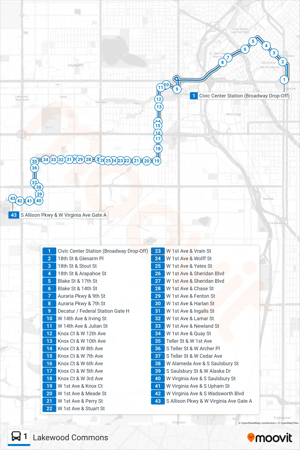
Stops list (1 - Lakewood Commons)
- Civic Center Station (Broadway Drop-Off)
- 18th St & Glenarm Pl
- 18th St & Stout St
- 18th St & Arapahoe St
- Blake St & 17th St
- Blake St & 14th St
- Auraria Pkwy & 9th St
- Auraria Pkwy & 7th St
- Decatur / Federal Station Gate H
- W 14th Ave & Irving St
- W 14th Ave & Julian St
- Knox Ct & W 12th Ave
- Knox Ct & W 10th Ave
- Knox Ct & W 8th Ave
- Knox Ct & W 7th Ave
- Knox Ct & W 6th Ave
- Knox Ct & W 5th Ave
- Knox Ct & W 3rd Ave
- W 1st Ave & Knox Ct
- W 1st Ave & Meade St
- W 1st Ave & Perry St
- W 1st Ave & Stuart St
- W 1st Ave & Vrain St
- W 1st Ave & Wolff St
- W 1st Ave & Yates St
- W 1st Ave & Sheridan Blvd
- W 1st Ave & Sheridan Blvd
- W 1st Ave & Chase St
- W 1st Ave & Fenton St
- W 1st Ave & Harlan St
- W 1st Ave & Ingalls St
- W 1st Ave & Lamar St
- W 1st Ave & Newland St
- W 1st Ave & Quay St
- Teller St & W 1st Ave
- S Teller St & W Archer Pl
- S Teller St & W Cedar Ave
- W Alameda Ave & S Saulsbury St
- S Saulsbury St & W Alaska Dr
- W Virginia Ave & S Saulsbury St
- W Virginia Ave & S Upham St
- W Virginia Ave & S Wadsworth Blvd
- S Allison Pkwy & W Virginia Ave Gate A