
1+ Bus Route Map
View the 1+ route map and see all 1+ stops along the route. The map of 1+ shows where the bus travels and the location of each stop, making it easy to understand the entire route at a glance.
Explore Lucca and Province - Tuscan Bus Lines routes on the map and see where Lucca and Province - Tuscan Bus Lines bus services operate. Use the 1+ map to find bus stops and see how the 1+ connects different areas along its trip.
All 1+ stops on the map are displayed in route order, helping you follow the 1+ bus from the first stop to the last.
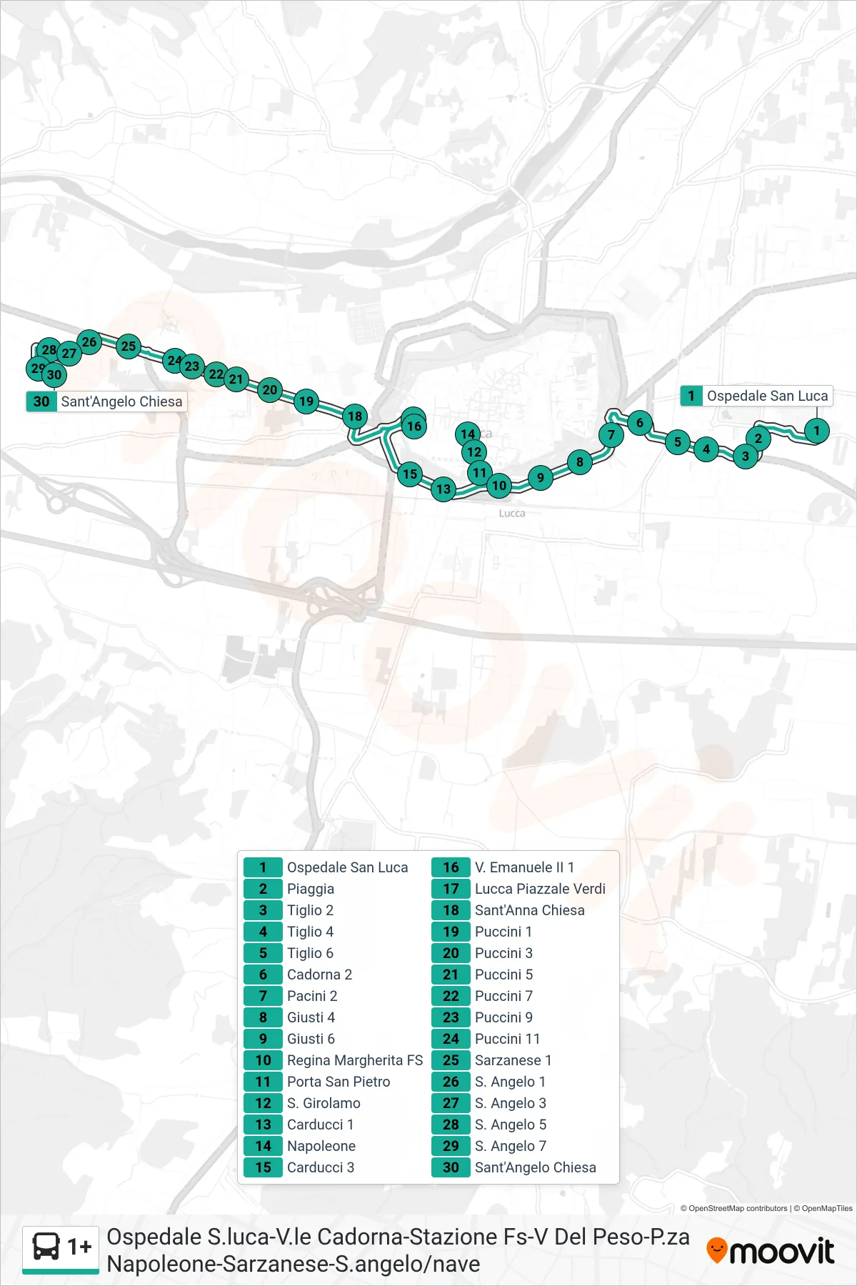

Stops list (1+ - Sant'Angelo Chiesa)
- San Luca Hospital
- Piaggia
- Tiglio 2
- Linden 4
- Tiglio 6
- Cadorna 2
- Pacini 2
- Giusti 4
- Giusti 6
- Regina Margherita Railway Station
- San Pietro Gate
- S. Girolamo
- Carducci 1
- Napoleone
- Carducci 3
- V. Emanuele II 1
- Lucca Piazzale Verdi
- Sant'Anna Church
- Puccini 1
- Puccini 3
- Puccini 5
- Puccini 7
- Puccini 9
- Puccini 11
- Sarzanese 1
- St. Angelo 1
- S. Angelo 3
- St. Angelo 5
- St. Angelo 7
- Sant'Angelo Church