
1 Bus Route Map
View the 1 route map and see all 1 stops along the route. The map of 1 shows where the bus travels and the location of each stop, making it easy to understand the entire route at a glance.
Explore Green Bay Metro Transit routes on the map and see where Green Bay Metro Transit bus services operate. Use the 1 map to find bus stops and see how the 1 connects different areas along its trip.
All 1 stops on the map are displayed in route order, helping you follow the 1 bus from the first stop to the last.
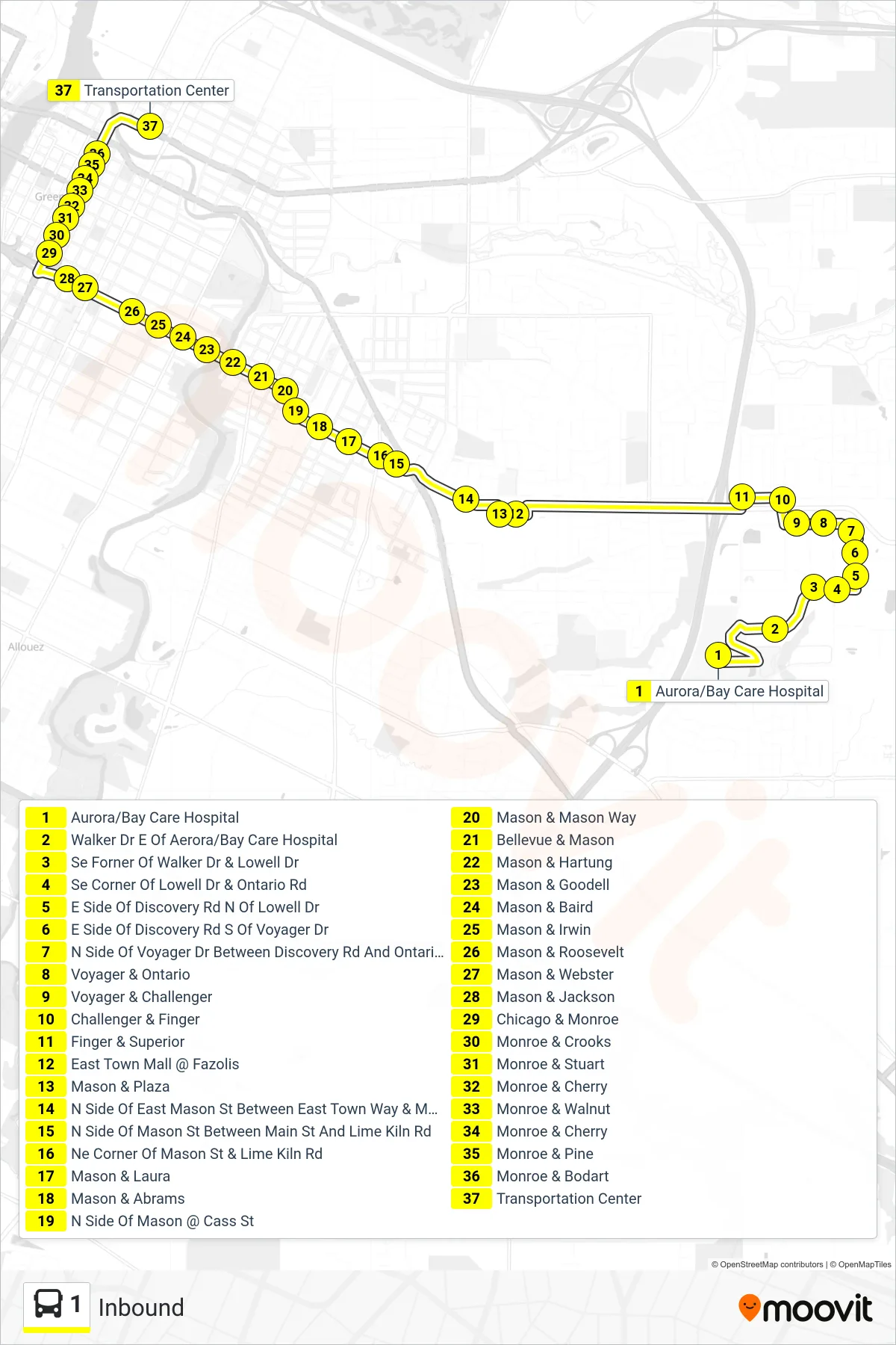
Stops list (1 - Inbound)
- Aurora/Bay Care Hospital
- Walker Dr E Of Aerora/Bay Care Hospital
- Se Forner Of Walker Dr & Lowell Dr
- Se Corner Of Lowell Dr & Ontario Rd
- E Side Of Discovery Rd N Of Lowell Dr
- E Side Of Discovery Rd S Of Voyager Dr
- N Side Of Voyager Dr Between Discovery Rd And Ontario Rd
- Voyager & Ontario
- Voyager & Challenger
- Challenger & Finger
- Finger & Superior
- East Town Mall @ Fazolis
- Mason & Plaza
- N Side Of East Mason St Between East Town Way & Main St
- N Side Of Mason St Between Main St And Lime Kiln Rd
- Ne Corner Of Mason St & Lime Kiln Rd
- Mason & Laura
- Mason & Abrams
- N Side Of Mason @ Cass St
- Mason & Mason Way
- Bellevue & Mason
- Mason & Hartung
- Mason & Goodell
- Mason & Baird
- Mason & Irwin
- Mason & Roosevelt
- Mason & Webster
- Mason & Jackson
- Chicago & Monroe
- Monroe & Crooks
- Monroe & Stuart
- Monroe & Cherry
- Monroe & Walnut
- Monroe & Cherry
- Monroe & Pine
- Monroe & Bodart
- Transportation Center