
1 Bus Route Map
View the 1 route map and see all 1 stops along the route. The map of 1 shows where the bus travels and the location of each stop, making it easy to understand the entire route at a glance.
Explore Galeem routes on the map and see where Galeem bus services operate. Use the 1 map to find bus stops and see how the 1 connects different areas along its trip.
All 1 stops on the map are displayed in route order, helping you follow the 1 bus from the first stop to the last.
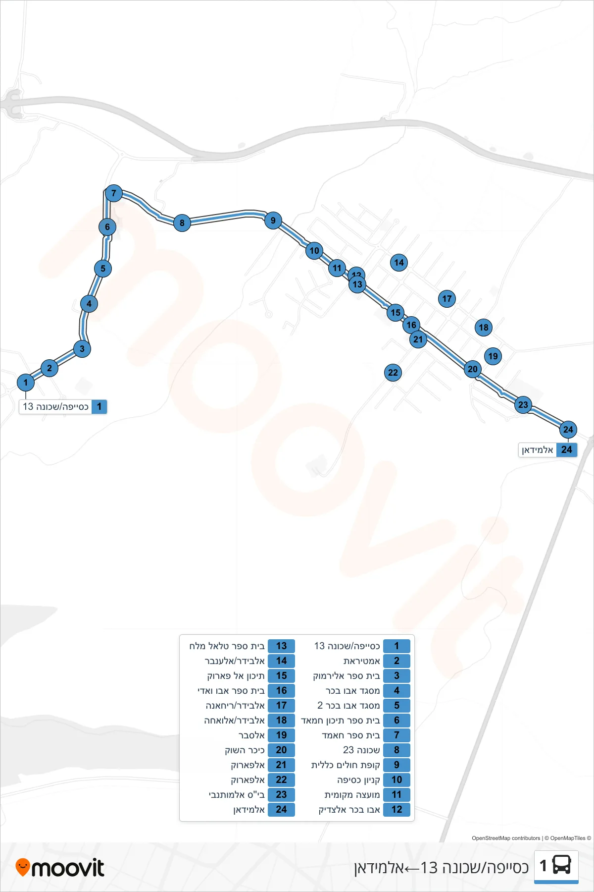
Stops list (1 - Kuseife/Neighborhood 13→Al-Midan)
- Kuseife/Neighborhood 13
- Amtirat
- Al-Yarmouk School
- Abu Bakr Mosque
- Abu Bakr Mosque 2
- Hamad High School
- Hamed School
- Neighborhood 23
- Health Clinic
- Kuseife Mall
- Local Council
- Abu Bakr Al-Siddiq
- Talal Malach School
- Al-Bider/Al-Anbar
- Al-Farouk High School
- Abu Wadi School
- Al-Baydar/Rihanna
- Al-Bider/Al-Waha
- Alsaber
- Market Square
- Al-Farouk
- Al-Farouk
- Al-Mutanabbi School
- Al-Midan