
1 Bus Route Map
View the 1 route map and see all 1 stops along the route. The map of 1 shows where the bus travels and the location of each stop, making it easy to understand the entire route at a glance.
Explore Red Rose Transit Authority routes on the map and see where Red Rose Transit Authority bus services operate. Use the 1 map to find bus stops and see how the 1 connects different areas along its trip.
All 1 stops on the map are displayed in route order, helping you follow the 1 bus from the first stop to the last.
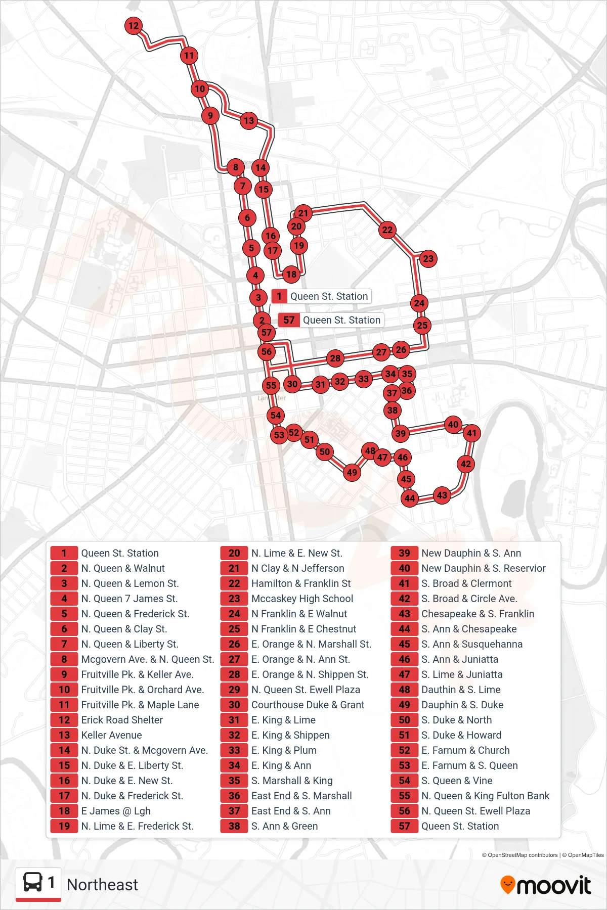
Stops list (1 - Northeast)
- Queen St. Station
- N. Queen & Walnut
- N. Queen & Lemon St.
- N. Queen 7 James St.
- N. Queen & Frederick St.
- N. Queen & Clay St.
- N. Queen & Liberty St.
- Mcgovern Ave. & N. Queen St.
- Fruitville Pk. & Keller Ave.
- Fruitville Pk. & Orchard Ave.
- Fruitville Pk. & Maple Lane
- Erick Road Shelter
- Keller Avenue
- N. Duke St. & Mcgovern Ave.
- N. Duke & E. Liberty St.
- N. Duke & E. New St.
- N. Duke & Frederick St.
- E James @ Lgh
- N. Lime & E. Frederick St.
- N. Lime & E. New St.
- N Clay & N Jefferson
- Hamilton & Franklin St
- Mccaskey High School
- N Franklin & E Walnut
- N Franklin & E Chestnut
- E. Orange & N. Marshall St.
- E. Orange & N. Ann St.
- E. Orange & N. Shippen St.
- N. Queen St. Ewell Plaza
- Courthouse Duke & Grant
- E. King & Lime
- E. King & Shippen
- E. King & Plum
- E. King & Ann
- S. Marshall & King
- East End & S. Marshall
- East End & S. Ann
- S. Ann & Green
- New Dauphin & S. Ann
- New Dauphin & S. Reservior
- S. Broad & Clermont
- S. Broad & Circle Ave.
- Chesapeake & S. Franklin
- S. Ann & Chesapeake
- S. Ann & Susquehanna
- S. Ann & Juniatta
- S. Lime & Juniatta
- Dauthin & S. Lime
- Dauphin & S. Duke
- S. Duke & North
- S. Duke & Howard
- E. Farnum & Church
- E. Farnum & S. Queen
- S. Queen & Vine
- N. Queen & King Fulton Bank
- N. Queen St. Ewell Plaza
- Queen St. Station