
1 Bus Route Map
View the 1 route map and see all 1 stops along the route. The map of 1 shows where the bus travels and the location of each stop, making it easy to understand the entire route at a glance.
Explore Magistrat der Stadt Homburg v.d.H. routes on the map and see where Magistrat der Stadt Homburg v.d.H. bus services operate. Use the 1 map to find bus stops and see how the 1 connects different areas along its trip.
All 1 stops on the map are displayed in route order, helping you follow the 1 bus from the first stop to the last.
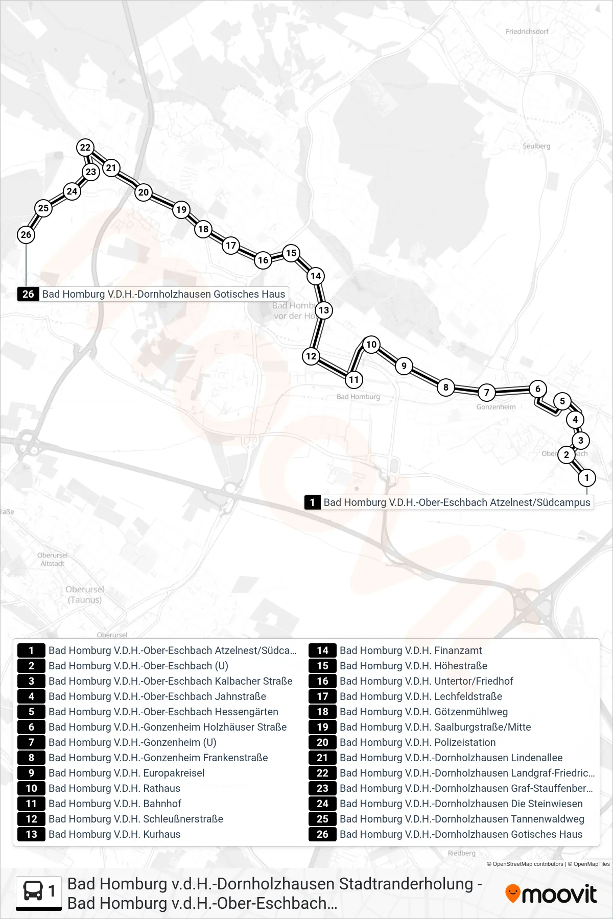
Stops list (1 - Bad Homburg V.D.H.-Dornholzhausen Gotisches Haus)
- Bad Homburg V.D.H.-Ober-Eschbach Atzelnest/Südcampus
- Bad Homburg V.D.H.-Ober-Eschbach (U)
- Bad Homburg V.D.H.-Ober-Eschbach Kalbacher Straße
- Bad Homburg V.D.H.-Ober-Eschbach Jahnstraße
- Bad Homburg V.D.H.-Ober-Eschbach Hessengärten
- Bad Homburg V.D.H.-Gonzenheim Holzhäuser Straße
- Bad Homburg V.D.H.-Gonzenheim (U)
- Bad Homburg V.D.H.-Gonzenheim Frankenstraße
- Bad Homburg V.D.H. Europakreisel
- Bad Homburg V.D.H. Rathaus
- Bad Homburg V.D.H. Bahnhof
- Bad Homburg V.D.H. Schleußnerstraße
- Bad Homburg V.D.H. Kurhaus
- Bad Homburg V.D.H. Finanzamt
- Bad Homburg V.D.H. Höhestraße
- Bad Homburg V.D.H. Untertor/Friedhof
- Bad Homburg V.D.H. Lechfeldstraße
- Bad Homburg V.D.H. Götzenmühlweg
- Bad Homburg V.D.H. Saalburgstraße/Mitte
- Bad Homburg V.D.H. Polizeistation
- Bad Homburg V.D.H.-Dornholzhausen Lindenallee
- Bad Homburg V.D.H.-Dornholzhausen Landgraf-Friedrich-Platz
- Bad Homburg V.D.H.-Dornholzhausen Graf-Stauffenberg-Ring
- Bad Homburg V.D.H.-Dornholzhausen Die Steinwiesen
- Bad Homburg V.D.H.-Dornholzhausen Tannenwaldweg
- Bad Homburg V.D.H.-Dornholzhausen Gotisches Haus