
1 Light Rail Route Map
View the 1 route map and see all 1 stops along the route. The map of 1 shows where the light rail travels and the location of each stop, making it easy to understand the entire route at a glance.
Explore Saarbahn GmbH routes on the map and see where Saarbahn GmbH light rail services operate. Use the 1 map to find light rail stations and see how the 1 connects different areas along its trip.
All 1 stops on the map are displayed in route order, helping you follow the 1 light rail from the first station to the last.
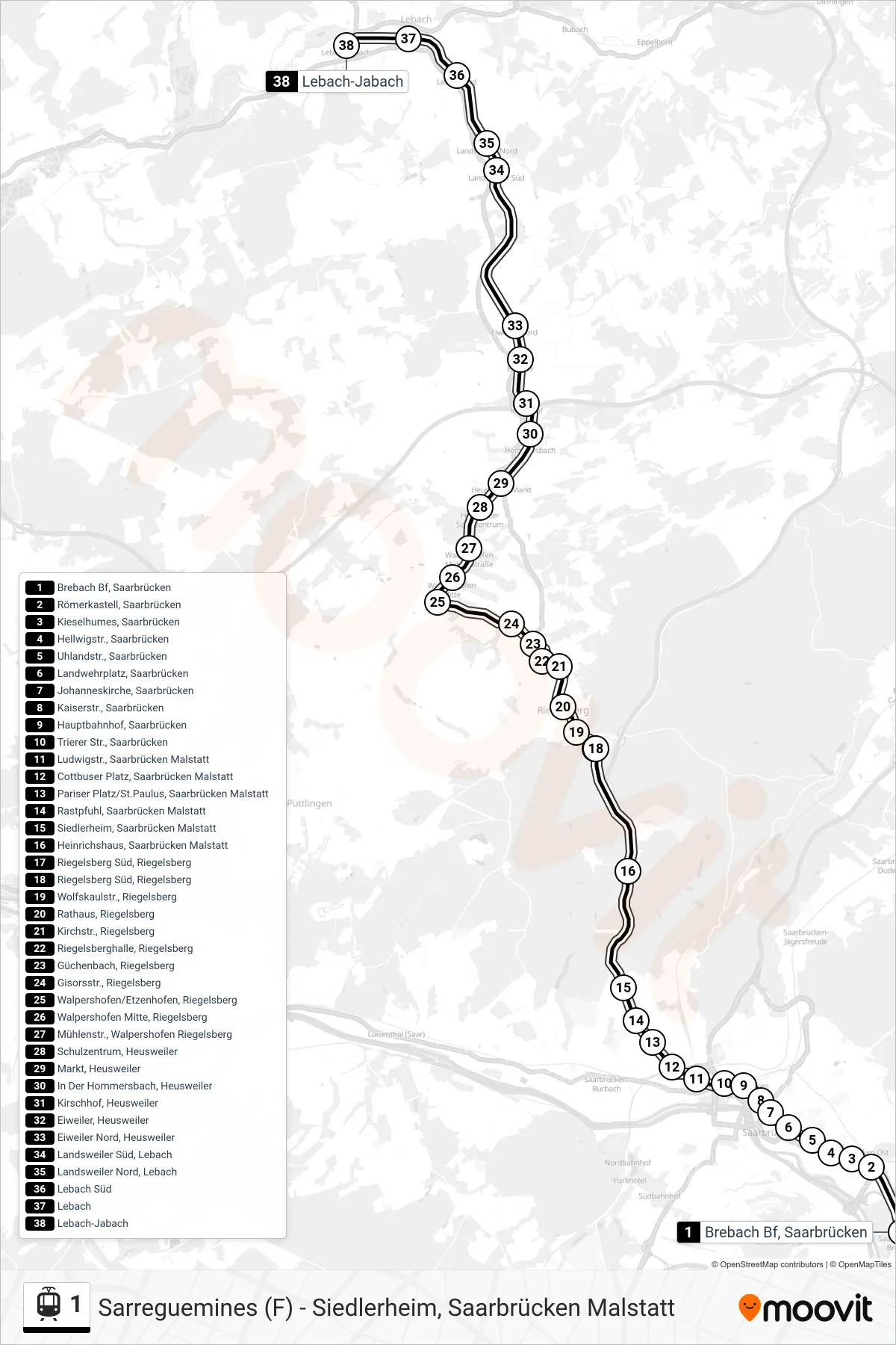
Stops list (1 - Lebach-Jabach)
- Brebach Bf, Saarbrücken
- Römerkastell, Saarbrücken
- Kieselhumes, Saarbrücken
- Hellwigstr., Saarbrücken
- Uhlandstr., Saarbrücken
- Landwehrplatz, Saarbrücken
- Johanneskirche, Saarbrücken
- Kaiserstr., Saarbrücken
- Hauptbahnhof, Saarbrücken
- Trierer Str., Saarbrücken
- Ludwigstr., Saarbrücken Malstatt
- Cottbuser Platz, Saarbrücken Malstatt
- Pariser Platz/St.Paulus, Saarbrücken Malstatt
- Rastpfuhl, Saarbrücken Malstatt
- Siedlerheim, Saarbrücken Malstatt
- Heinrichshaus, Saarbrücken Malstatt
- Riegelsberg Süd, Riegelsberg
- Riegelsberg Süd, Riegelsberg
- Wolfskaulstr., Riegelsberg
- Rathaus, Riegelsberg
- Kirchstr., Riegelsberg
- Riegelsberghalle, Riegelsberg
- Güchenbach, Riegelsberg
- Gisorsstr., Riegelsberg
- Walpershofen/Etzenhofen, Riegelsberg
- Walpershofen Mitte, Riegelsberg
- Mühlenstr., Walpershofen Riegelsberg
- Schulzentrum, Heusweiler
- Markt, Heusweiler
- In Der Hommersbach, Heusweiler
- Kirschhof, Heusweiler
- Eiweiler, Heusweiler
- Eiweiler Nord, Heusweiler
- Landsweiler Süd, Lebach
- Landsweiler Nord, Lebach
- Lebach Süd
- Lebach
- Lebach-Jabach
Change direction
- Route Map - 1 - Lebach
- Route Map - 1 - Hanweiler Bf, Kleinblittersdorf
- Route Map - 1 - Markt, Heusweiler
- Route Map - 1 - Riegelsberg Süd, Riegelsberg
- Route Map - 1 - Sarreguemines (F)
- Route Map - 1 - Siedlerheim, Saarbrücken Malstatt
- Route Map - 1 - Brebach Bf, Saarbrücken
- Route Map - 1 - Kleinblittersdorf Bf