
1 Subway Route Map
View the 1 route map and see all 1 stops along the route. The map of 1 shows where the subway travels and the location of each stop, making it easy to understand the entire route at a glance.
Explore MTA Subway routes on the map and see where MTA Subway subway services operate. Use the 1 map to find subway stations and see how the 1 connects different areas along its trip.
All 1 stops on the map are displayed in route order, helping you follow the 1 subway from the first station to the last.
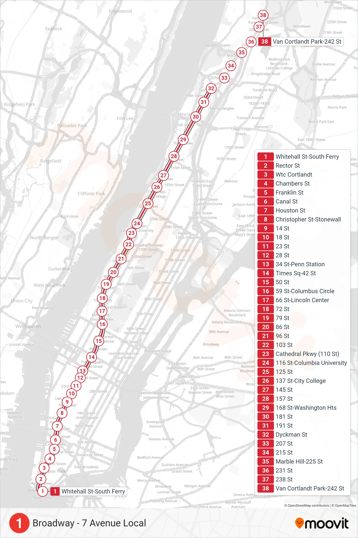
Stops list (1 - Uptown & The Bronx)
- Whitehall St-South Ferry
- Rector St
- Wtc Cortlandt
- Chambers St
- Franklin St
- Canal St
- Houston St
- Christopher St-Stonewall
- 14 St
- 18 St
- 23 St
- 28 St
- 34 St-Penn Station
- Times Sq-42 St
- 50 St
- 59 St-Columbus Circle
- 66 St-Lincoln Center
- 72 St
- 79 St
- 86 St
- 96 St
- 103 St
- Cathedral Pkwy (110 St)
- 116 St-Columbia University
- 125 St
- 137 St-City College
- 145 St
- 157 St
- 168 St-Washington Hts
- 181 St
- 191 St
- Dyckman St
- 207 St
- 215 St
- Marble Hill-225 St
- 231 St
- 238 St
- Van Cortlandt Park-242 St