
1 Bus Route Map
View the 1 route map and see all 1 stops along the route. The map of 1 shows where the bus travels and the location of each stop, making it easy to understand the entire route at a glance.
Explore Arriva routes on the map and see where Arriva bus services operate. Use the 1 map to find bus stops and see how the 1 connects different areas along its trip.
All 1 stops on the map are displayed in route order, helping you follow the 1 bus from the first stop to the last.
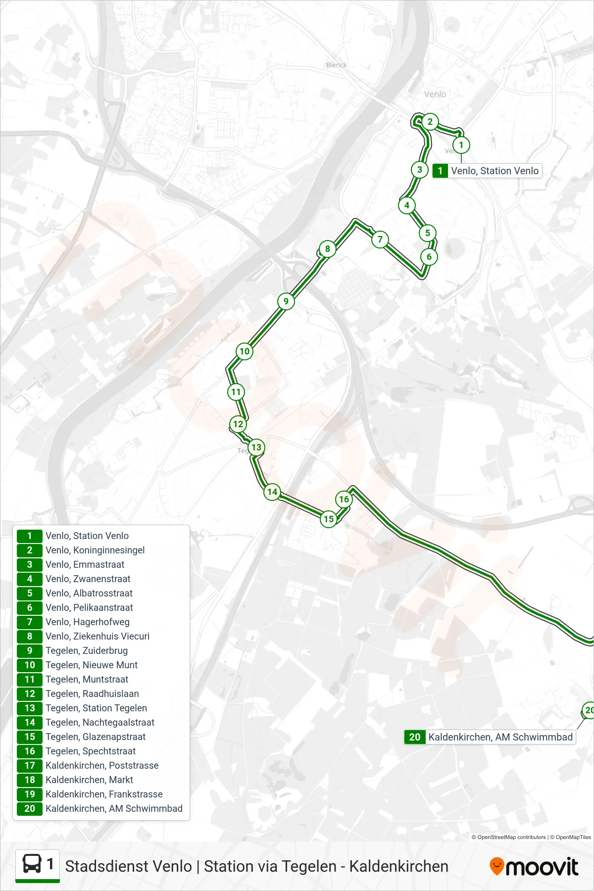
Stops list (1 - Kaldenkirchen)
- Venlo, Station Venlo
- Venlo, Koninginnesingel
- Venlo, Emmastraat
- Venlo, Zwanenstraat
- Venlo, Albatrosstraat
- Venlo, Pelikaanstraat
- Venlo, Hagerhofweg
- Venlo, Ziekenhuis Viecuri
- Tegelen, Zuiderbrug
- Tegelen, Nieuwe Munt
- Tegelen, Muntstraat
- Tegelen, Raadhuislaan
- Tegelen, Station Tegelen
- Tegelen, Nachtegaalstraat
- Tegelen, Glazenapstraat
- Tegelen, Spechtstraat
- Kaldenkirchen, Poststrasse
- Kaldenkirchen, Markt
- Kaldenkirchen, Frankstrasse
- Kaldenkirchen, AM Schwimmbad