
1 Bus Route Map
View the 1 route map and see all 1 stops along the route. The map of 1 shows where the bus travels and the location of each stop, making it easy to understand the entire route at a glance.
Explore De Lijn routes on the map and see where De Lijn bus services operate. Use the 1 map to find bus stops and see how the 1 connects different areas along its trip.
All 1 stops on the map are displayed in route order, helping you follow the 1 bus from the first stop to the last.
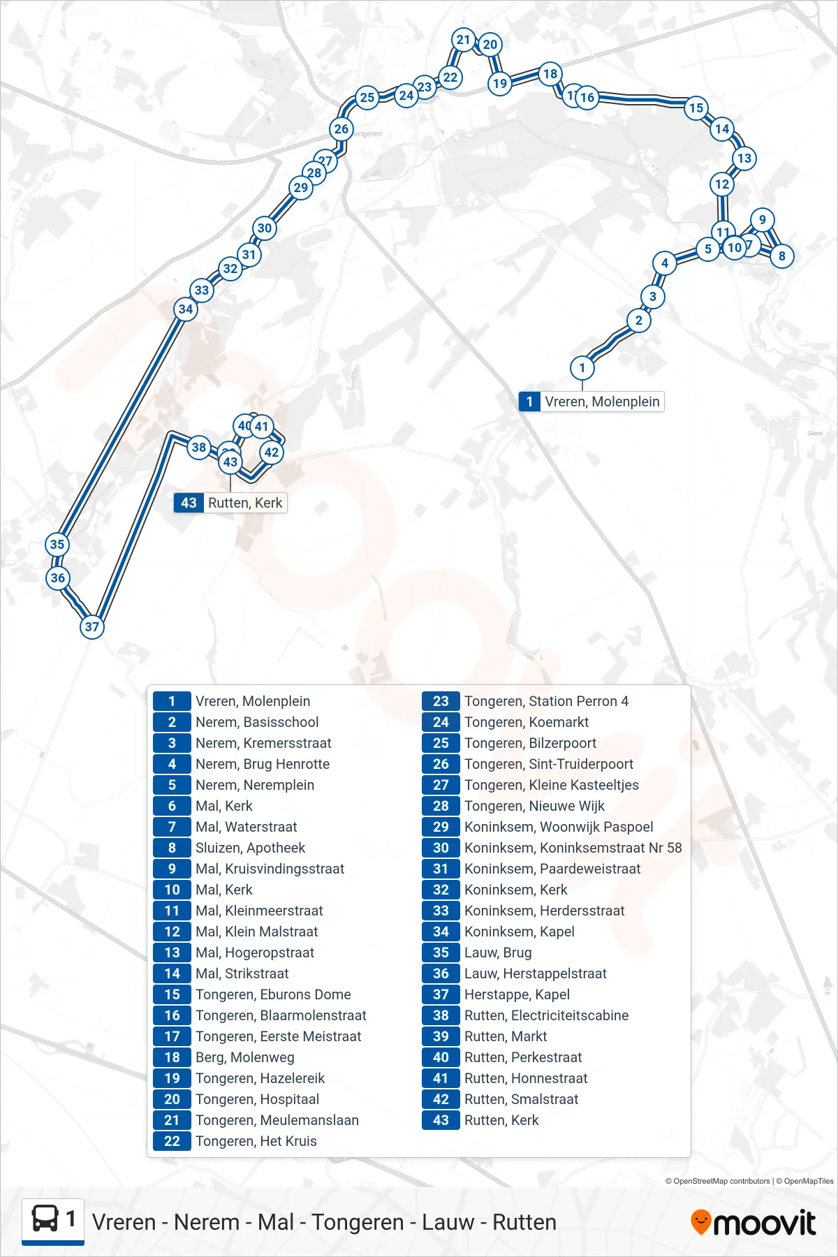
Stops list (1 - Rutten Kerk)
- Vreren, Molenplein
- Nerem, Basisschool
- Nerem, Kremersstraat
- Nerem, Brug Henrotte
- Nerem, Neremplein
- Mal, Kerk
- Mal, Waterstraat
- Sluizen, Apotheek
- Mal, Kruisvindingsstraat
- Mal, Kerk
- Mal, Kleinmeerstraat
- Mal, Klein Malstraat
- Mal, Hogeropstraat
- Mal, Strikstraat
- Tongeren, Eburons Dome
- Tongeren, Blaarmolenstraat
- Tongeren, Eerste Meistraat
- Berg, Molenweg
- Tongeren, Hazelereik
- Tongeren, Hospitaal
- Tongeren, Meulemanslaan
- Tongeren, Het Kruis
- Tongeren, Station Perron 4
- Tongeren, Koemarkt
- Tongeren, Bilzerpoort
- Tongeren, Sint-Truiderpoort
- Tongeren, Kleine Kasteeltjes
- Tongeren, Nieuwe Wijk
- Koninksem, Woonwijk Paspoel
- Koninksem, Koninksemstraat Nr 58
- Koninksem, Paardeweistraat
- Koninksem, Kerk
- Koninksem, Herdersstraat
- Koninksem, Kapel
- Lauw, Brug
- Lauw, Herstappelstraat
- Herstappe, Kapel
- Rutten, Electriciteitscabine
- Rutten, Markt
- Rutten, Perkestraat
- Rutten, Honnestraat
- Rutten, Smalstraat
- Rutten, Kerk