
1 Light Rail Route Map
View the 1 route map and see all 1 stops along the route. The map of 1 shows where the light rail travels and the location of each stop, making it easy to understand the entire route at a glance.
Explore HTM routes on the map and see where HTM light rail services operate. Use the 1 map to find light rail stations and see how the 1 connects different areas along its trip.
All 1 stops on the map are displayed in route order, helping you follow the 1 light rail from the first station to the last.
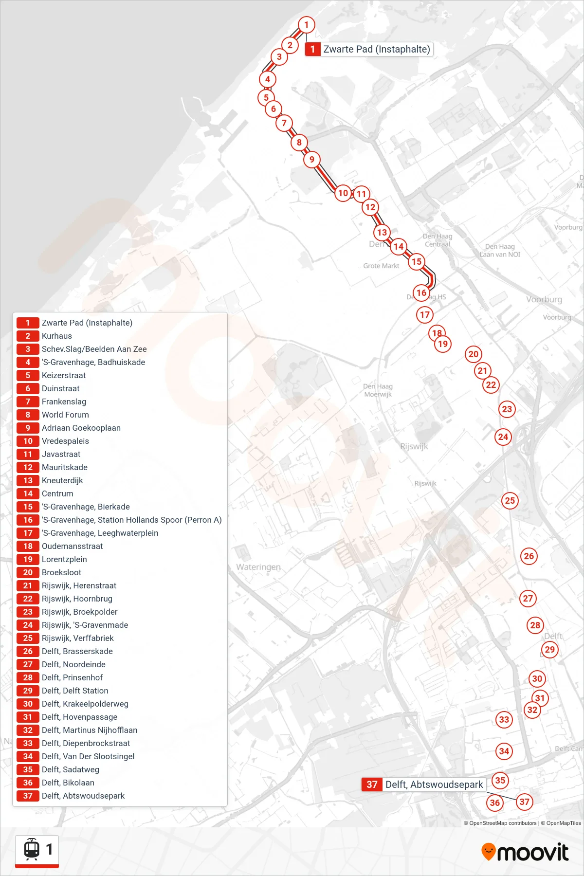
Stops list (1 - Scheveningen Noord)
- Zwarte Pad (Instaphalte)
- Kurhaus
- Schev.Slag/Beelden Aan Zee
- 'S-Gravenhage, Badhuiskade
- Keizerstraat
- Duinstraat
- Frankenslag
- World Forum
- Adriaan Goekooplaan
- Vredespaleis
- Javastraat
- Mauritskade
- Kneuterdijk
- Centrum
- 'S-Gravenhage, Bierkade
- 'S-Gravenhage, Station Hollands Spoor (Perron A)
- 'S-Gravenhage, Leeghwaterplein
- Oudemansstraat
- Lorentzplein
- Broeksloot
- Rijswijk, Herenstraat
- Rijswijk, Hoornbrug
- Rijswijk, Broekpolder
- Rijswijk, 'S-Gravenmade