
1 Light Rail Route Map
View the 1 route map and see all 1 stops along the route. The map of 1 shows where the light rail travels and the location of each stop, making it easy to understand the entire route at a glance.
Explore Rīgas satiksme routes on the map and see where Rīgas satiksme light rail services operate. Use the 1 map to find light rail stations and see how the 1 connects different areas along its trip.
All 1 stops on the map are displayed in route order, helping you follow the 1 light rail from the first station to the last.
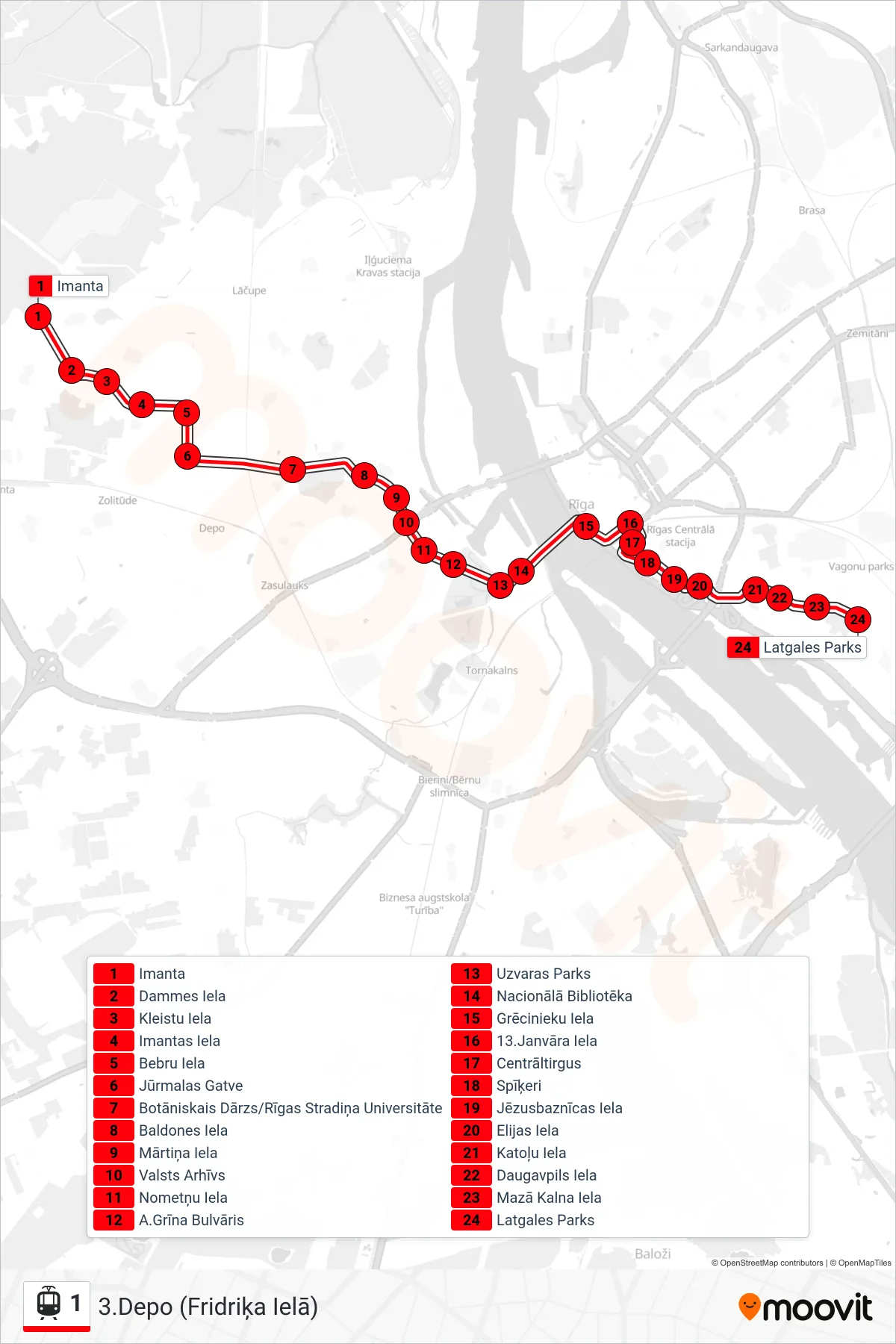
Stops list (1 - 3.Depo (Fridriķa Ielā))
- Imanta
- Dammes Iela
- Kleistu Iela
- Imantas Iela
- Bebru Iela
- Jūrmalas Gatve
- Botāniskais Dārzs/Rīgas Stradiņa Universitāte
- Baldones Iela
- Mārtiņa Iela
- Valsts Arhīvs
- Nometņu Iela
- A.Grīna Bulvāris
- Uzvaras Parks
- Nacionālā Bibliotēka
- Grēcinieku Iela
- 13.Janvāra Iela
- Centrāltirgus
- Spīķeri
- Jēzusbaznīcas Iela
- Elijas Iela
- Katoļu Iela
- Daugavpils Iela
- Mazā Kalna Iela
- Latgales Parks