
1 Bus Route Map
View the 1 route map and see all 1 stops along the route. The map of 1 shows where the bus travels and the location of each stop, making it easy to understand the entire route at a glance.
Explore GoCary routes on the map and see where GoCary bus services operate. Use the 1 map to find bus stops and see how the 1 connects different areas along its trip.
All 1 stops on the map are displayed in route order, helping you follow the 1 bus from the first stop to the last.
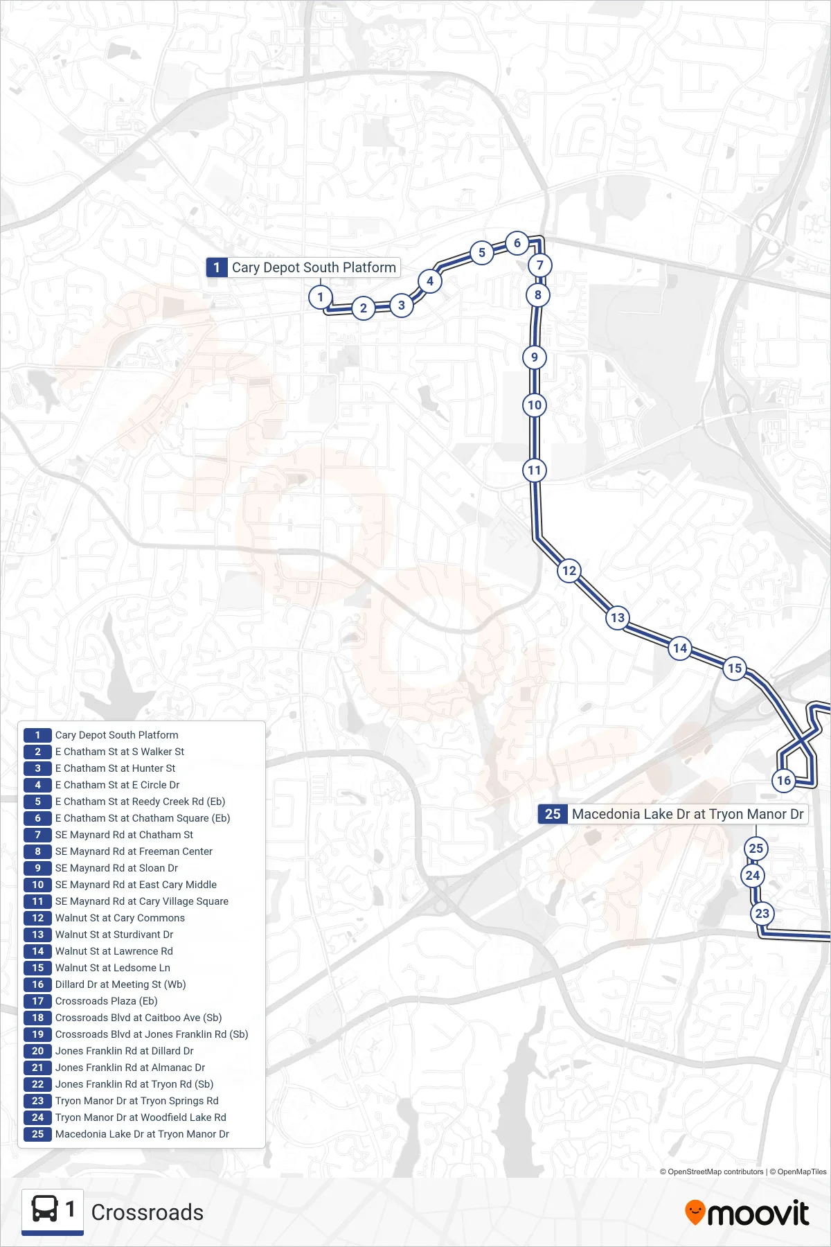
Stops list (1 - Tryon/Walnut Via Crossroads Plaza)
- Cary Depot South Platform
- E Chatham St at S Walker St
- E Chatham St at Hunter St
- E Chatham St at E Circle Dr
- E Chatham St at Reedy Creek Rd (Eb)
- E Chatham St at Chatham Square (Eb)
- SE Maynard Rd at Chatham St
- SE Maynard Rd at Freeman Center
- SE Maynard Rd at Sloan Dr
- SE Maynard Rd at East Cary Middle
- SE Maynard Rd at Cary Village Square
- Walnut St at Cary Commons
- Walnut St at Sturdivant Dr
- Walnut St at Lawrence Rd
- Walnut St at Ledsome Ln
- Dillard Dr at Meeting St (Wb)
- Crossroads Plaza (Eb)
- Crossroads Blvd at Caitboo Ave (Sb)
- Crossroads Blvd at Jones Franklin Rd (Sb)
- Jones Franklin Rd at Dillard Dr
- Jones Franklin Rd at Almanac Dr
- Jones Franklin Rd at Tryon Rd (Sb)
- Tryon Manor Dr at Tryon Springs Rd
- Tryon Manor Dr at Woodfield Lake Rd
- Macedonia Lake Dr at Tryon Manor Dr