
1 Bus Route Map
View the 1 route map and see all 1 stops along the route. The map of 1 shows where the bus travels and the location of each stop, making it easy to understand the entire route at a glance.
Explore Némus (Flers Agglo) routes on the map and see where Némus (Flers Agglo) bus services operate. Use the 1 map to find bus stops and see how the 1 connects different areas along its trip.
All 1 stops on the map are displayed in route order, helping you follow the 1 bus from the first stop to the last.
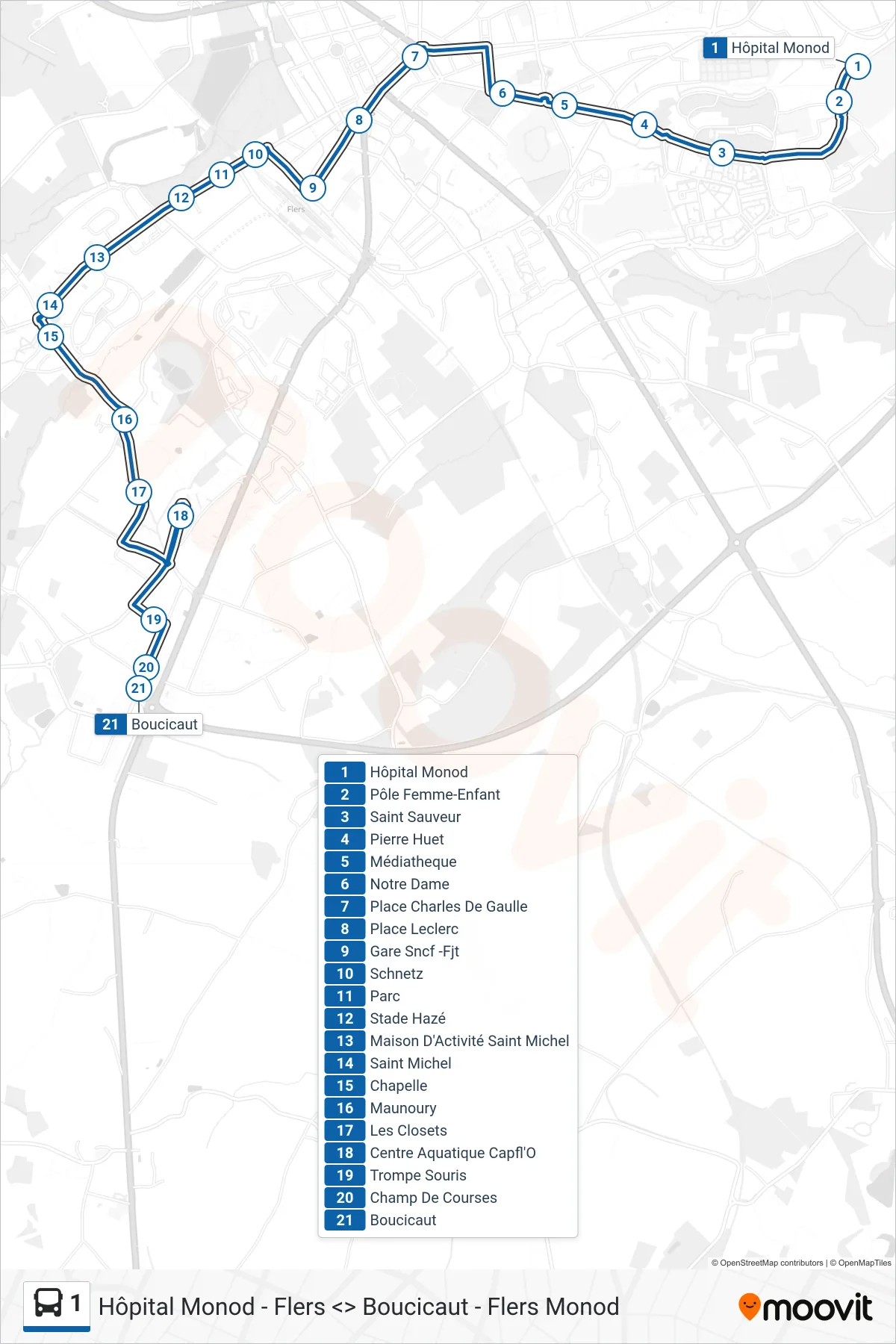
Stops list (1 - Boucicaut)
- Hôpital Monod
- Pôle Femme-Enfant
- Saint Sauveur
- Pierre Huet
- Médiatheque
- Notre Dame
- Place Charles De Gaulle
- Place Leclerc
- Gare Sncf -Fjt
- Schnetz
- Parc
- Stade Hazé
- Maison D'Activité Saint Michel
- Saint Michel
- Chapelle
- Maunoury
- Les Closets
- Centre Aquatique Capfl'O
- Trompe Souris
- Champ De Courses
- Boucicaut