
1 Bus Route Map
View the 1 route map and see all 1 stops along the route. The map of 1 shows where the bus travels and the location of each stop, making it easy to understand the entire route at a glance.
Explore County Connection routes on the map and see where County Connection bus services operate. Use the 1 map to find bus stops and see how the 1 connects different areas along its trip.
All 1 stops on the map are displayed in route order, helping you follow the 1 bus from the first stop to the last.
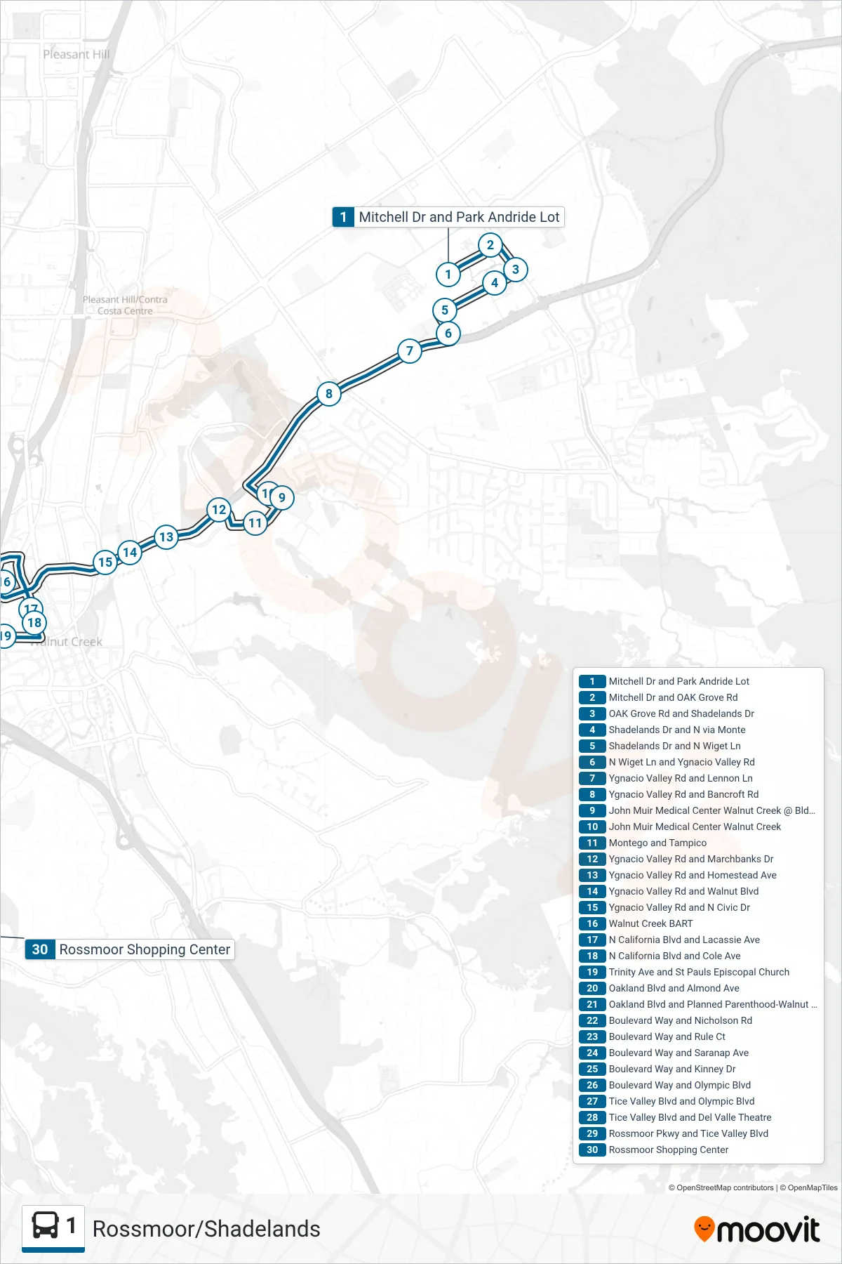
Stops list (1 - Rossmoor via Walnut Creek BART)
- Mitchell Dr and Park Andride Lot
- Mitchell Dr and OAK Grove Rd
- OAK Grove Rd and Shadelands Dr
- Shadelands Dr and N via Monte
- Shadelands Dr and N Wiget Ln
- N Wiget Ln and Ygnacio Valley Rd
- Ygnacio Valley Rd and Lennon Ln
- Ygnacio Valley Rd and Bancroft Rd
- John Muir Medical Center Walnut Creek @ Bldg #133
- John Muir Medical Center Walnut Creek
- Montego and Tampico
- Ygnacio Valley Rd and Marchbanks Dr
- Ygnacio Valley Rd and Homestead Ave
- Ygnacio Valley Rd and Walnut Blvd
- Ygnacio Valley Rd and N Civic Dr
- Walnut Creek BART
- N California Blvd and Lacassie Ave
- N California Blvd and Cole Ave
- Trinity Ave and St Pauls Episcopal Church
- Oakland Blvd and Almond Ave
- Oakland Blvd and Planned Parenthood-Walnut Creek Health Center
- Boulevard Way and Nicholson Rd
- Boulevard Way and Rule Ct
- Boulevard Way and Saranap Ave
- Boulevard Way and Kinney Dr
- Boulevard Way and Olympic Blvd
- Tice Valley Blvd and Olympic Blvd
- Tice Valley Blvd and Del Valle Theatre
- Rossmoor Pkwy and Tice Valley Blvd
- Rossmoor Shopping Center