
1 Bus Route Map
View the 1 route map and see all 1 stops along the route. The map of 1 shows where the bus travels and the location of each stop, making it easy to understand the entire route at a glance.
Explore Keolis Bassin de Thau routes on the map and see where Keolis Bassin de Thau bus services operate. Use the 1 map to find bus stops and see how the 1 connects different areas along its trip.
All 1 stops on the map are displayed in route order, helping you follow the 1 bus from the first stop to the last.
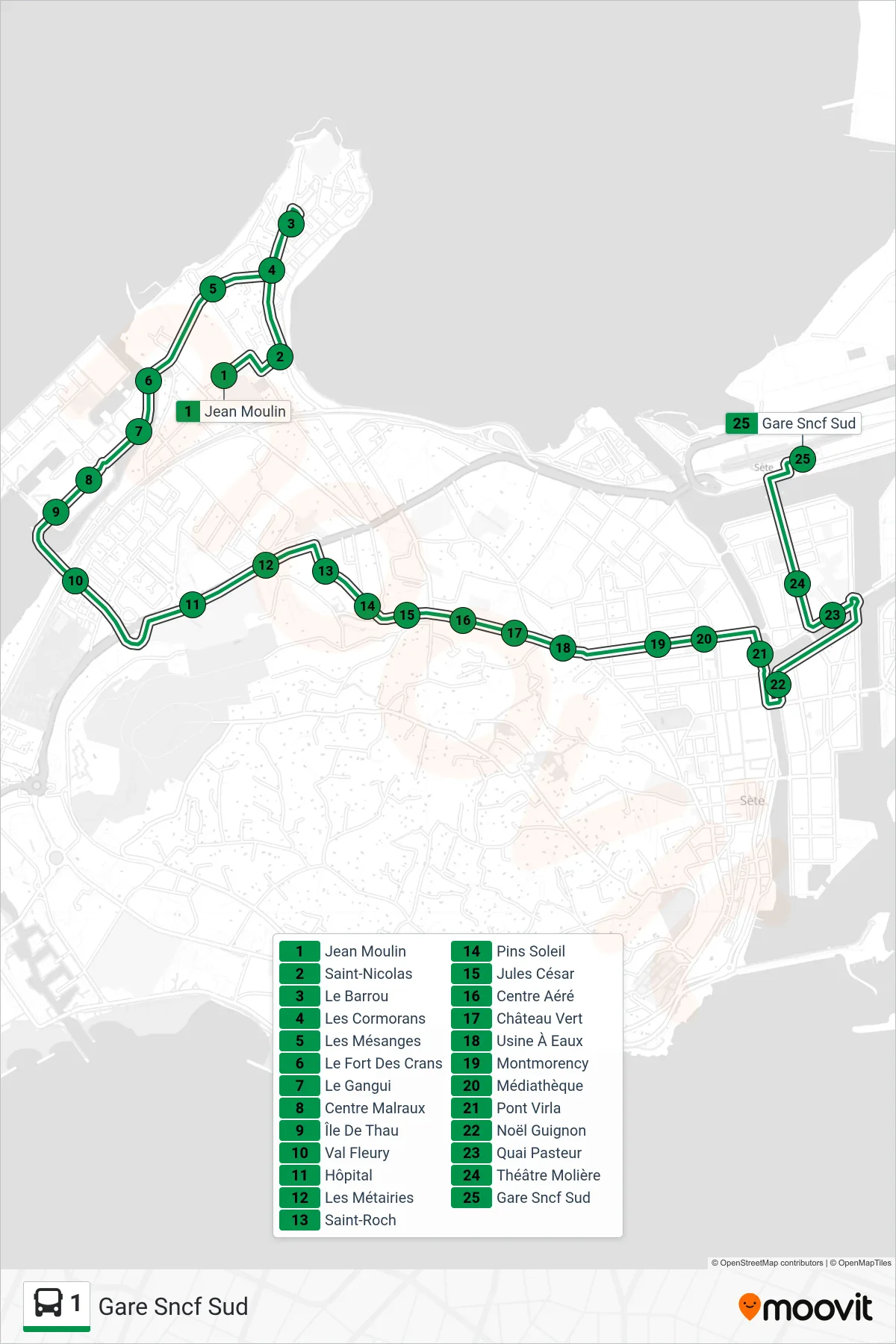

Stops list (1 - Gare Sncf Sud)
- Jean Moulin
- Saint-Nicolas
- Le Barrou
- Les Cormorans
- Les Mésanges
- Le Fort Des Crans
- Le Gangui
- Centre Malraux
- Île De Thau
- Val Fleury
- Hôpital
- Les Métairies
- Saint-Roch
- Pins Soleil
- Jules César
- Centre Aéré
- Château Vert
- Usine À Eaux
- Montmorency
- Médiathèque
- Pont Virla
- Noël Guignon
- Quai Pasteur
- Théâtre Molière
- Gare Sncf Sud