
1 Bus Route Map
View the 1 route map and see all 1 stops along the route. The map of 1 shows where the bus travels and the location of each stop, making it easy to understand the entire route at a glance.
Explore Blekingetrafiken routes on the map and see where Blekingetrafiken bus services operate. Use the 1 map to find bus stops and see how the 1 connects different areas along its trip.
All 1 stops on the map are displayed in route order, helping you follow the 1 bus from the first stop to the last.
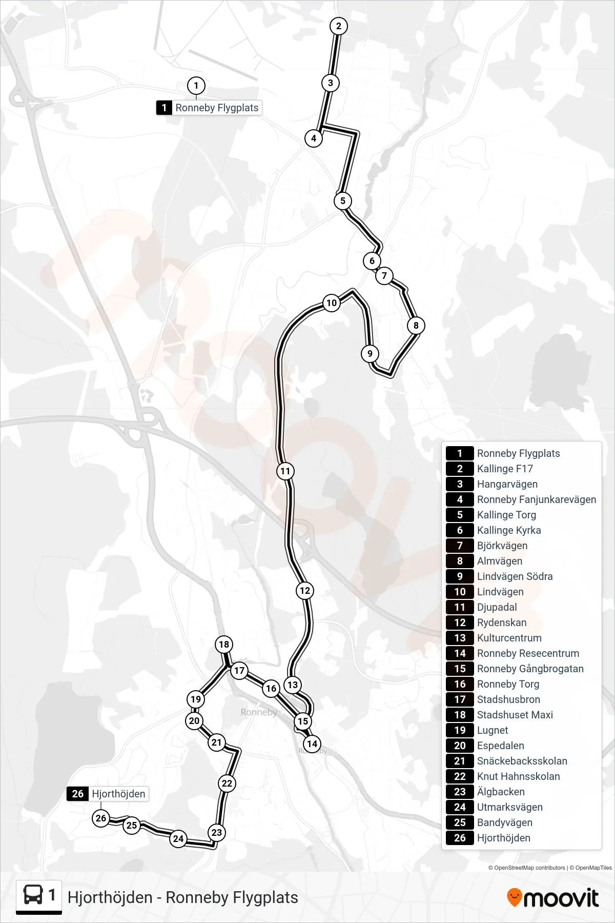
Stops list (1 - Hjorthöjden)
- Ronneby Flygplats
- Kallinge F17
- Hangarvägen
- Ronneby Fanjunkarevägen
- Kallinge Torg
- Kallinge Kyrka
- Björkvägen
- Almvägen
- Lindvägen Södra
- Lindvägen
- Djupadal
- Rydenskan
- Kulturcentrum
- Ronneby Resecentrum
- Ronneby Gångbrogatan
- Ronneby Torg
- Stadshusbron
- Stadshuset Maxi
- Lugnet
- Espedalen
- Snäckebacksskolan
- Knut Hahnsskolan
- Älgbacken
- Utmarksvägen
- Bandyvägen
- Hjorthöjden