
1 Tram Route Map
View the 1 route map and see all 1 stops along the route. The map of 1 shows where the tram travels and the location of each stop, making it easy to understand the entire route at a glance.
Explore routes on the map and see where tram services operate. Use the 1 map to find tram stations and see how the 1 connects different areas along its trip.
All 1 stops on the map are displayed in route order, helping you follow the 1 tram from the first station to the last.
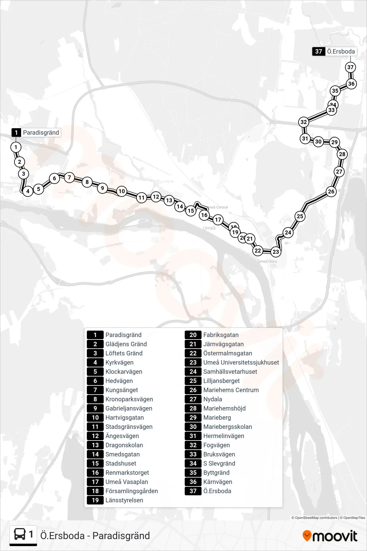
Stops list (1 - Ö.Ersboda)
- Paradisgränd
- Glädjens Gränd
- Löftets Gränd
- Kyrkvägen
- Klockarvägen
- Hedvägen
- Kungsänget
- Kronoparksvägen
- Gabrieljansvägen
- Hartvigsgatan
- Stadsgränsvägen
- Ängesvägen
- Dragonskolan
- Smedsgatan
- Stadshuset
- Renmarkstorget
- Umeå Vasaplan
- Församlingsgården
- Länsstyrelsen
- Fabriksgatan
- Järnvägsgatan
- Östermalmsgatan
- Umeå Universitetssjukhuset
- Samhällsvetarhuset
- Lilljansberget
- Mariehems Centrum
- Nydala
- Mariehemshöjd
- Marieberg
- Mariebergsskolan
- Hermelinvägen
- Fogvägen
- Bruksvägen
- S Slevgränd
- Byttgränd
- Kärnvägen
- Ö.Ersboda