
1 Bus Route Map
View the 1 route map and see all 1 stops along the route. The map of 1 shows where the bus travels and the location of each stop, making it easy to understand the entire route at a glance.
Explore TUT routes on the map and see where TUT bus services operate. Use the 1 map to find bus stops and see how the 1 connects different areas along its trip.
All 1 stops on the map are displayed in route order, helping you follow the 1 bus from the first stop to the last.
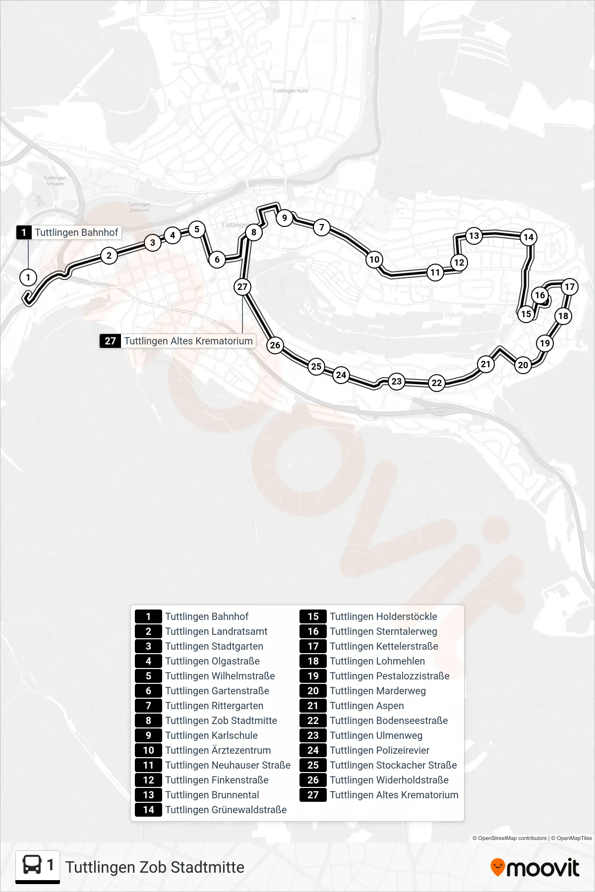
Stops list (1 - Tuttlingen Zob Stadtmitte)
- Tuttlingen Bahnhof
- Tuttlingen Landratsamt
- Tuttlingen Stadtgarten
- Tuttlingen Olgastraße
- Tuttlingen Wilhelmstraße
- Tuttlingen Gartenstraße
- Tuttlingen Rittergarten
- Tuttlingen Zob Stadtmitte
- Tuttlingen Karlschule
- Tuttlingen Ärztezentrum
- Tuttlingen Neuhauser Straße
- Tuttlingen Finkenstraße
- Tuttlingen Brunnental
- Tuttlingen Grünewaldstraße
- Tuttlingen Holderstöckle
- Tuttlingen Sterntalerweg
- Tuttlingen Kettelerstraße
- Tuttlingen Lohmehlen
- Tuttlingen Pestalozzistraße
- Tuttlingen Marderweg
- Tuttlingen Aspen
- Tuttlingen Bodenseestraße
- Tuttlingen Ulmenweg
- Tuttlingen Polizeirevier
- Tuttlingen Stockacher Straße
- Tuttlingen Widerholdstraße
- Tuttlingen Altes Krematorium