
1 Bus Route Map
View the 1 route map and see all 1 stops along the route. The map of 1 shows where the bus travels and the location of each stop, making it easy to understand the entire route at a glance.
Explore Stadtwerke Heilbronn - Verkehrsbetriebe routes on the map and see where Stadtwerke Heilbronn - Verkehrsbetriebe bus services operate. Use the 1 map to find bus stops and see how the 1 connects different areas along its trip.
All 1 stops on the map are displayed in route order, helping you follow the 1 bus from the first stop to the last.
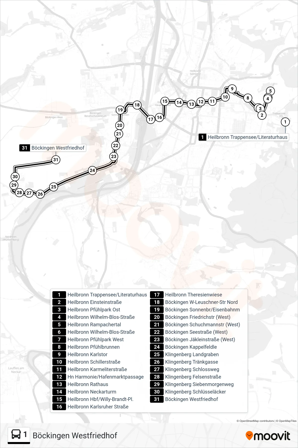
Stops list (1 - Böckingen Westfriedhof)
- Heilbronn Trappensee/Literaturhaus
- Heilbronn Einsteinstraße
- Heilbronn Pfühlpark Ost
- Heilbronn Wilhelm-Blos-Straße
- Heilbronn Rampachertal
- Heilbronn Wilhelm-Blos-Straße
- Heilbronn Pfühlpark West
- Heilbronn Pfühlbrunnen
- Heilbronn Karlstor
- Heilbronn Schillerstraße
- Heilbronn Karmeliterstraße
- Hn Harmonie/Hafenmarktpassage
- Heilbronn Rathaus
- Heilbronn Neckarturm
- Heilbronn Hbf/Willy-Brandt-Pl.
- Heilbronn Karlsruher Straße
- Heilbronn Theresienwiese
- Böckingen W-Leuschner-Str Nord
- Böckingen Sonnenbr/Eisenbahnm
- Böckingen Friedrichstr (West)
- Böckingen Schuchmannstr (West)
- Böckingen Seestraße (West)
- Böckingen Jäkleinstraße (West)
- Böckingen Kappelfeldle
- Klingenberg Landgraben
- Klingenberg Tränkgasse
- Klingenberg Schlossweg
- Klingenberg Felsenstraße
- Klingenberg Siebenmorgenweg
- Klingenberg Schlüsseläcker
- Böckingen Westfriedhof
Change direction
- Route Map - 1 - Heilbronn Hbf/Willy-Brandt-Pl.
- Route Map - 1 - Heilbronn Rathaus
- Route Map - 1 - Heilbronn Badener Hof
- Route Map - 1 - Heilbronn Harmonie/Kunsthalle
- Route Map - 1 - Böckingen W-Leuschner-Str Süd
- Route Map - 1 - Heilbronn Rampachertal
- Route Map - 1 - Klingenberg Schlüsseläcker
- Route Map - 1 - Böckingen Jäkleinstraße (West)
- Route Map - 1 - Heilbronn Trappensee/Literaturhaus