
1 Bus Route Map
View the 1 route map and see all 1 stops along the route. The map of 1 shows where the bus travels and the location of each stop, making it easy to understand the entire route at a glance.
Explore Süd Weil am Rhein Lörrach routes on the map and see where Süd Weil am Rhein Lörrach bus services operate. Use the 1 map to find bus stops and see how the 1 connects different areas along its trip.
All 1 stops on the map are displayed in route order, helping you follow the 1 bus from the first stop to the last.
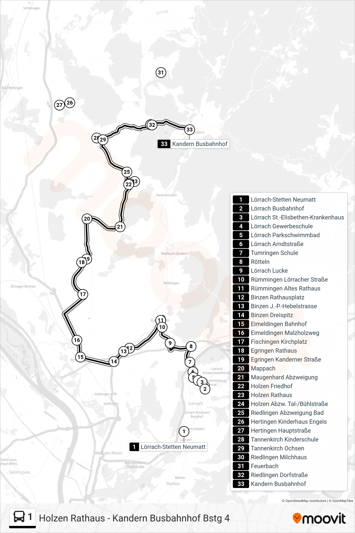
Stops list (1 - Kandern Busbahnhof Bstg 4)
- Lörrach-Stetten Neumatt
- Lörrach Busbahnhof
- Lörrach St.-Elisbethen-Krankenhaus
- Lörrach Gewerbeschule
- Lörrach Parkschwimmbad
- Lörrach Arndtstraße
- Tumringen Schule
- Rötteln
- Lörrach Lucke
- Rümmingen Lörracher Straße
- Rümmingen Altes Rathaus
- Binzen Rathausplatz
- Binzen J.-P.-Hebelstrasse
- Binzen Dreispitz
- Eimeldingen Bahnhof
- Eimeldingen Malzholzweg
- Fischingen Kirchplatz
- Egringen Rathaus
- Egringen Kanderner Straße
- Mappach
- Maugenhard Abzweigung
- Holzen Friedhof
- Holzen Rathaus
- Holzen Abzw. Tal-/Bühlstraße
- Riedlingen Abzweigung Bad
- Hertingen Kinderhaus Engels
- Hertingen Hauptstraße
- Tannenkirch Kinderschule
- Tannenkirch Ochsen
- Riedlingen Milchhaus
- Feuerbach
- Riedlingen Dorfstraße
- Kandern Busbahnhof