
1 Bus Route Map
View the 1 route map and see all 1 stops along the route. The map of 1 shows where the bus travels and the location of each stop, making it easy to understand the entire route at a glance.
Explore Montgomery County Ride On routes on the map and see where Montgomery County Ride On bus services operate. Use the 1 map to find bus stops and see how the 1 connects different areas along its trip.
All 1 stops on the map are displayed in route order, helping you follow the 1 bus from the first stop to the last.
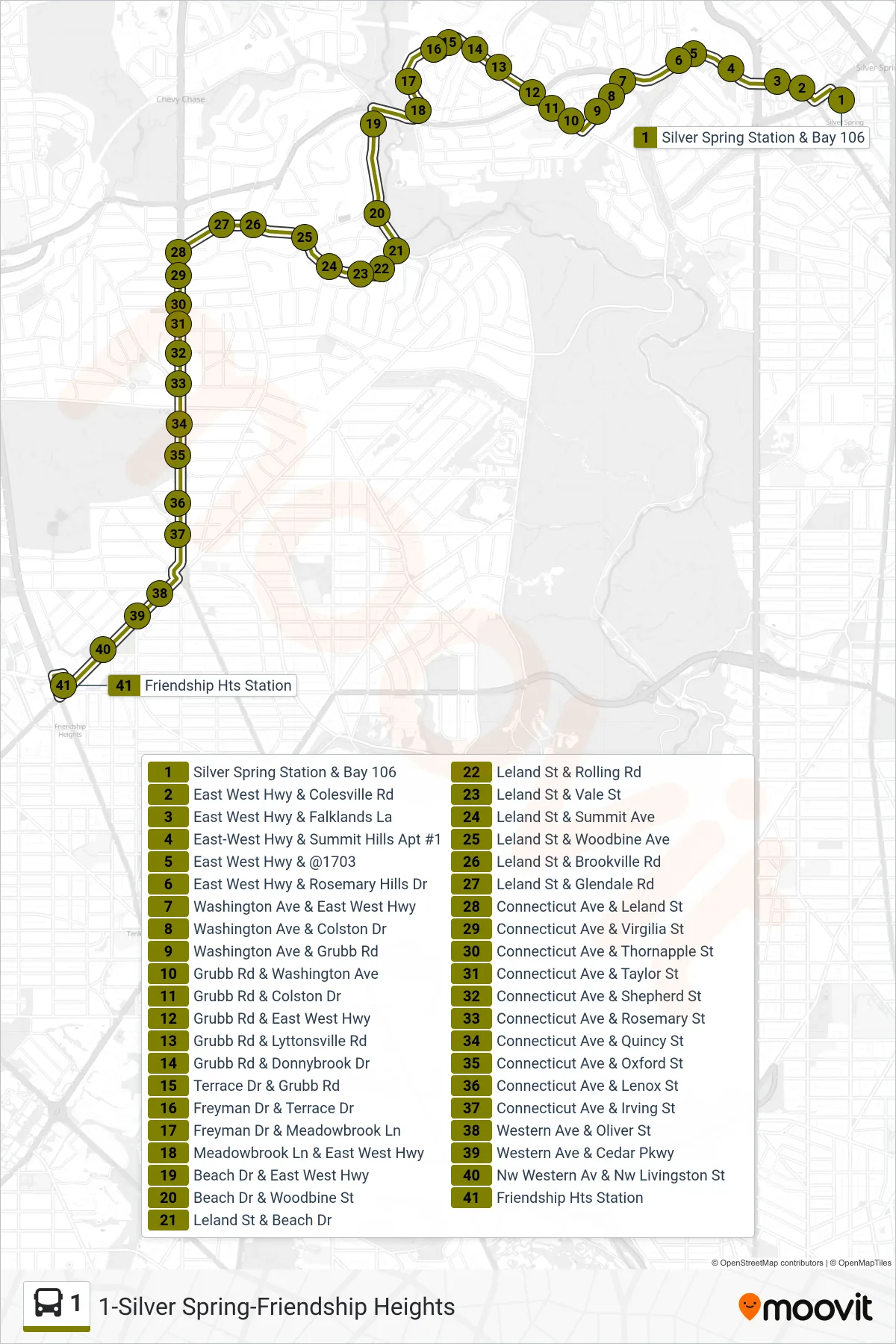
Stops list (1 - Friendship Heights Via Leland)
- Silver Spring Station & Bay 106
- East West Hwy & Colesville Rd
- East West Hwy & Falklands La
- East-West Hwy & Summit Hills Apt #1
- East West Hwy & @1703
- East West Hwy & Rosemary Hills Dr
- Washington Ave & East West Hwy
- Washington Ave & Colston Dr
- Washington Ave & Grubb Rd
- Grubb Rd & Washington Ave
- Grubb Rd & Colston Dr
- Grubb Rd & East West Hwy
- Grubb Rd & Lyttonsville Rd
- Grubb Rd & Donnybrook Dr
- Terrace Dr & Grubb Rd
- Freyman Dr & Terrace Dr
- Freyman Dr & Meadowbrook Ln
- Meadowbrook Ln & East West Hwy
- Beach Dr & East West Hwy
- Beach Dr & Woodbine St
- Leland St & Beach Dr
- Leland St & Rolling Rd
- Leland St & Vale St
- Leland St & Summit Ave
- Leland St & Woodbine Ave
- Leland St & Brookville Rd
- Leland St & Glendale Rd
- Connecticut Ave & Leland St
- Connecticut Ave & Virgilia St
- Connecticut Ave & Thornapple St
- Connecticut Ave & Taylor St
- Connecticut Ave & Shepherd St
- Connecticut Ave & Rosemary St
- Connecticut Ave & Quincy St
- Connecticut Ave & Oxford St
- Connecticut Ave & Lenox St
- Connecticut Ave & Irving St
- Western Ave & Oliver St
- Western Ave & Cedar Pkwy
- Nw Western Av & Nw Livingston St
- Friendship Hts Station