
10 Bus Route Map
View the 10 route map and see all 10 stops along the route. The map of 10 shows where the bus travels and the location of each stop, making it easy to understand the entire route at a glance.
Explore MBTA routes on the map and see where MBTA bus services operate. Use the 10 map to find bus stops and see how the 10 connects different areas along its trip.
All 10 stops on the map are displayed in route order, helping you follow the 10 bus from the first stop to the last.
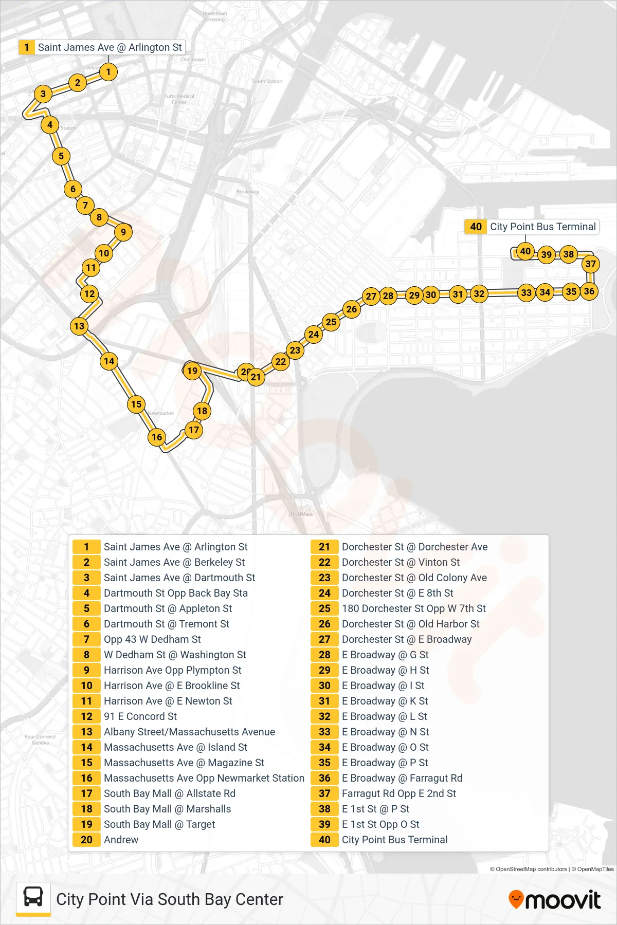
Stops list (10 - City Point Via South Bay Center)
- Saint James Ave @ Arlington St
- Saint James Ave @ Berkeley St
- Saint James Ave @ Dartmouth St
- Dartmouth St Opp Back Bay Sta
- Dartmouth St @ Appleton St
- Dartmouth St @ Tremont St
- Opp 43 W Dedham St
- W Dedham St @ Washington St
- Harrison Ave Opp Plympton St
- Harrison Ave @ E Brookline St
- Harrison Ave @ E Newton St
- 91 E Concord St
- Albany Street/Massachusetts Avenue
- Massachusetts Ave @ Island St
- Massachusetts Ave @ Magazine St
- Massachusetts Ave Opp Newmarket Station
- South Bay Mall @ Allstate Rd
- South Bay Mall @ Marshalls
- South Bay Mall @ Target
- Andrew
- Dorchester St @ Dorchester Ave
- Dorchester St @ Vinton St
- Dorchester St @ Old Colony Ave
- Dorchester St @ E 8th St
- 180 Dorchester St Opp W 7th St
- Dorchester St @ Old Harbor St
- Dorchester St @ E Broadway
- E Broadway @ G St
- E Broadway @ H St
- E Broadway @ I St
- E Broadway @ K St
- E Broadway @ L St
- E Broadway @ N St
- E Broadway @ O St
- E Broadway @ P St
- E Broadway @ Farragut Rd
- Farragut Rd Opp E 2nd St
- E 1st St @ P St
- E 1st St Opp O St
- City Point Bus Terminal