
10 Bus Route Map
View the 10 route map and see all 10 stops along the route. The map of 10 shows where the bus travels and the location of each stop, making it easy to understand the entire route at a glance.
Explore Cities Area Transit routes on the map and see where Cities Area Transit bus services operate. Use the 10 map to find bus stops and see how the 10 connects different areas along its trip.
All 10 stops on the map are displayed in route order, helping you follow the 10 bus from the first stop to the last.
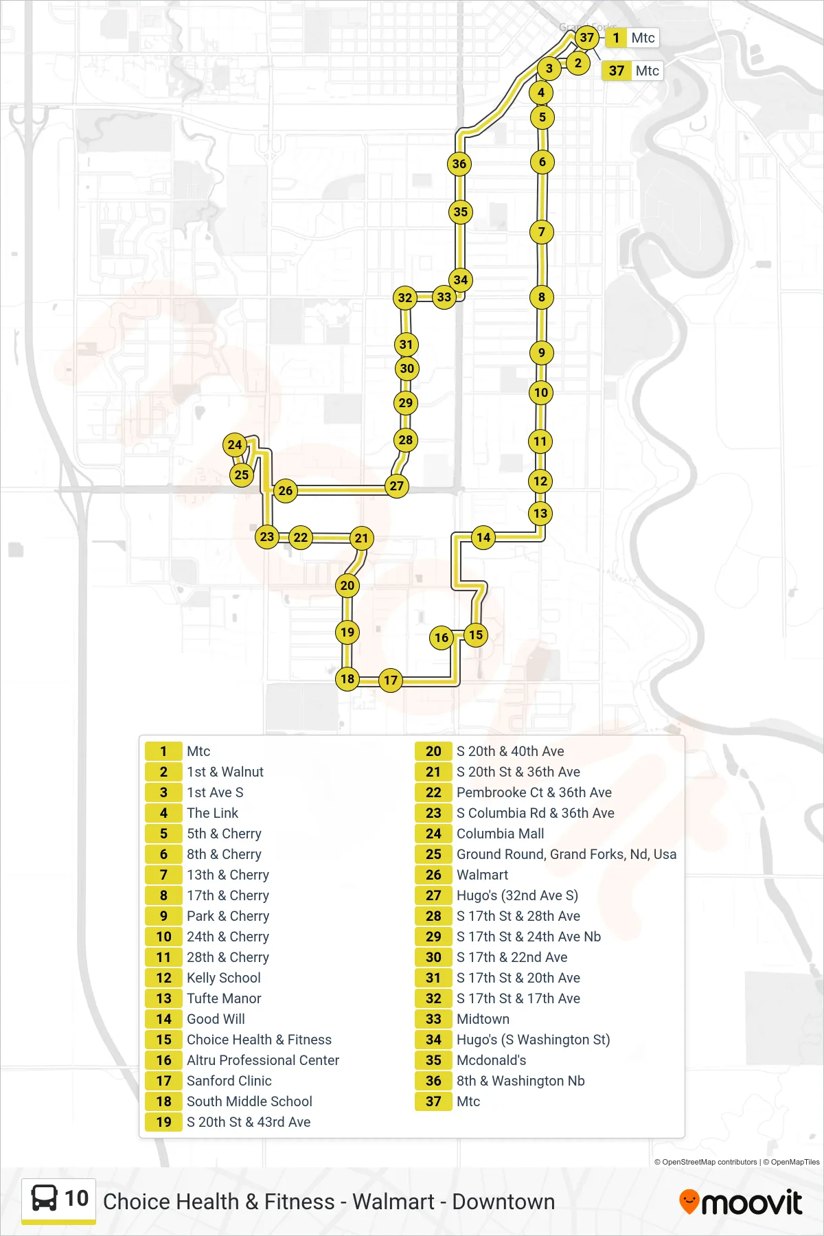
Stops list (10 - Mtc→Mtc)
- Mtc
- 1st & Walnut
- 1st Ave S
- The Link
- 5th & Cherry
- 8th & Cherry
- 13th & Cherry
- 17th & Cherry
- Park & Cherry
- 24th & Cherry
- 28th & Cherry
- Kelly School
- Tufte Manor
- Good Will
- Choice Health & Fitness
- Altru Professional Center
- Sanford Clinic
- South Middle School
- S 20th St & 43rd Ave
- S 20th & 40th Ave
- S 20th St & 36th Ave
- Pembrooke Ct & 36th Ave
- S Columbia Rd & 36th Ave
- Columbia Mall
- Ground Round, Grand Forks, Nd, Usa
- Walmart
- Hugo's (32nd Ave S)
- S 17th St & 28th Ave
- S 17th St & 24th Ave Nb
- S 17th & 22nd Ave
- S 17th St & 20th Ave
- S 17th St & 17th Ave
- Midtown
- Hugo's (S Washington St)
- Mcdonald's
- 8th & Washington Nb
- Mtc