
10 Bus Route Map
View the 10 route map and see all 10 stops along the route. The map of 10 shows where the bus travels and the location of each stop, making it easy to understand the entire route at a glance.
Explore Superbus routes on the map and see where Superbus bus services operate. Use the 10 map to find bus stops and see how the 10 connects different areas along its trip.
All 10 stops on the map are displayed in route order, helping you follow the 10 bus from the first stop to the last.
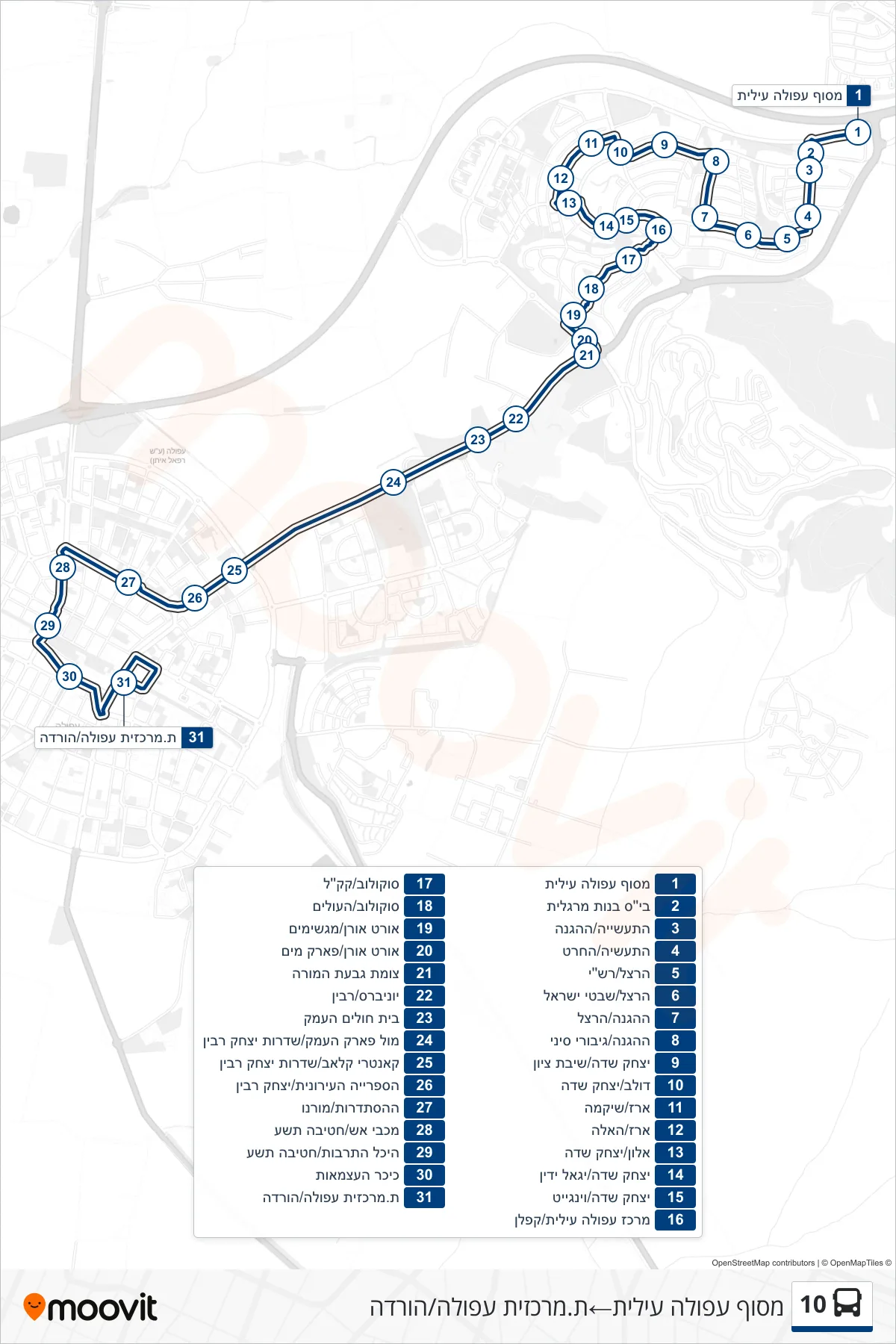
Stops list (10 - Afula Ilit Terminal→Afula Central Station/Drop Off)
- Afula Ilit Terminal
- Margalit Girls School
- HaTaasiya/HaHagana
- HaTa'asiya/HaCharet
- Herzl/Rashi
- Herzl/Shivtei Israel
- HaHagana/Herzl
- HaHagana/Giborei Sinai
- Yitzhak Sadeh/Shivat Zion
- Dolev/Yitzhak Sadeh
- Erez/Shikma
- Erez/HaEla
- Alon/Yitzhak Sadeh
- Yitzhak Sadeh/Yigal Yadin
- Yitzhak Sadeh/Wingate
- Afula Illit Center/Kaplan
- Sokolov/KKL
- Sokolov/HaOlim
- ORT Oren/Magshimim
- ORT Oren/Water Park
- Givat HaMoreh Junction
- Universe/Rabin
- Ha'Emek Hospital
- Facing Valley Park/Yitzhak Rabin Boulevard
- Country Club/Yitzhak Rabin Boulevard
- City Library/Yitzhak Rabin
- HaHistadrut/Morenu
- Fire Station/9th Brigade
- Culture Hall/9th Brigade
- Independence Square
- Afula Central Station/Drop Off