
10 Bus Route Map
View the 10 route map and see all 10 stops along the route. The map of 10 shows where the bus travels and the location of each stop, making it easy to understand the entire route at a glance.
Explore KVG Bus routes on the map and see where KVG Bus bus services operate. Use the 10 map to find bus stops and see how the 10 connects different areas along its trip.
All 10 stops on the map are displayed in route order, helping you follow the 10 bus from the first stop to the last.
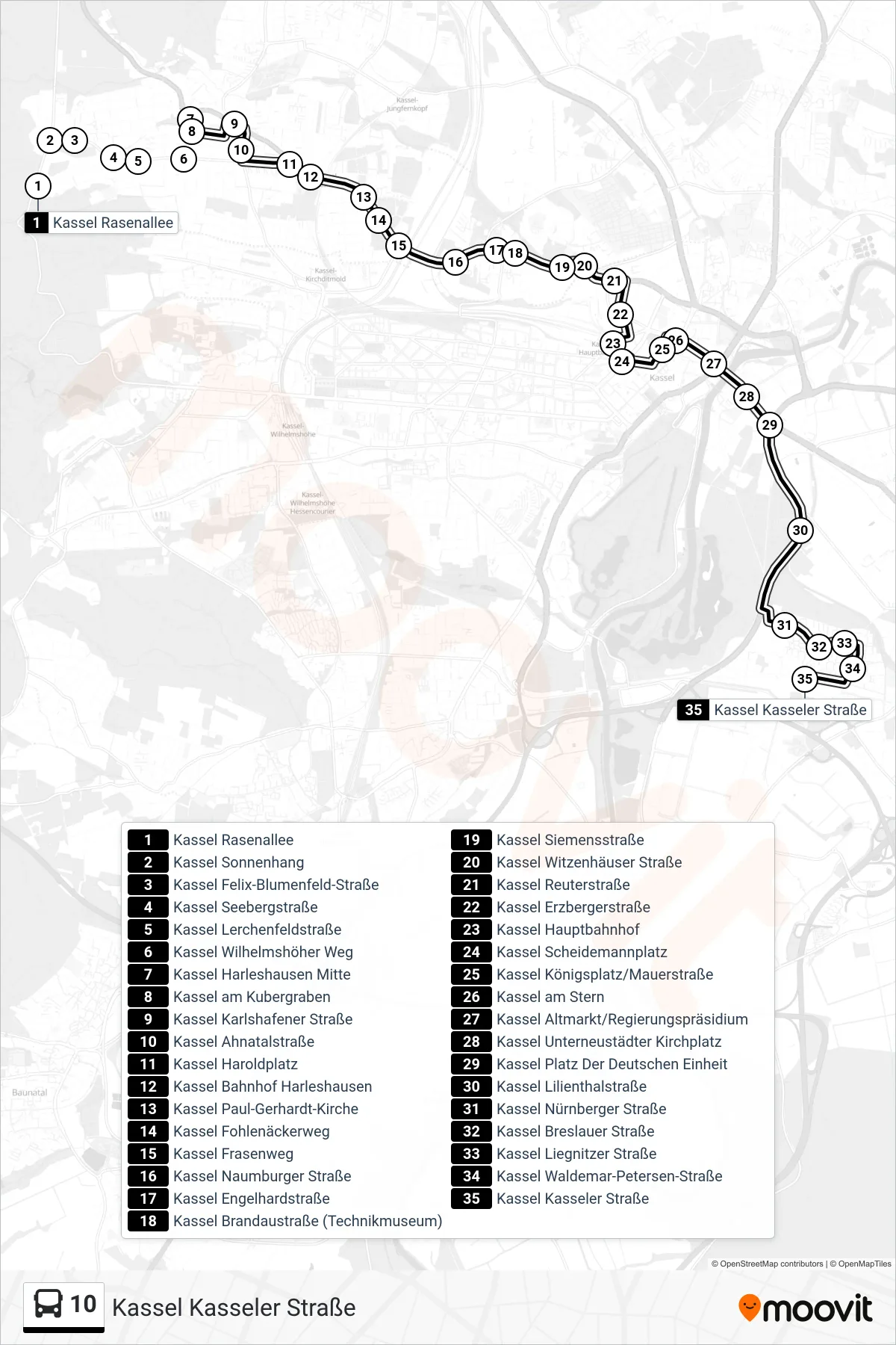
Stops list (10 - Kassel Kasseler Straße)
- Kassel Rasenallee
- Kassel Sonnenhang
- Kassel Felix-Blumenfeld-Straße
- Kassel Seebergstraße
- Kassel Lerchenfeldstraße
- Kassel Wilhelmshöher Weg
- Kassel Harleshausen Mitte
- Kassel am Kubergraben
- Kassel Karlshafener Straße
- Kassel Ahnatalstraße
- Kassel Haroldplatz
- Kassel Bahnhof Harleshausen
- Kassel Paul-Gerhardt-Kirche
- Kassel Fohlenäckerweg
- Kassel Frasenweg
- Kassel Naumburger Straße
- Kassel Engelhardstraße
- Kassel Brandaustraße (Technikmuseum)
- Kassel Siemensstraße
- Kassel Witzenhäuser Straße
- Kassel Reuterstraße
- Kassel Erzbergerstraße
- Kassel Hauptbahnhof
- Kassel Scheidemannplatz
- Kassel Königsplatz/Mauerstraße
- Kassel am Stern
- Kassel Altmarkt/Regierungspräsidium
- Kassel Unterneustädter Kirchplatz
- Kassel Platz Der Deutschen Einheit
- Kassel Lilienthalstraße
- Kassel Nürnberger Straße
- Kassel Breslauer Straße
- Kassel Liegnitzer Straße
- Kassel Waldemar-Petersen-Straße
- Kassel Kasseler Straße
Change direction
- Route Map - 10 - Kassel Industriepark-Waldau-Ost/Ikea
- Route Map - 10 - Kassel Auestadion
- Route Map - 10 - Kassel Platz Der Deutschen Einheit
- Route Map - 10 - Kassel Gesamtschule Waldau
- Route Map - 10 - Kassel Platz Der Deutschen Einheit
- Route Map - 10 - Rasenallee
- Route Map - 10 - Am Kubergraben
- Route Map - 10 - Kassel Königsplatz/Mauerstraße
- Route Map - 10 - Kassel Ahnatalstraße
- Route Map - 10 - Kassel Kasseler Straße
- Route Map - 10 - Kassel Ahnatalstraße