
10 Bus Route Map
View the 10 route map and see all 10 stops along the route. The map of 10 shows where the bus travels and the location of each stop, making it easy to understand the entire route at a glance.
Explore Transporte Integrado Misionero (TIM) routes on the map and see where Transporte Integrado Misionero (TIM) bus services operate. Use the 10 map to find bus stops and see how the 10 connects different areas along its trip.
All 10 stops on the map are displayed in route order, helping you follow the 10 bus from the first stop to the last.
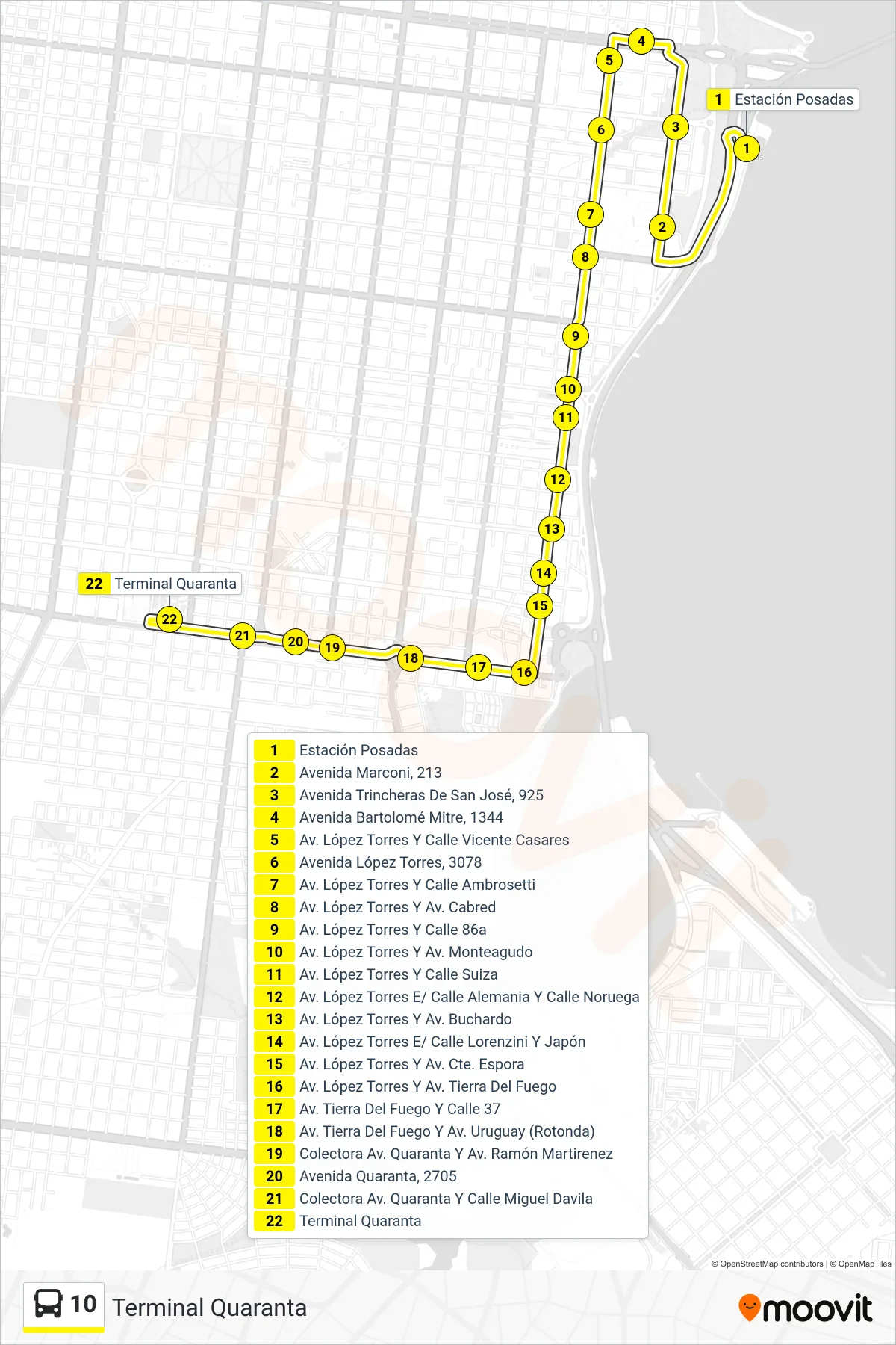
Stops list (10 - Terminal Quaranta)
- Estación Posadas
- Avenida Marconi, 213
- Avenida Trincheras De San José, 925
- Avenida Bartolomé Mitre, 1344
- Av. López Torres Y Calle Vicente Casares
- Avenida López Torres, 3078
- Av. López Torres Y Calle Ambrosetti
- Av. López Torres Y Av. Cabred
- Av. López Torres Y Calle 86a
- Av. López Torres Y Av. Monteagudo
- Av. López Torres Y Calle Suiza
- Av. López Torres E/ Calle Alemania Y Calle Noruega
- Av. López Torres Y Av. Buchardo
- Av. López Torres E/ Calle Lorenzini Y Japón
- Av. López Torres Y Av. Cte. Espora
- Av. López Torres Y Av. Tierra Del Fuego
- Av. Tierra Del Fuego Y Calle 37
- Av. Tierra Del Fuego Y Av. Uruguay (Rotonda)
- Colectora Av. Quaranta Y Av. Ramón Martirenez
- Avenida Quaranta, 2705
- Colectora Av. Quaranta Y Calle Miguel Davila
- Terminal Quaranta