
10 Bus Route Map
View the 10 route map and see all 10 stops along the route. The map of 10 shows where the bus travels and the location of each stop, making it easy to understand the entire route at a glance.
Explore WestCat (Western Contra Costa) routes on the map and see where WestCat (Western Contra Costa) bus services operate. Use the 10 map to find bus stops and see how the 10 connects different areas along its trip.
All 10 stops on the map are displayed in route order, helping you follow the 10 bus from the first stop to the last.
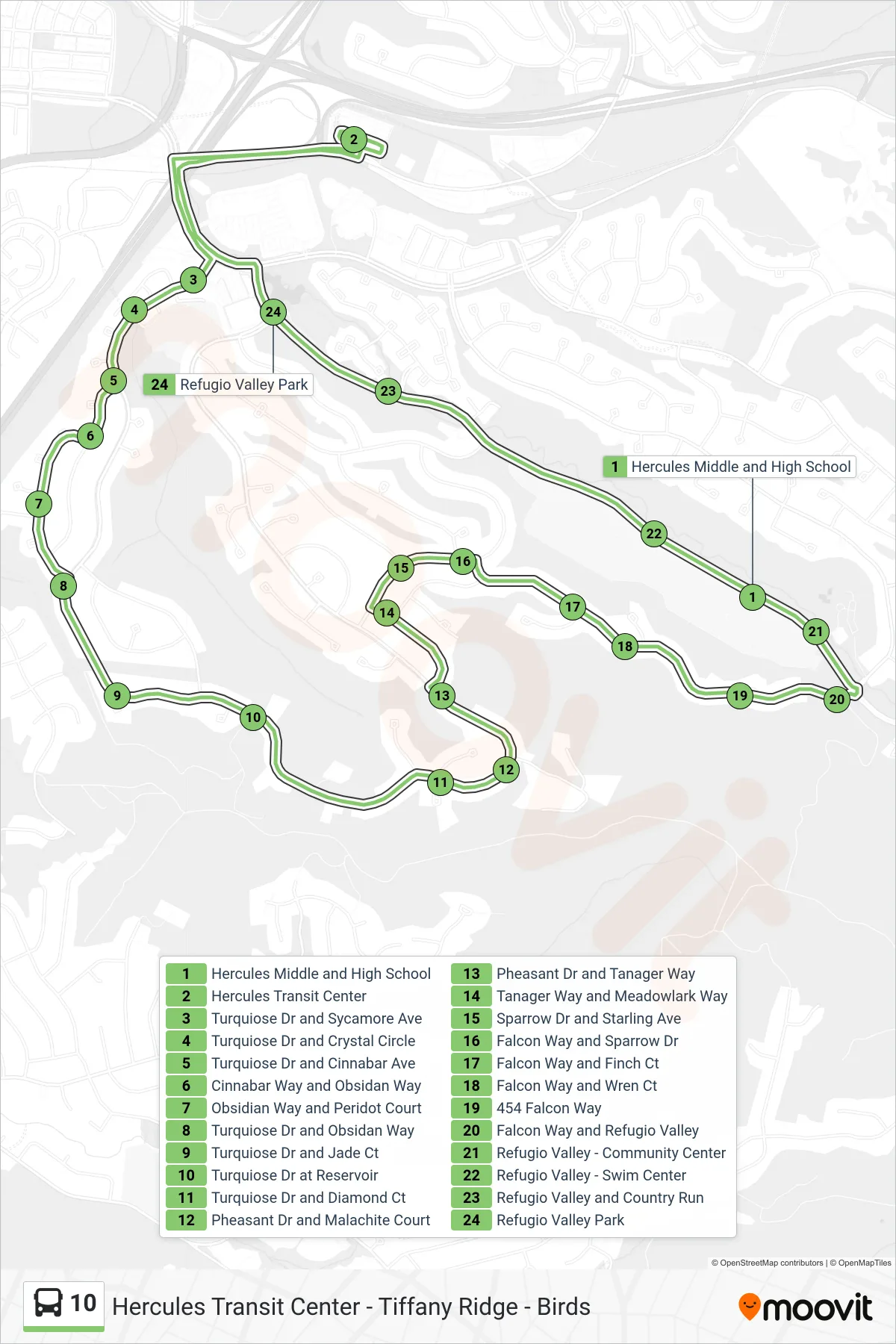
Stops list (10 - Loop Route)
- Hercules Middle and High School
- Hercules Transit Center
- Turquiose Dr and Sycamore Ave
- Turquiose Dr and Crystal Circle
- Turquiose Dr and Cinnabar Ave
- Cinnabar Way and Obsidan Way
- Obsidian Way and Peridot Court
- Turquiose Dr and Obsidan Way
- Turquiose Dr and Jade Ct
- Turquiose Dr at Reservoir
- Turquiose Dr and Diamond Ct
- Pheasant Dr and Malachite Court
- Pheasant Dr and Tanager Way
- Tanager Way and Meadowlark Way
- Sparrow Dr and Starling Ave
- Falcon Way and Sparrow Dr
- Falcon Way and Finch Ct
- Falcon Way and Wren Ct
- 454 Falcon Way
- Falcon Way and Refugio Valley
- Refugio Valley - Community Center
- Refugio Valley - Swim Center
- Refugio Valley and Country Run
- Refugio Valley Park